July 15, 2006
 July 15, 2006
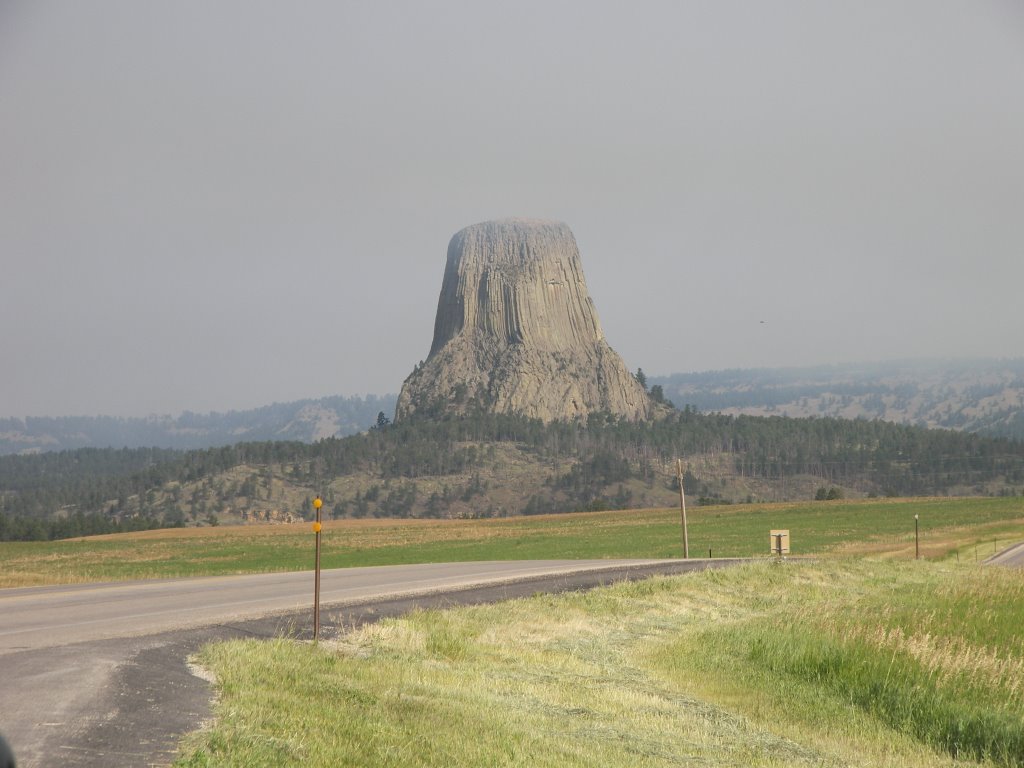
Last night, the setting sun was orange with wildfire smoke. This morning it looks a lot clearer. We head northwest on Rt. 14 towards Devils Tower National Monument. As we get closer we see a lot of black smoke to the left but no signs of the tower on the right. We find that the turnoff to Devils Tower is open but our route back southwest to I90 is closed. As we descend to the river valley we finally see the tower. It is much smaller than I had expected. As we get closer, we snap a picture from the road and plan on getting better shots on the way out. Despite being smaller it is really cool and very unique. Devils Tower is the solidified core of a volcano. The rest of the volcano being softer eroded away over millions of years. The sides of the tower are relatively smooth and cornered and look like a big stack of gray pencils on end. On entering the park, we do the circular hike around the base of the tower. We run into a park ranger giving a talk who says that the tower is a popular rock-climbing venue. Halfway around we see a group of climbers partway up. I would love to climb it also, but not today. The further around we get the smokier it becomes. As we finish the smoke smell is getting intense. On the drive away, the tower is enveloped in smoke and we are glad we snapped a picture on the way in.
We return to I90 and head west again. The land starts out like prairie ranches but slowly gets drier and eventually looks like a prairie desert. This could be called the badlands in my estimation. We start to see the Rocky Mountains in the distance still snowcapped despite the weather forecast of 104F today! The interstate system does not extend to Yellowstone. We have to decide which local route to take into the park. As I look at the height of the mountains, I wonder if an RV is the best way to travel over them. We decide to take I90 as far as we can first. I90 in the middle of Wyoming makes a right turn in front of the Rockies and heads north into Montana before heading west again.

Because of the intense heat, we decide to continue driving and at 7PM we arrive in Billings and spend the night at KOA#1. It is a large and crowded park, but it sits right on the banks of the Yellowstone River. Probably fed by snowmelt, the Yellowstone here is broad and swift with an eroded undercut cliff wall on the opposite side. Ten miles down river is a place called Pompey's Pillar where William Clark (of Lewis and Clark) carved his name and date into a rock. On the return voyage, Lewis and Clark had temporarily split up with Clark taking the Yellowstone River back, right by our campsite.
posted by Mike and Aimee at 8:51 AM
![]()
![]()

0 Comments:
Post a Comment
<< Home