August 15, 2022

The Utah/Arizona border region has no end of interesting geologic formations to discover. Our first visit with the RV was a month long and we have been back many times. I have always dreamed of buying a jeep so we could explore the more remote areas. We have never done it since neither Aimee nor I relish the idea of getting stuck in the middle of nowhere (which eventually happens to all off-roaders.) So today we are pursuing an alternative that probably works better for us. We hired a guide to drive us in his vehicle. We met him here in Kanab, UT and loaded into his vintage Chevy Suburban. He is an ex-geologist. Most of the geologists I have met went into the field because of their love of the outdoors.

We made our way east up the Kaibab Plateau where we pick up two more hikers, retired Chicago teachers now living outside Phoenix. After a dozen more miles we turn north on the unpaved House Rock Road. We make a brief stop at a Condor viewing area but none are to be seen. After some ten miles we turn onto an even smaller and rougher back road. The area is mostly pinyon pine and juniper scabland that is leased to free-range cattle ranchers. After many more miles the track turns into deep red sand. Fortunately with the heavy monsoons the sand is somewhat compact. Our guide makes driving it look easy. But even he goes off road when confronted with deep wet spots. After two and a half hours we reach the White Pocket Recreation Area.
 Like the Wave this isolated pocket of Navajo Sandstone outcropping is otherworldly. In the White Pocket, much of the normally red sandstone is almost completely covered with a layer of bleached-white sandstone that has shrunk and cracked into cauliflower-shaped tiles. To me they look like the scales on the back of an enormous prehistoric crocodile. There are sections bigger than football fields.
 In some areas the White Pocket has been eroded exposing the underlying red sandstone. Some swirls look very similar to the Wave. These undulations are probably the petrification of the prehistoric sand dune shapes that once covered the Colorado Plateau. In other areas the layers are all jumbled up in ways geologists struggle to explain.
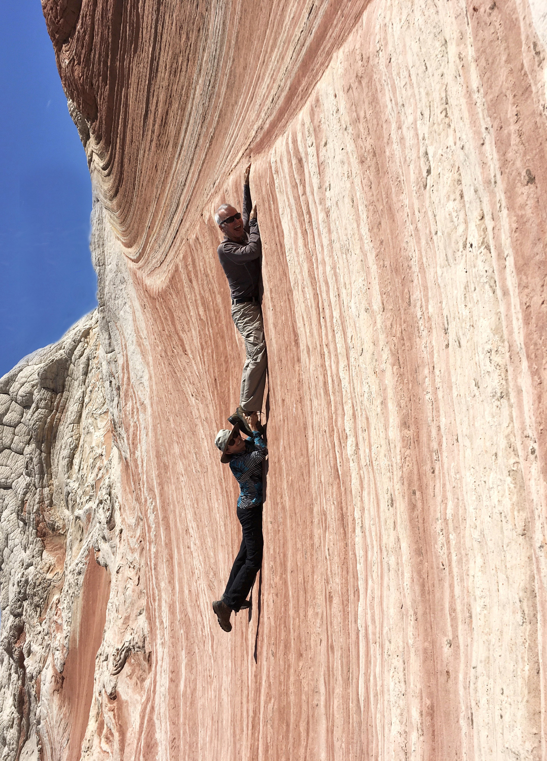
 Aimee and I have some fun climbing one of the red sandstone formations but almost get ourselves into trouble when we slip off the ledge. Aimee luckily grabbed my foot at the last minute. We have our sack lunch in a sheltered spot on this sandstone.
 The roar of Chocolate Falls is not the only unexpected benefit of the heavy monsoons. Many of the depressions in the rocks here are filled with water giving me many opportunities to photograph reflections.
Our circular hike eventually brings us back to the car where we begin the long drive back to Kanab. At the House Rock turnoff, we run into another tour vehicle with a failed transmission. We give one of the passengers, an Italian visitor, a lift into town. If I needed more encouragement to hire a guide instead of buying a jeep, I just got it.


Our circular hike eventually brings us back to the car where we begin the long drive back to Kanab. At the House Rock turnoff, we run into another tour vehicle with a failed transmission. We give one of the passengers, an Italian visitor, a lift into town. If I needed more encouragement to hire a guide instead of buying a jeep, I just got it.

posted by Mike and Aimee at 5:04 AM
![]()
![]()

0 Comments:
Post a Comment
<< Home