Wednesday, June 30, 2010

June 29, 2010

June 29, 2010

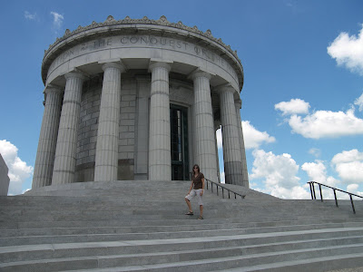
From Lincoln State Park we drove a couple hours to Vincennes, IN to visit George Rogers Clark National Historic Park. Our first view is of the gigantic memorial to him. It is the size and shape of the Jefferson Memorial in DC. Apparently George is more famous than I realized. George is the older brother of William who explored the Louisiana Territory with Meriwether Lewis. In the Visitor Center we learn that he along with Daniel Boone were the primary trailblazers leading pioneers from Virginia to new lands in Kentucky and Tennessee. When the Revolutionary War started the British paid the Indians to attack American colonists in Kentucky. George Rogers Clark led a militia to attack British outposts at Kaskaskia, Cahokia and here in Vincennes. To secure Vincennes he led his troops on a winter forced march across Illinois. As a result when the Treaty of Paris was negotiated the US gained the Northwest Territory. If it wasn’t for this victory, I would be writing this journal in Canadian.

From the Park, Aimee and I walked thru the historic area to Grouseland, home of William Henry Harrison, when he served as Governor of the Indiana Territory in 1800. We were given a tour of the period home by a very knowledgeable docent and then we perused a series of exhibits on Harrison’s life. Harrison gained military fame for his later victories in the Shawnee Indian War and against the British in the War of 1812. He was elected president in 1840. Unfortunately he gave the longest ever inaugural address on a cold wet winter day, got pneumonia, and died after only thirty days in office. Now he is only known for having the shortest presidency.

From Vincennes, we drove to Effingham, IL to have dinner with my oldest sister. Afterwards we drive the last couple hours to Godfrey to spend Independence Day with my parents.

June 28, 2010

June 28, 2010

We spent last night in Bardstown, KY at Our Old Kentucky Home state park. Also in the park is a golf course and outdoor theatre showing the musical, The Stephen Foster Story. It was nice but hooomid! Stephen Foster was America’s first professional songwriter. He is actually from Pennsylvania but has been adopted by the locals because of his song, “My Old Kentucky Home”. He is famous for songs like “Oh Susanna”, “Way down upon the Swanee river”, “Camptown races, and “Beautiful dreamer”. They are catchy tunes, and to Aimee’s displeasure I spent the day whistling them.

We had planned to take advantage of the golf course at our doorstep but it rained all night. So we left town. We only made it a few miles when we ran into the Jim Beam distillery. It is the largest so we felt the obligation to stop. There was no tour but we partook of an early morning tasting with a group of square dancers and Swedes.

Crossing north into Indiana we stopped at Falls of the Ohio State Park. Unbeknownst to me the Ohio River was unnavigable past this point because of a waterfall here. This caused travelers to stop here and a large community popped up. Eventually a canal was dug and Louisville thrived. The Interpretative Center had exhibits on the area. The falls flows over an ancient coral reef formed 350 million years ago when this area was a shallow sea. After running thru the exhibits, we walk out to the riverbank to look for fossils from Devonian times, the Age of Fishes.

From Louisville, we continued west to Lincoln Boyhood National Memorial. The exhibit room continues Lincoln’s early story. He spent his teenage years here. His father moved the family to frontier Indiana to find land that he could buy with a clear Federal title. Unfortunately two years later his mother died of milk disease, a not uncommon frontier disease. Unknown at the time, when cattle graze on wooded lands they can ingest deadly white snakeroot which poisons the milk. We walk around this frontier farm. Growing up on the frontier, Abe had almost no formal schooling but yet learned to read and write and do “ciphering”.

We spend the night next door at Lincoln State Park not sure of what time it is. The counties in this part of Indiana are all in different time zones. Not Central and Eastern, but rather “fast time” and “slow time”.

June 27, 2010

June 27, 2010

Not far north of Mammoth Cave is Abraham Lincoln Birthplace National Historic Site. There I learned Abe was shot by an Indian in 1786. No, this isn’t ”bizarro world” history. That is what happened to the grandfather of the same name shortly after he followed Daniel Boone into the frontier known as ”Kaintuck”. The more famous Abe was born 23 years later in a log cabin. Unfortunately Abe’s father ran into title problems on the property he bought and was evicted. It happened again with the farm he then rented. Disgusted with Kentucky’s title issues, he left for Indiana with young Abe in tow. Many years later, his supposed birth cabin was sent all over the US for exhibition. In the 20th century, the pieces were bought up and returned here. Around it was built the first Lincoln Memorial. Unfortunately the Memorial is under repair and we can't look inside. On our way north we also stopped at the next farm his family rented.

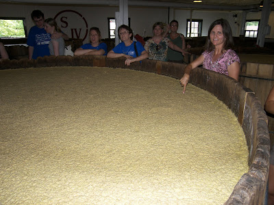
Aimee is tiring of these historical sites, so she suggests hitting the “Bourbon Trail”. We stop at the closest, Makers Mark. It is a cute distillery, but we had never heard of it till we saw it mentioned in the movie ”Crazy Heart” two weeks ago. We took a tour of the distillery and learned how Whiskey is made from fermented corn, distilled and aged in oak barrels. We were surprised at the open fermentation tanks. We were even invited to stick our fingers into the mash to taste. After the tour we were invited to a tasting of the final product. Neither of us really appreciates fine whiskey but we did like the mint julep. Mint Julep is whiskey infused with mint and sweetened. Makers Mark’s claim to fame is that they hand dip each bottle with a red wax seal. To celebrate Chicago’s recent Stanley Cup Championship, they issued some commemorative bottles dipped in black wax.

Our next distillery stop is Heaven Hill. We were too late for the tour and tasting but they had a lot of displays about Whiskey. In colonial times, excess corn was turned into Whiskey by most farmers and used to barter for goods. Whiskey was the hard currency of the day. Kentucky used to be Virginia’s Bourbon county. Kentucky farmers put their whiskey in oak barrels and shipped it down river to New Orleans. This accidental aging mellowed the flavor and soon people started asking for “Bourbon” Whiskey. Later the US enacted laws codifying “bourbon” as American made corn whiskey aged in charred new white oak barrels.

Sunday, June 27, 2010

June 26, 2010

June 26, 2010

Our original plan this summer was to tour the southeast US making sure we were in Florida at the end of July to see one of the last space shuttle launches. NASA threw us a curve ball delaying the last two blastoffs till this fall. After a week in the South I am secretly relieved. This southern heat and humidity is a killer destroying any desire for outdoor living. Normally we enjoy staying at public parks, sitting outside in the evening, communing with nature. Instead we are relegated to mostly private parks with electrical hookups so we can sit inside with the A/C on full blast.

We have been making our way up north with little relief from the heat. Mammoth Cave National Park is a great opportunity to find some natural Arctic weather. We stopped in at the park’s Visitor Center late yesterday evening to find the place still a beehive of activity and learn most cave tours sell out in advance. We immediately booked two of the few still remaining. Mammoth Cave is not only a National Park but also a World Heritage Site. Mammoth is by far the longest cave system in the world at almost 400 mapped miles. We start the morning with the “New Entrance” tour. It begins with a short bus ride to the opening and a long descent by spiral staircase to the main shaft. Compared to other caves this one has virtually no decoration. Just a single, albeit impressive, wall near the tour end known as ”Frozen Niagara”.

To pass the time till our next tour Aimee and I hike (above ground) to see the “River Styx“ natural spring. This spring turns out to be water that percolates into the cave, carving new channels, eventually emerging horizontally out of a hillside. Apparently the cave is still being carved, hence the lack of decorative stalagmites and stalactites. Right now we are happy just standing outside the main cave entrance enjoying the blast of cool air emanating from it. If I was an Indian this is where I would have slept on muggy summer nights.


At 2pm we take the Historic Entrance Tour. This two-hour hike takes us through a section of cave that looks exactly like a manmade mine. It has long horizontal runs with some very deep vertical shafts. And no decoration! The cave is interesting but definitely not for those looking for beautiful cave formations. I am failing to understand why this place is so crowded.

Friday, June 25, 2010

June 25, 2010

June 25, 2010

The Tennessee and Cumberland Rivers flow into the Ohio within a few miles of each other. Both have been dammed up near their mouth forming long parallel lakes. The thin strip of land between them was bought up by the government and turned into the Land Between the Lakes National Recreation Area. From Fort Donelson we drove north thru the LBL. It is mostly wooded with a few meadows on which buffalo and elk graze. Near the middle we stop at a Forest Service wildlife rehab center. It is more of a nature center and local zoo with owls, eagles, wolves, bobcats and a lot of bird feeders and flowerbeds. A nice break for an hour.

At the other end of the parking lot are the remains of an antebellum iron furnace. Apparently the whole area is dotted with them because the region is rich in the three necessary ingredients: iron ore, limestone and lots of timber. We walk a short interpretative trail to see how this operation worked. It is amazing how much manpower was required to run these tiny furnaces in those early industrial times. Every day it needed 165 wheelbarrows of ore and limestone and one acre of wood. After reading this I am thinking back to our Civil War battlefield tours and wondering how either side could have made enough iron to supply all the cannon balls both sides were tossing at each other.

We emerge out of the LBL in Kentucky where we head east and spend the night outside Mammoth Cave National Park.

June 24, 2010

June 24, 2010

A few miles south in Murfreesboro,TN is Stones River National Battlefield. While Grant and his army were sailing up the Tennessee River and taking Corinth (and fighting off a counterattack at Shiloh), another army was going up the Cumberland. Nashville was taken without a fight. In late 1862 this Army of the Cumberland started marching from Nashville toward the rail junction in Chattanooga. Thirty miles southeast in Murfreesboro, they ran into the Confederate army and prepared for battle. Unfortunately the Union army seems to keep forgetting the fundamental dictum of war (Get there firstest with the mostest). In this battle, the Confederate army awoke earlier and started the attack while the Union was still drinking their first cup of coffee. A rout ensued and the North fell back in panic. Only stubborn resistance by a few units allowed a stalemate to result. When the Rebels retreated south a few days later, the North claimed victory. This battle was another bloodbath worse than Shiloh. One third of all troops were casualties. We did the auto tour of the battlefield and attended a ranger talk but both were uninteresting.

From Murfreesboro we drove to the northwest part of the state to Fort Donelson National Battlefield. The battle here set the stage for Shiloh and Stones River. Working closely with the Navy and their river gunboats, Grant planned to take control of the Tennessee and Cumberland Rivers. Before Grant could get in position, the gunboats had forced the Rebels to surrender Fort Henry guarding the Tennessee. When they attacked Fort Donelson on the Cumberland the gunboats lost and Grant was forced to lay siege. In a matter of days the Rebel general surrendered 13,000 troops. This was not only the North’s first big victory of the Civil War but they had their first winning general in Grant.


Just as we were heading out of the Visitor Center a huge thunderstorm hit and we waited it out for an hour and a half. When it slowed down to a slow drizzle we made a mad dash on the auto tour route. Fort Donelson was an earthworks fortress and is mostly still intact. It is also in a very hilly region. Grant is probably lucky the idiots in charge surrendered so fast.

Wednesday, June 23, 2010

June 23, 2010

June 23, 2010

From Pickwick Dam in southern Tennessee, we make the short drive to Shiloh National Military Park. Our northerly drive is unfortunately visiting a series of Civil War battles in reverse chronology. Ulysses Grant intent on taking the rail junction at Corinth, MS sailed up the Tennessee River and started assembling his army here at Pittsburgh Landing near a little log chapel named Shiloh Church. Grant made a crucial mistake of not protecting his beachhead here. The rebel general at Corinth took the offensive and in April 1862 made a preemptive strike at Grant. Caught with his pants down, Grant almost got wiped out. With some fortuitous luck and stubborn resistance by one of his units, he survived the first day. Expected reinforcements arrived overnight. To his credit, instead of retreating to regroup or playing defense, Grant struck back hard early the next morning and forced the Rebels to retreat back to Corinth.

We spent most of the day driving the auto tour of the battlefield and listening to several ranger talks. The Shiloh battlefield is special because it remains almost like it was nearly 150 years ago. And Shiloh was a bloodbath. The first big one of the Civil War. Over 20,000 troops were lost in 36 hours, more than all the wars the US had fought to that point. Both sides suddenly realized this war was no game.

From Shiloh we drove north stopping briefly at the Tennessee River Museum. Finding little of interest we made our way back to the Natchez Trace Parkway. Discovering that there are virtually no RV parks anywhere in the vicinity we drive late into the evening and stay at a park outside Nashville. We make one brief stop along the Trace at Meriwether Lewis’ grave and monument. On his journey back to DC from St Louis in 1809, he stayed at a tavern here overnight. He was mysteriously shot twice and died. Most believe it was suicide. A sad ending to the man who bravely led the Corps of Discovery.

June 22, 2010

June 22, 2010

We start the day driving north on the Natchez Trace Parkway. The parkway is a two lane heavily wooded road reminiscent of what the colonial countryside was like. We stop at a roadside pullout for a short hike along the original path, now Natchez Trace National Scenic Trail.

Not far from Tupelo, MS we stop at Brices Crossroads National Battlefield. For some reason the Visitor Center is run by the local community instead of the Park Service. It is small but well done. The battle occurred here in 1864 at the same time Sherman was advancing on Atlanta. Fearing an attack on his supply line, Sherman sent one of his generals to fend off an attack from Mississippi. Although the Union lost the battle, Sherman’s supplies were safeguarded and he was able to take and burn Atlanta sowing the seeds of the South’s defeat. From the Visitor Center, we drove to the Battlefield. Like Tupelo, it is just a small roadside park with a monument and requisite two cannons. The Park Service is nowhere to be seen.

From Brices, we head north to Corinth, MS. There we stop at the Interpretative Center. This new NPS facility is very interesting. The Confederacy had very few rail lines. Two major rail arteries intersected here in Corinth. In 1862 General Grant sailed up the Tennessee River intent on capturing this strategic point and cutting the South’s ability to move supplies around. After a brutal battle at Shiloh, Grant moved to begin a siege of Corinth. It was set to be the largest battle of the war with both sides bringing over 100,000 troops to Corinth. The rebel general fearing a deadly siege vacated Corinth saving his army from destruction.

We drive over to the depot to see the rail junction and then walk downtown to have lunch at a turn of the century soda fountain. Afterwards we drive around Corinth to see some of the earthworks and stop at Contraband Park. As the Union struck into the south, freed slaves (known as contraband) fled north to camps setup to care for them and begin their transition to freedom. One major camp was here in Corinth.

After spending most of the day in Corinth we head northeast and stay at a BLM park on the Tennessee River just below the TVA's Pickwick hydroelectric dam.

Monday, June 21, 2010

June 21, 2010

June 21, 2010

Our first stop today is Arkansas Post National Memorial in southeast Arkansas. Incredibly this location near the junction of the Arkansas and Mississippi Rivers was the earliest European settlement in the Mississippi valley, older than New Orleans. The French founded it in 1686. A surprising amount of history occurred here. A revolutionary war, an Indian war and a civil war battle were all fought here. It was also the first capital of the Arkansas territory. The site is now almost totally surrounded by swamps and infested with mosquitoes and alligators in this isolated part of southern Arkansas. We walked around the site and then headed into Mississippi.


Late in the day we arrived in downtown Tupelo, MS to see the Tupelo National Battlefield. It turns out to be just a small city park with one monument and two cannons. Disappointed, we drive over to the Natchez Trace Parkway Visitor Center but they have no info either. The Natchez Trace was the national road that people walked back to the Midwest (Nashville) after floating down the Mississippi River. A few miles down the Parkway we stop and walk among the remains of a Chickasaw Indian village.

June 20, 2010

June 20, 2010

Natchitoches, LA (pronounced Nakatish) is on the sleepy Cane River. It turns out to be quiet because it is not really a river anymore. It used to be the busy Red River but in the early 1800’s settlers cleared a major logjam and the Red River ended up cutting a new channel leaving this section stranded. It is now a really long skinny lake. A few miles downstream we visit the Cane River Creole Historic Park. The park consists of two former cotton plantations that time passed by. They are interesting but the heat and humidity here are killers of my curiosity.
These plantations started off as slave enterprises. After the Civil War most of the blacks stayed on the plantation as tenant farmers and sharecroppers. The brutal reality was that little changed when they converted to “voluntary” servitude. Today we call this predicament being chained to a “job”. I can relate. I had the same dream of wanting to shake loose the shackles of “the man”. Only a few days ago Aimee and I celebrated the fourth anniversary of our Emancipation Proclamation. Free at Last!

From the Cane River area we worked our way with the A/C turned on high to the northeast corner of Louisiana and the Poverty Point Monument. It turns out the name is a misnomer. Although Reagan designated it a National Monument, Arkansas wouldn’t relinquish control so it remains a state historic site. Poverty Point is an Indian archeology site from before 1500 BC. Besides being incredibly old for the New World, it is huge, and was only recognized from aerial photographs. It consists of concentric earthen ridges almost a mile wide surrounding a central courtyard (see scale model). A community of maybe 4000 pre-agriculture hunter-gatherer Indians lived here. Artifacts found at the site indicate this ancient people traded for goods from all over the US. The whole story seems incredible. Because of the heat I was secretly happy when the park ranger said we could take a tram tour. We would have drowned in our own sweat hiking this huge site. The tour and museum turned out to be a hidden gem.

Saturday, June 19, 2010

June 18-19, 2010


June 18-19, 2010

Texas is a pain in the #$%&! You gotta love Texans but their state, ugh! After two and a half days of driving we are still in the state. Anybody who thinks we are running out of land hasn’t been to Texas. They have enough for everybody and then some. We drove so much here we wore out one of our tires and had to make a pit stop for repairs in Longview, TX.

Because of the delay we decided to stop for the evening in Natchitoches, LA. (Kudos to anybody who knows the correct way to pronounce the name of this town!) It turned out to be a blessing in disguise. Natchitoches has a beautiful little downtown. The main street runs along the picturesque Cane River and is lined with antebellum buildings adorned with “French Quarter-esque” wrought iron porches. For color, everywhere you look are gorgeous flowering trees.


We started at one end with a tour of the reconstructed Fort St. Jean Baptiste. In the early 1700’s this area was the frontier between French Louisiana and the northeastern edge of New Spain (the future Mexico). Our personal tour guide gave us the lowdown on the difference between the Creoles and Cajuns. Cajuns were the French exiles from Canada (Acadia), while the Creoles were the offspring of the original French settlers who inter-married with black slaves and the local Indians. To really discern the subtle differences ourselves we window shopped till we came upon a restaurant featuring Cajun and Creole dishes. Mmmm! Vive la difference!

Friday, June 18, 2010

June 16-17, 2010


June 16-17, 2010

It is summer in Tucson and we are late getting out of town. Today we finished packing the RV, secured the house, and started our journey east. As I drive I am thinking I hope I got the watering system understood enough I don’t kill our orange trees while we are gone. Since we left at noon we only make it to Las Cruces, NM by dinnertime. Not a problem since the historic original town of Old Mesilla has the best Mexican food around.

It is almost as hot here as it is in Tucson. Feeling overheated we make a detour to revisit Carlsbad Caverns National Park. Despite the heat, the cave temperature is always in the 50’s. Ah, feels good. And even the second time the cave is pretty cool. The natural entrance is a long continuous downhill hike of 75 stories, kind of like descending into the bowels of the earth. So much so, that is why they filmed the sixties classic, “Journey to the center of the earth” here.


But we are not really at Carlsbad to see the cave again. We are here to see a spectacle of nature. During summer the cavern is host to a huge colony of bats visiting from Mexico. So in the evening we attend a ranger talk at the cave entrance and when the sun sets, a swarm of bats as thick as smoke flies out the entrance. For a solid twenty minutes, tens of thousands of bats circle upward from the cave depths in a whirling vortex. Once at the entrance they stream to our right in search of their nightly meal of insects.
Newer Posts Older Posts