Tuesday, May 27, 2008

May 26, 2008


May 26, 2008

When we awoke this morning, cleanup crews were already out policing the Indy 500 grass lots. I should have spent the night collecting the millions of aluminum beer cans strewn about the grounds. It would have bought a lot of gas.

From Indianapolis, we continued our journey west along the old National Road route to its terminus at Vandalia, IL. Vandalia was Illinois’ second capital from 1819-1839. We gave ourselves a tour of the restored capital building where Lincoln served as an Illinois legislator. After this briefest of stops we were on our way to Alton, IL (actually Godfrey) where my parents live. Aimee and I are both getting a little testy and we need a short break from our togetherness before we head out to the northeast.

May 25, 2008


May 25, 2008

The 92nd running of the Indy 500 starts at 1 PM this afternoon. When we start walking to the track around 9 AM, the rest of this massive lot we are parked in is filled with tens of thousands of cars. We spend the next couple hours checking out the infield of the track and walking along pit row. There are all kinds of events leading up to the start of the race including a low-altitude flyover of four military jets at the end of the National Anthem. Once the race starts Aimee and I are shocked. The noise is deafening and it is impossible to hear Aimee yell into my ear. After fifteen minutes we buy earplugs to prevent ear pain. We bought seats in the “Paddock” along the straightaway across from the pits. The cars are 20 yards away and zipping by at over 230 mph. A blink of an eye. Think of standing by an interstate and then triple the speed. My body rumbles when the cars pass. The track is 2.5 miles around taking the racers 45 seconds to circumnavigate the oval. The race is really a stop and start event. They race fast for a while, then somebody crashes and they drive slow till the track gets cleared, and then fast again. The winner of this marathon in many respects is the one who can avoid crashing. Not an easy thing going at an average speed of 220 mph.

Some of the pits are across the track from us. If you want to watch them change tires, you have to stay awake. They have the tires off, new ones on, and the fuel tank refilled in mere seconds. Amazing. Halfway thru this four-hour race, we walk the mile to a corner stand to see the difference. It is much better place for a racing fan to watch the action but the spectacle and impact is lost.

Scott Dixon from New Zealand won the race but Danica Patrick is sure the fan favorite. The announcer was always mentioning her position throughout the race. There are now three woman drivers, and all left the race because of accidents (no big surprise).

I have to say the one of the nicest parts of the event was when we watched the crowd of cars inch their way out of the parking lot while we relax and drink a beer.

May 24, 2008


May 24, 2008

We are just an hour east of Indianapolis, IN. Indy is having a big race tomorrow so we decide to stay and watch it. We easily find the Indianapolis Motor Speedway, but we are too early for Race Day camping around the stadium. Those rates don’t apply till seven tonight, so we hang around town eating, shopping and reading the time away. At seven we make our way into the expansive Coke grass lot. On the way we pass a sea of RV’s and tents, attendees that have been here since Thursday. It is a college-like atmosphere of mostly the young partying their brains out. We are put at the very end of this enormous lot, seemingly now miles from the stadium. After we get settled, we take a walk to the racetrack and its carnival-like atmosphere. It is a people watchers extravaganza with all types from sinner to preacher well represented. The beer is freely flowing while Nazi-looking Indiana State troopers stand clustered away from the crowd, but still a visible deterrent of trouble. Along the way we scalp a couple tickets for tomorrow. There are all kinds of seats to choose from. The racetrack is huge with stands that seem to go on forever. By the time we are halfway around the stadium our legs are tired and we turn around. We are now miles away from home. I hope we make it back to the RV before it gets dark; otherwise we might not find it. As we approach our RV, a beautiful red sunset is forming. Unfortunately the view is marred by a haze of thick campfire smoke floating over the field.

May 23, 2008


May 23, 2008

From Buck Creek, it is only twenty minutes to Dayton, OH and Wright-Patterson Air Force Base. On the base is the awesome National Air Force Museum. We have been here before and you can easily spend all day here. Our goal is to revisit the early flight section. It is primarily about Orville and Wilbur Wright’s struggle to develop the first practical airplane. They had lots of competition, who were all ultimately unsuccessful. The Wright brothers, however, were dedicated, meticulous, and undeterred. They painstakingly worked out all the hurdles to design each necessary component: adequate lift, flight control, propellers, and a lightweight powerful engine. Then they had to teach themselves to fly and most importantly do it without killing themselves. We breeze through the rest of the museum only stopping to see the plane that dropped the bomb on Nagasaki. It ties in with our nuclear tour and with a book both of us read last fall about the aircrew’s story.

After the museum we drive to the Dayton Aviation Heritage National Historic Park, Huffman Prairie Visitor Center on the other side of the base. There we watch an interesting movie about the Wright Brothers and then explore the exhibits. The highlight is a flight simulator for the 1905 Wright Flyer III. Aimee enjoys watching me crash the plane three times. The controls were very touchy. We then drive to Huffman Prairie in the center of the base. It is the cow pasture where the Wright Brothers perfected the airplane from 1904-1905. It must have been shocking for the local farmers to see a noisy machine circling above for the very first time in history.

Leaving Wright-Patterson AFB, we head into downtown Dayton to see the bicycle shop where the brothers first started their tinkering. Just before rush hour we head out of Dayton and rejoin the National Road route west. We cross the border into Indiana and get the last spot at a very crowded private campground.

May 22, 2008


May 22, 2008

We are continuing west through Ohio following the route of the original National Road. Our explorations have been expensive lately. Two days ago I passed up $3.79/gallon gasoline, thinking it too expensive. That seems to be a terrific bargain today. Just about every gas station is now up to $3.99. I guess nobody wants to be the first to go over $4 and make the news. By luck we found a slow-to-keep-up station off the highway still selling at $3.85. As I am filling up with this “cheap” gas, an Amish couple trots by in their horse-drawn buggy. The lady waves at me. Normally I would think she is being friendly, but right now I am thinking she is rubbing the high gas price in my face. I wonder how many horses it would take to pull our RV??

We make a brief detour to Dresden, OH and the factory site of Longaberger Baskets. This is Aimee’s idea, not mine. I have to say though I am impressed. There must be tons of money in basket weaving. The factory floor is huge with hundreds of workers hand-making all sizes; they make 17,000 high-priced baskets every day! From now on I am going to encourage Aimee’s desire to learn basket weaving. We could use the extra money to buy gas. On the way back to the highway, we pass the Longaberger corporate headquarters. The building is in the shape of an enormous basket!

We continue west spending the night at Buck Creek State Park. Our campsite faces the lake and we enjoy a beautiful sunset over the water.

May 21, 2008


May 21, 2008

In the center of Williamsport, MD is one of several Visitor Centers for the C&O Canal National Historic Park. George Washington, who lived along the Potomac, had a dream of opening a canal along this unnavigable river to promote trade with the resource-rich Ohio Valley. George was the canal company’s first president, but he did not live to see it succeed. Groundbreaking didn’t occur until 1828. After 22 years of construction, the canal only made it to Cumberland, MD, halfway to the goal of Pittsburgh. The canal was old technology. On the very same day, construction also began on the B&O railroad, and it arrived in Cumberland eight years sooner. On the park grounds is the site of an aqueduct that carried the canal water in a bridge over a Potomac feeder stream. As we take a photo, we watch a group of cyclists beginning a ride down a section of the mule towpath. I am jealous. They have local friends that will meet them upstream and chauffeur them back.

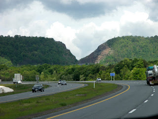
From Williamsport we drive west along Maryland’s panhandle up and down innumerable hills. We then cross into Pennsylvania arriving at Fort Necessity National Battlefield. This one is really going to throw Aimee for a loop as it doesn’t pertain to the Revolutionary or Civil Wars. In 1754, France and England were both vying for the Ohio Valley. England sent 22-year old colonial George Washington to lead a group of men to construct a road from Cumberland, MD to the “forks of the Ohio” (Pittsburgh). Along the way he ran into a group of French soldiers, attacked them, killing the commander. Fearing retaliation, he quickly built a small wooden stockade, aptly named Fort Necessity. Unfortunately his defense was poor and he was forced to surrender. Not an illustrious start to a military career, especially since this incident touched off a global war. In America, it was known as the French and Indian War. We take a quick walk past the reconstructed fort (in the rain).

The Visitor Center also memorializes the National Road that was built past here. Years later, after the Revolution, George Washington bought the site of Fort Necessity, built a tavern inn, and pushed the US to build a road along his original trail, linking Cumberland, MD with the frontier. Congress eventually approved this first federally funded highway program. Begun in 1811, it was planned to end in my hometown of Alton, IL. It only made it as far as Vandalia, IL. Leaving the park we follow a very hilly US 40 along the route of this National Road, past a tollhouse and numerous taverns, into Ohio where we stay the night at Barkcamp State Park.

May 20, 2008


May 20, 2008

It poured again all night. I am beginning to think the East is one big rain forest. By morning the rain has stopped so we take the park shuttle back into the historic town of Harpers Ferry, WV. There we walk the railroad bridge across the Potomac River to Maryland. Our intent was to hike up the cliff to an overlook for a good view of the environs. Aimee is cold and vetoes the idea. Instead we walk along the riverbank and the C&O Canal that follows the Potomac. The entire length of the canal is now part of the C&O Canal National Historic Park and the Potomac Heritage National Scenic Trail.

After this quick tour, we are back in the RV for a short drive to Sharpsburg, MD and Antietam National Battlefield. We watch a movie about the battle in the Visitor Center. In September 1862, Robert E. Lee led his Confederate troops across the Potomac to bring the war to the North. When Harpers Ferry troops failed to retreat with his advance he was forced to split his army, sending half back to capture them. By shear luck, Union General McClellan found a misplaced copy of Lee’s battle orders, giving him a strategic advantage. McClellan attacked in what turned out to be the bloodiest single day of the war, 24,000 lost. Both sides fought with antiquated bloody frontal assaults. Despite the North’s numerical superiority, the battle ended in a draw; Lee, however, retreated ending his Northern campaign. Lincoln took advantage of the “win” and issued his Emancipation Proclamation freeing slaves in Rebel states, adding slavery elimination to Union war goals, and hoping to preclude intervention by England.

After the movie, we take an audio tour drive around the battlefield. It is mostly open fields crossed by fence-lined roads that have become immortalized in the first journalistic photography. One of the battle sites is a beautiful bridge that is hard to believe was the site of major carnage. At one stop I overhear a guide giving a lecture to a busload of senior citizens. The guide’s voice is very distinctive and so familiar. I remember him from the Vicksburg audio tour we took two weeks ago. He is the former Chief Historian of the National Park Service.

We spend the night at one of Yogi Bear’s Jellystone campgrounds in nearby Williamsport, MD.

Monday, May 26, 2008

May 19, 2008


May 19, 2008

We finished our drive through Shenandoah National Park this morning. It seems much prettier today but the weather is also bright and sunny (albeit cold!) Being cold weather weanies now, we forgo any hiking.

We make a brief stop at nearby Cedar Creek and Belle Grove National Historic Park. This minor Civil War battlefield is a "partnership" park and has no NPS ranger.

We continue across the border to West Virginia and Harpers Ferry National Historic Park. What a gem this place is! The whole antebellum town is preserved as a park. It has something for everybody. The scenery is beautiful sitting at the confluence of the Potomac and Shenandoah Rivers. Surrounded by steep cliffs, the Potomac carves the only water route thru the Blue Ridge Mountains. Because of this location, it was a crossroads of history. The fast rivers provided power for the start of the American industrial revolution, especially guns, with the US locating a primary armory here. It was a transportation hub with the B&O railroad and C&O Canal passing by making it a target of the Civil War. Each side held the town four times and a major battle was fought here. John Brown, the firebrand abolitionist, raided the Federal Armory here, planning to use the arms to free all slaves. He was captured (by Robert E. Lee), hanged, and became a martyr for anti-slavery. Fearing similar events, the South seceded two years later and the Civil War was on.

There is no public parking in the tight confines of the town so we take a park shuttle from the Visitor Center. We tour each original building in town. Half are historically accurate; the other half contain exhibits on each facet of the town’s colorful history. We spend the night at the adjoining KOA Campground.

Tuesday, May 20, 2008

May 18, 2008


May 18, 2008

We left earlier than normal this morning to get across Virginia following the Shenandoah Valley northeast. It is a pretty pastoral countryside. Along the way we stop at Cyrus McCormick’s Farm. In 1831 Cyrus demonstrated the world’s first mechanical reaper. Little more than a simple mechanical mower made mostly of wood with some forged iron gears and teeth, it revolutionized farming and life in the US. The reaper sped harvests by five times using a fraction of the manpower and led to the population shift off the farm. Cyrus moved the operation to Chicago to the serve the vast grain fields of the Midwest. His company eventually became International Harvester. The story has some relevance for us because we believe that one of Aimee’s deceased uncles was a McCormick descendent. This interesting farm and workshop has a replica of the original and miniatures of many of the early reapers.

Continuing along the valley we arrive at Shenandoah National Park. This long, narrow park sits on the spine of the Blue Ridge Mountains. Its main feature is the 105-mile Skyline Drive that traverses the park. Just past the south entrance we stop at Beagle Gap for a short hike to some meadows we are told have wildflowers. We saw nothing but a handful of small yellow weeds. Our old yard in Lombard had more. Skyline Drive has 75 overlooks. We stop at the first few but they are all starting to look alike. Shenandoah Park is pretty but for me not dramatically different from the southern Illinois area I grew up in, albeit with taller hills. Great Smoky and Shenandoah were both conceived in the 1920’s, pieced together from private lands, with the goal of having an eastern National Park for the new automobile-driving middle class. The Shenandoah site was picked because of its proximity to DC.

The next two hours of our journey down Skyline Drive is in rain, making the views poor. The highlight is an overlook pullout where we see a motorcycle rider proposing on one knee to a very wet and cold lady. She said yes! By the time we reach the center of the park at Big Meadow, it starts to clear up. We stop at the Visitor Center and then take a short hike to Dark Hollow waterfall. It is a nice walk (and a better way to see the park) and I get some good photos. We spend the evening at the nearby campground.

May 17, 2008


May 17, 2008

From Knoxville, TN it was a half hour to Oak Ridge and our last installment of nuclear history. There were three main sites in the Manhattan Project. Los Alamos was the research brain, Hanford, WA, the manufacturer of plutonium, and Oak Ridge, the enricher of Uranium. The American Museum of Energy here preserves Oak Ridge’s history. Natural Uranium contains only 1% U-235 useful for an atomic bomb. It must be separated from its sister isotope U-238 in very difficult processes. (A process Iran is now trying to master.) This secret Tennessee city, which didn’t exist on any maps, built three different huge production plants hoping that one would succeed in producing sufficient quantities for the war. Oak Ridge produced just enough uranium for one untested bomb. Unfortunately for the Japanese it worked the first time, at Hiroshima. The rest of the museum is devoted to other forms of energy, which we breeze through. Aimee spends her museum time in the bathroom reading about oddball facts on toilet paper history and soap.

From Oak Ridge we head towards the far northeast corner of Tennessee and the Cumberland Gap National Historic Park. The Appalachians consist of parallel mountain ridges and valleys formed when the African continental plate rammed into North America millions of years ago. Cumberland Gap is a notch in one of these ridges. When the original colonies started getting crowded, they looked west for expansion. Daniel Boone led pioneers along his new Wilderness Road over this pass from Virginia to Kentucky opening the Ohio Valley to settlement. From the park Visitor Center, Aimee and I hike the Wilderness Road up to the Gap retracing part of Boone’s journey.

With a few hours of daylight left we drive thru beautiful rolling hills eastward into Virginia stopping at a private park in Glade Springs, VA.

Friday, May 16, 2008

May 16, 2008


May 16, 2008

It poured all night. Now morning, the rain has stopped here in the Great Smoky Mountains National Park but it is still very overcast and cool. I am thinking we turned north a little too early. We drive uphill into the center of the park. The sun looks like it is starting to peak through the clouds; and we cross our fingers. At the crest we take the branch road that leads to the Clingman’s Dome trailhead. Our string of luck has run out. When we get there, we are back in the clouds and it is cold. We get out the jackets and make the half-mile walk uphill to the summit. At 6643 feet, Clingman’s Dome is the highest point in the park and in Tennessee. That is summit number two for us in the Hilltoppers Club. Only 48 more states to go. I bet the view is awesome when it is clear. Right now I can only see twenty feet.

We coast downhill to the north side of the park. It is a beautiful drive thru spectacular forests. We need to come back in the fall some day when the colors are ablaze. We stop for a few photos but not for any hiking. I would like to do a section of the 2100-mile Appalachian Trail that stretches from Georgia to Maine. But we are not in the hiking mood and the crowds of cars at the trailheads leave little room for RV’s. Unfortunately for us Old Smoky is the most popular of all National Parks with more than a million visitors a month at peak times.

Driving north out of the park, somebody turns a switch and we are in the tourist town of Gatlinburg, TN. What a contrast to the park. For the next umpteen miles, it is nothing but a long string of tourist traps. Finally we get to the interstate, which we take to nearby Knoxville, TN where we spend the night in a private RV park.

May 15, 2008


May 15, 2008

A half hour west of Blacksburg, SC is another Revolutionary War battlefield, Cowpens National Battlefield. Following the success at Kings Mountain, Patriot militias harass the British with guerrilla warfare until Continental Army soldiers under Daniel Morgan can arrive from the north. Alerted to a growing army, the British send a force of British Regulars to eliminate it. Morgan picks a frontier grazing spot, where farmers fatten their cows on the way to market (The Cowpens), to make his stand. He shrewdly uses two lines of Patriot militia sharpshooters to weaken the British line and draw them into a trap where the Continentals finish them off. After watching a movie about the battle we walk the flat open battlefield. Along the way, we run into several large groups. Talking to them we find they are army officers on a “Battle School “ field trip. I would love to go to their Battle School. If only I didn’t have to enlist to do so!!!

From the battle park, we cross into North Carolina and run straight into the Appalachian Mountains. A dozen of the exits along the North Carolina highway are decorated with some of the best wildflower displays I have seen. Unfortunately Aimee forbids me from stopping the RV on the interstate to take pictures. She is no fun! West of Asheville, NC we pick up the Blue Ridge Parkway, which we take into the Great Smoky Mountains National Park. The Blue Ridge Parkway is a picturesque tourist road that rides the Appalachians connecting the Smokies with Shenandoah National Park. As we climb higher, we hit the cloud layer and visibility drops to less than 20 feet in the dense fog. You just have to look around at the low-lying cloud drifts to see why they call these mountains, the Smokies. Unfortunately for us, it starts to pour, so we head to Smokemont campground to wait out the rain.

Thursday, May 15, 2008

May 14, 2008


May 14, 2008

We continue north in South Carolina to Congaree National Park. The park is a preserve of the last old-growth hardwood bottomland forest in the US. It sits on the floodplain of the Congaree River and mostly consists of tupelo and bald cypress trees. We hike the 2-mile boardwalk loop off the visitor center. The park seems to be more swamp-like than flood plain. The stands of bald cypress with their wide bottoms and “knees” (conical roots sticking out of the surrounding ground) are both pretty and eerie. I am not sure if I would drive out of the way to see the park however. Looking for small birds that nest atop the knees, we instead discover a 2-inch long “Fishing Spider” that dives into the water in search of minnows to eat. Aimee is more enamored with a bright green Anole lizard that does push-ups to attract the ladies.

From Congaree we continue north to King’s Mountain National Military Park, just south of the North Carolina border. The battle here was fought in 1780, the fifth year of the Revolutionary War. Hoping to split the colonies and break a stalemate, the British invaded the south hoping to gain support of Tories (Americans still loyal to Britain). Instead their brutality alienated the population. An enraged militia reinforced by Tennessee sharpshooters surrounded a British-led Tory militia atop the steep ridge here. Unfortunately this “high ground” was heavily wooded allowing the American Patriots to advance Indian-style from tree-to-tree and win the day. The battle was a turning point in the war. It stopped the British advance into North Carolina, setting up their ultimate defeat the next summer at Yorktown, VA. After watching a film about the battle, Aimee and I walk a trail around the hilltop battlefield. Along the way Aimee tells me we have to stop switching wars; it is too confusing. I tell her to just think of this as America’s first Civil War, pitting Americans loyal to England against Americans wanting independence.

We spend the night at the adjoining King’s Mountain State Park in Blacksburg, SC.

May 13, 2008


May 13, 2008

Fort McCallister State Park is a two-fer. Not only does it offer RV hookups, it is also a significant historical site. The visitor center has a small museum on the fort’s history. After Sherman captured Atlanta in 1864, he made his famous “March to the Sea”, without his supply trains, but rather living off the land, slashing and burning as he went. When he finally reached Savannah, GA, he was in bad need of supplies. Fort McCallister, guarding a local river inlet, stood in his way. Despite the fort withstanding repeated river barrages, it was lightly guarded by land and Sherman captured it in fifteen minutes. From the visitor center we walk around the reconstructed fort and admire the great condition it is in. We fight annoying Mayflies the whole time.

We then make the short drive into downtown Savannah where we take a trolley tour of the historical district. It is a one-mile square grid of well-preserved 19th century homes intermixed with loads of beautiful parks. Very romantic and very southern. If we were city people, Savannah looks like a great place to spend the winter. We try to have lunch at Paula Dean’s restaurant but it is booked all day. Walking the city, we stop at the location of the recurring bus stop scene from the movie, Forrest Gump. Unfortunately they put the park bench in a museum and never replaced it.

Leaving Savannah, we head north, crossing into South Carolina, where we spend the night at Colleton State Park with the RV overlooking the Edisto River.

May 12, 2008


May 12, 2008

We wake up to gorgeous weather on Jekyll Island, GA, dry, sunny and cool. We take advantage and play 18 holes of golf on the “Oleander” course, the newest and most modern. It is in the center of the island, with narrow fairways cut thru the pine forest. The course is almost empty and we play a quick round. Aimee beats me by two strokes. I am struggling to adjust my game from dry desert to humid bayou. I have new respect for the pros who do so every week. Before leaving, I stop in the clubhouse to drop off a lost club we found. The pro asked me how we did. When I respond the course is beautiful but my game leaves something to be desired, he answers, “It is hard when we all have day jobs!” I laugh along with him, though embarrassed on the inside since I can no longer use that excuse for my poor play.

We leave Jekyll Island and turn north. Outside Savannah, GA we stop for groceries, where I notice the right tire looking low. That is when I discover that the inner tire is dead flat. Ooooh, I wonder how long it has been that way. With rear “dualies”, the inner tire is out of sight, out of mind. I try to inflate the tire with air but that only results in a loud hiss. Luckily we find a tire dealer still open only a mile away. Two experienced technicians find the valve stem has rotted out. Less than an hour and only a few dollars later, we are on our way. We spend the night nearby at Fort McCallister State Park where we have the park virtually to ourselves.

Monday, May 12, 2008

May 11, 2008


May 11, 2008

Jekyll Island, GA is only seven miles long and two wide, a biking paradise. So we rise early for a 10-mile peddle around the northern half along a nature preserve and past the beach. Good thing we started early. As soon as we got back to the RV, it started pouring. Stuck in the house, we read the Sunday newspaper, do the crossword, and nap. This is our first rainout day. I brought along a bunch of DVD’s just for this occasion. What I didn’t plan for though was the noise. The pitter-patter of rain on our roof is so loud, TV watching is out of the question. We spend the night here again.

Sunday, May 11, 2008

May 10, 2008


May 10, 2008

From Tifton, GA we drove till we hit the Atlantic Ocean and “Georgia’s Jewel”, Jekyll Island. We got the recommendation to come here from an RV couple that had been following us from one attraction to another on Wednesday. They told us Jekyll Island is where they spend the winter.

After paying the toll to get on this barrier island we park at the beach and take a walk along the ocean, one of Aimee’s favorite things to do. Relaxed, we park near the Historical District and stroll, shop, and chill out. Jekyll Island was the winter playground of America’s northern industrialists at the turn of the century. Their mansions and clubhouse are now hotels. The stables and smaller buildings are artsy shops. The historic area is very pretty, with moss-covered plantation oaks, palm trees, and beautiful flowers. The super rich have new playgrounds. Now owned by the state of Georgia, Jekyll Island is a favorite destination for southerners of more modest non-billionaire means.

Jekyll Island has four golf courses. We decide to play the 100+ year-old historic 9-hole course called the “Dunes”. Ancient courses have their challenge; the postage stamp-size greens are impossible to hit in regulation. After the personal lesson I gave Aimee, she is hitting the ball well and almost beats me. It takes a lucky chip-in birdie to put her away. She has a big advantage here. The air here is so thick and heavy, it is taking a good 30-40 yards off my drives. By the time we finish, we are drenched. This Deep South humidity is a killer.

We spend the night at a large, but almost full campground on Jekyll Island with the AC turned on high.

Friday, May 09, 2008

May 9, 2008


May 9, 2008

Across the highway from the town of Andersonville, GA is the National Historic Site. During the Civil War, the Confederacy built a prison camp here, Camp Sumter. We start at the visitor center expecting to learn about Andersonville. We do but the visitor center is mainly the home of the National POW Museum and it is quite extensive. One could easily spend all day in the museum listening to POW experiences from every one of our past wars. At best, conditions were tolerable, but for most they were excruciatingly bad, seemingly worse than being shot at on the front line. It is a heart-breaking museum to go thru.

Afterwards, we take a ranger walk and a driving tour around the prison site. Andersonville was the largest of all Civil War prisons holding at one point 33,000 POW’s. Unfortunately it turned out to be the most notorious too. The prison consisted of a high wooden stockade circling an enormous field with a tiny stream running thru the center. Inside it was a free-for-all, with the men having to fend for themselves. The lucky few were able to make crude shelters from scrounged fabric or wood. Most lived exposed to the elements. Food and clean water were scarce and disease was rampant. During its short tenure, the camp averaged 1000 deaths a month. After the war, the stockade commander was hanged for war crimes. He had the bad luck to be on the losing side, because Union prison camps were no picnic either and had almost as bad a mortality rate (including the one located in my hometown of Alton, IL). Next door to the prison camp is a National Cemetery containing the graves of all the Union soldiers that died here. It is a sea of white headstones.

We spend the night at a private RV park in Tifton, GA.

May 8, 2008


May 8, 2008

Not having had much opportunity to use our bikes, we get them out this morning for a ride around to the other side of Chewacla State Park. There we find a short trail downhill to a manmade waterfall. I took some long exposure photos of the falls to blur the motion and turn the water silky smooth. I read how to do this last autumn, but living all winter in dry Tucson, this is my first chance to practice.

Back on the road, we cross the state line and enter Plains, GA, home of Jimmy Carter. His and wife Rosaylnn’s former high school is now a museum on his life. Carter’s political career was like a rocket. Almost overnight he went from local school board member to President of the US. Just as fast he was back in Plains. Amazingly the Carters have spent almost their entire life in this tiny town. He still teaches Sunday school and takes his turn mowing the church grass. Aimee and I have a peanut butter sandwich for lunch in honor of our 39th president.

From Plains, we continue on to nearby Andersonville, GA where we spend the night in a city RV park in the historic district.

May 7, 2008


May 7, 2008

Waking early we finished our journey to Montgomery, AL, the cradle of the Confederacy and Civil Rights. We trolleyed and walked around to all the downtown sites. On Civil Rights we saw Martin Luther King’s house and church. On the Confederacy, we saw the Rebels’ first capitol and White House. We also walked by the memorial to my favorite country singer Hank Williams. Although all were noteworthy, none were remarkable and worth more than a picture. The Confederate Capitol was only here a few months before it moved to Richmond. Reverend King was all about his words and actions, not his buildings.

We had a hotdog lunch at Montgomery’s oldest restaurant and then left heading east for the Tuskegee Institute National Historic Site. This historic college campus contains a museum honoring Booker T. Washington and George Washington Carver. With the help of northern philanthropists, Booker started the Tuskegee Institute to educate former slaves. Tuskegee specialized in the practical arts. The students learned construction techniques and brick making “on the job” by building their own classrooms. Booker also lured Carver here to teach agricultural science. Carver was a natural scientist who focused on improved methods for poor farmers to feed themselves. He is famous for his work with the peanut, a crop crucial to the South when the boll weevil devastated cotton production.

A few miles to the east is the Tuskegee Airmen Historic Site. This work-in-progress is dedicated to the army air corps training of black pilots to fight in Europe during WWII. As a result of the Tuskegee Airmen’s performance, the armed forces were completely integrated a few years later.

We spend the night in Chewacla State Park outside Auburn, AL.

May 6, 2008


May 6, 2008

Today has been mostly a driving day. From Vicksburg, MS we drove east across Mississippi to Alabama. There we stopped at the Tourist Info center for maps and recommendations. The clerk suggested seeing the bridge in Selma across the Alabama River. An hour and a half later we are taking a picture of it but not really knowing its significance. I must be a little too young and too much of a Yankee.

Our route from Selma to Montgomery is a National Historic Trail. Partway along we stop at the newly built Lowndes Voting Rights Interpretative Center where we learn the significance. In 1965 few blacks in this area were registered to vote. The minority whites kept a tight rein on political power with poll taxes, literacy tests, and intimidation. A particularly draconian sheriff caused events in Selma to boil over. When some demonstrators marching to the capital in Montgomery were stopped at the Selma bridge and beaten on “Bloody Sunday” the situation attracted worldwide attention. Supporters from all over the nation flooded in for protest marches and President Johnson pushed into law a nationwide voting rights bill. Easy registration didn’t immediately result in black political power. Some plantation owners in Lowndes County kicked black registrants off the land and into “tent cities”. The interpretative center is located at the site of one.

In some ways it is hard to believe that southerners practiced such despicable behavior when all we hear all day is ”yes sir, no sir”. It makes me feel really old.

We spend the night a few miles away at the Army Corp of Engineers’ Prairie Creek Campground. It is nice (and scenic) as are most of the public parks. We are finding most have water and electrical hookups available. When convenient public parks are now our first choice. That has not always been the case. Our first trial run at a state park in Wisconsin was a near disaster. Not only didn’t we have water and electricity, the water in the RV had gone “smelly” from lack of use. It was too much like camping everyday for Aimee (if you twisted my arm, me too). Now we know what we are doing and readily trade cable TV and Internet access for a beautiful environment.

Tuesday, May 06, 2008

May 5, 2008


May 5, 2008

This morning we drove into downtown Vicksburg, MS but we see little that interests us except for the old Courthouse where the Union raised their flag of victory. After this brief drive thru, we cross the Mississippi to see Grant’s canal, and the scene of one of his several attempts to take Vicksburg. This one was clever. The soldiers dug a canal across the elbow of the river, hoping to divert the flow away from Vicksburg. After suffering disease and heatstroke, instead of scouring a bypass, the slow-moving Mississippi just filled it with silt. All Grant needed to do was wait. About ten years later, Mother Nature changed the course of the river leaving Vicksburg high and dry. If it weren’t for the Battlefield Park and casino boats, Vicksburg would be a ghost town.

The civil war was hard on Mississippi. The state went from being the richest before the war to one of the poorest. Aimee and I decide we need a day of leisure, so we spend the rest of the day at the same RV Park relaxing.

May 4, 2008


May 4, 2008

The Vicksburg, MS RV Park we are staying at is connected with the local casino boat and includes breakfast. So we take the shuttle to the casino for a sumptuous breakfast. It is crowded. This must be the thing to do here on Sunday morning.

After breakfast we drove up to the Vicksburg National Military Park. While the Union army was bogged down in Virginia against Robert E. Lee, General Grant made steady progress in the western theater by working in conjunction with the unmatched Union Navy. Vicksburg was the final linchpin of the Mississippi. It was a heavily fortified city called the “Gibraltar of the Confederacy”. Grant spent a year trying to take it. Finally one plan worked. He marched his army down the west bank of the Mississippi, while the navy made a daring night passage past Vicksburg. The navy then ferried the army across the river so he could attack from the east. He now had the city surrounded. After several fruitless attacks, Grant settled into a siege. On July 4, 1863, all 30,000 starving Confederates troops surrendered. The Confederacy was cut in half.

We stop at the Visitor center to look at the exhibits and then purchase an Audio tour for the drive. The park is similar to Gettysburg but since it was a siege, not nearly as interesting. Mostly it consists of earthworks and monuments everywhere you look. Illinois monuments in particular. It appears that every eligible male in Illinois at the time must have fought here. (No wonder the Union won!)

For me the most interesting point of the park is the USS Cairo. The Cairo was an ironclad warship that bombarded Vicksburg from the river, but has the distinction of being the first warship sunk by a mine. In 1964, amazingly, they found it buried in the riverbed, then raised and restored it. It now sits under an open tent. Most of the metal parts are there including the boilers, engines, paddlewheel, cannon, and armor plating. What wood did not survive has been reconstructed. It is really cool! Inside the little adjoining museum they have all the artifacts that were found inside, most in mint condition.

Surprisingly even Aimee is turning into a Civil War expert. I was shocked when during the drive, she noted off to one side, “There’s a couple of Napoleons”. I figured they were just all cannons to her. After spending all day taking the 2.5-hour driving tour, we settle back to the same RV Park as last night.

Sunday, May 04, 2008

May 3, 2008


May 3, 2008

Back in town we stopped first at Natchez National Historic Park. This site turns out to be another cotton plantation house called Melrose. We have seen enough old houses and this one doesn’t seem to have anything unique so we pass on the house tour. I am not sure why the National Park system owns it. We take a few minutes to walk the grounds where we discover a slave house with an interesting museum on slavery. We were surprised to learn that a black woman in New York successfully sued to use the public bus. 100 years before Rosa Parks!

We drove to the tourist info center where we watched a movie on the history of Natchez. Natchez was the New Orleans of the cotton plantations. Not wanting to really live on the plantation, the millionaire owners had their town homes here.

From the tourist center, we gave ourselves an abbreviated walking tour of the historic downtown. Our first stop was the second house of the Natchez Historical Park, the William Johnson House. I wasn’t expecting much, but it turned out to have an interesting wrinkle. The house was owned by a freed black man who became modestly wealthy owning a string of barbershops. He accumulated enough wealth to build a nice brick home in Natchez and purchase a small farm nearby. Oddly enough he even owned slaves. What made his story unique was that he kept a journal of his experiences living as free black in antebellum times. An early blogger!

We finished our walking tour looking at the exteriors of some rather large mansions surrounded by flowering magnolia trees. The biggest was 14,000 sq. ft. On the way out of town we stopped at Longwood, the largest and most unique house. Built as a 6-story octagonal tower, the owner had the great misfortune of starting construction in 1860 and he never could finish the interior because of the war. The family ended up living in the basement. At only 10,000 sq. ft., it was hardly livable. When finished Longwood was to be 30,000 sq. ft!

We left town heading north on the Natchez Trace Parkway. It is a little used highway running thru the forest paralleling the original trail. Quite nice and peaceful. Commissioned by Thomas Jefferson, this early highway was built to connect the far southwestern corner of the US (Natchez) to Nashville. Along the way we stopped at Emerald Mound, an Indian platform from the Mississippian culture. We spent the night at a private RV Park in Vicksburg, MS.

May 2, 2008


May 2, 2008

Yesterday evening while enjoying my cocktail beside the RV, a red liquid rained down on me. Looking up I discover we are parked under what I learn is a Mulberry Tree and a flock of sweet-toothed Cedar Waxwings gorging (messily) on the ripe fruit. Not one to be left out of the party, I give them a taste too.

In the morning we drive across the street to the Audubon State Historic Site to tour Oakley House. As we approach this state-owned plantation house we are greeted by a tom turkey strutting his beautiful stuff. I sneak up close to get a good picture but before I can he comes and poses in front of me. It turns out “Gus” is an adopted pet of the site and apparently very vain. The visitor center has some nice exhibits on the history of the area. We learn that John James Audubon spent time as a tutor here, sketching wildlife, before he became a famous artist. Unlike the plantations near New Orleans, the ones north of Baton Rouge were all cotton farms started by English settlers. The plantations along the lower Mississippi were so lucrative before the Civil War they produced the majority of US millionaires at the time.

Also in St. Francisville is Rosedown, another cotton plantation. This is the most elaborate yet. It is by far the biggest and most opulent house we have seen, but the grounds are awesome. The entrance road is lined with oak trees and there are extensive gardens surrounding the house. After the house tour we would have liked to spend some time wandering the gardens but we got hit with a huge rainstorm. Not in a hurry I sat out the biggest downpour with Miss Aimee, on rocking chairs, enjoying the view from Rosedown’s veranda, pretending we owned the place. All we needed were a couple mint juleps.

From St. Francisville, we drove north to Natchez, MS where we spent the night at Natchez State Park.

Friday, May 02, 2008

May 1, 2008


May 1, 2008

From Houma, LA we drove north to the Mississippi River and the site of one of the more famous antebellum plantation homes in the area, Oak Alley. The lower Mississippi is choked with these homes and you could spend weeks touring them. Oak Alley is a former sugar cane plantation house that was built in the 1830’s by a Frenchman. We start with the tour of the house. It is nice, but only of modest size, and nothing we haven’t seen before. At the end though we are shown out the front door and that is where this place excels. The path leading to the river is lined with twenty-eight majestic 300-year old oak trees that canopy the lane. Awesome and very romantic! So much so that this spot has been in many movies, such as Tom Cruise and Brad Pitt’s “Interview with the Vampire”. I am in big trouble though as Aimee tells me she has found her dream home. I remind her about the bugs and the humidity but she doesn’t seem to be hearing me.

I drag Aimee back to the RV and we follow the Mississippi River north past Baton Rouge to the Port Hudson State Historic Site. In the Civil War, Union troops tried to divide the Confederates by controlling the Mississippi. The river was vital for the south to export their cotton crop. Port Hudson and Vicksburg were the last bastions of Confederate control. Port Hudson was strategic because it was the first high ground of the lower Mississippi. Union Forces conducted the longest siege of the war here and the Confederates only surrendered once they heard Vicksburg fell. Aside from a movie and some exhibits there isn’t much to see aside from some recreated earthworks. Even the Mississippi isn’t visible. Since the war, the river decided to change course and move westward.

We spend the night at a private park outside St. Francisville, LA.

Thursday, May 01, 2008

April 30, 2008


April 30, 2008

Our target this morning is just south of Lafayette, LA, Avery Island, a hill in the midst of this swampy land. Once we get there we learn that Avery sits atop a salt dome bulging out of the earth. That is when I remember salt mining is big in southern Louisiana. I just didn’t realize the salt bulges up out of the earth.

Avery Island is the home of the McIlhennys and their family Tabasco factory. This is where they bottle the world’s supply. We take the factory tour where we learn that the pepper sauce is a vinegar solution of fermented Tabasco peppers. The tour was short, thankfully so, because we were accompanied by a hundred screaming middle school students on a field trip. Afterwards we head to the company store to taste the various varieties, and browse the logo merchandise. Amazingly they sell Tabasco Sauce in gallon jugs! Unfortunately after being Tabasco sauce devotees for years, we recently found we like Louisiana Hot Sauce a lot better.

Also on Avery Island is the Jungle Garden, a beautiful park of huge live oaks draped in Spanish moss and crisscrossed with alligator-laden bayous and ponds. One lake has thousands of snowy egrets resting on it.

From Avery Island we head southeast further into Cajun country, passing lots of antebellum homes perched along the bayou. We spend the night in a crummy RV Park outside Houma, LA.
Newer Posts Older Posts