Thursday, September 01, 2011

August 31, 2011

August 31, 2011

Lava Beds National Monument’s claim to fame is the huge number of lava tube caves. At the Visitor Center we borrow flashlights and then set out to explore a few of the easiest. We start at Skull Cave. This tube is short but cold, so much so, that there is a patch of permanent ice at the end.

Our second trek is Valentine cave. We don’t go far, maybe a hundred yards. It is a little eerie going in an unlighted cave by yourself with only a couple flashlights. Caves have little allure for us. Plus this one has several junctions. I didn’t realize that lava tubes branch off and the tubes are layered on top of each other. We turn around to go back and immediately run into a intersection. Uhoh!
I didn’t notice that on the way in and panic momentarily sets in. Which way? Fortunately another couple is talking at the entrance so we find our way out. Whew! That was too close. The next handful of caves, I look in the entrance but that’s it. My bravery starting to come back, we go in the last easy one, Sentinel. We could hike this one for a half-mile and leave by a second exit. Instead we go a hundred yards and turn around.

Aimee and I are not big cavers. If we were this would be a very nice playground. It is a beautiful park and there are lots of tube caves, large and small, that you can explore on your own, and despite our fears, are relatively safe. You can’t get “too” lost. I could see families having fun here.

This park is a two-fer. On our drive out of the park we explore the above ground history. The Modoc War was fought here in 1872. The Modoc were Indians that lived on a large shallow lake that used to exist on the edge of the lava fields. They refused to go to a reservation in Oregon, so the Army was sent in. Despite being outnumbered 10 to 1, the Modoc held out for six months among the rocky outcroppings and lava tubes inflicting heavy losses. We take a half-mile hike around the main battlefield “lava fortress”.

The park is actually a Three-fer. A few miles away is one of nine sections of the new far-flung park WWII Valor in the Pacific WWII National Monument. This one is the Tule Lake internment camp. We learned about this place at Manzanar a couple weeks ago. Tule Lake started out as one of the ten Japanese internment camps but turned into a more notorious segregation camp. The army forced all internees to answer a loyalty questionnaire. Those that objected or answered with qualifications were deemed disloyal and got sent here. It was a stupid “military intelligence” questionnaire, like asking everybody, “Are you a spy?” The real spies wouldn’t say yes. I met the ranger for this park at Lava Beds yesterday. She gave us a private tour today of the jail after lunch. Despite being new she was very good. Even though most of the camp was sold off or scrapped, it actually doesn’t look too different today. The jail is now surrounded by a migrant labor camp, with the same rows of barrack housing. That is a weird twist of history.

August 30, 2011

August 30, 2011

Whiskeytown National Recreation Area is a lake formed by a dam across the Sacramento River. It is a picturesque lake nestled in a hilly valley. We sat and had our cocktail by the lake last night.

Whiskeytown is also gold country. Prospectors discovered gold here igniting the gold rush of 1849. I give panning a try in the very stream that ignited the rush. I came up dry. I need to come back on the weekend when Park rangers demonstrate proper technique and the prime locations. Till then I’ll have to break the news to Aimee that she is not getting that gold anniversary ring.

On the way out of the area, we stop for a short visit to Shasta State Historic Site. Shasta is a ghost town from the gold rush era. This place is confirmation that the only people who got rich panning for gold were the suppliers of pans.

From Whiskeytown we drove north past the snow-capped volcano Mt. Shasta. In the northeast corner of California we arrive at Lava Beds National Monument. The park is one small section of Medicine Lake volcano, the largest in the West. It is as tall as Mt. St. Helens but many times wider (about the size of Chicago) because the lava was thin and runny. This kind of lava flows down the side of a volcano inside tubes. This area is so full of tubes that the land looks infested with giant moles.

From the Visitor Center we take a hike through a short tube in which the park has installed lighting. But before we can, we get grilled on other caves we have visited. Since we toured Mammoth in Kentucky last year, our shoes get a thorough scrubbing and disinfection. They think we might be a carrier of an eastern bat disease. The ranger did such a good job cleaning our shoes, Aimee and I bring him all our other shoes too.

We spend the night in the park campground. It is nice and meets the high expectations we have of National Parks.

August 29, 2011

August 29, 2011

Today is our wedding anniversary. I asked Aimee what she wanted and she said "to go home". We don’t have enough gas for that. How about something closer. I found just the right gift. A tour of the Jelly Belly factory! We went there this morning and Aimee was like a kid in a candy store. Well, I guess it is a candy store. Jelly Belly, probably made famous by Ronald Reagan, is a master of marketing. Who else could have turned jellybeans into big business? Jelly Belly fame is from the wild flavors they sell. We tasted a few before going on the tour. Second most popular flavor is buttered popcorn. Who would have thought!

The tour follows a catwalk above the frenetic factory floor. The main process occurs in what looks like a giant rock tumbler. Here the hard coating is sprayed onto the soft gooey centers. What I found most interesting is the constant movement of beans. It seems the workers are either loading the beans into boxes or emptying them out of these same boxes. As an engineer, it seemed terribly inefficient. But I guess that chaos is the result of the huge number of flavors they have to make, store, and then mix before final packaging.

Just around the corner from Jelly Belly we had the choice of touring an olive oil factory or a brewery. We chose Budweiser. We thought a couple beers would go better with lunch than olive oil. I have taken Aimee to many places she considers off-the-wall in the middle of nowhere. But she is always shocked to see a crowd wherever I take her. So who would have imagined that we would be the sole tourists at a Busch brewery. We got our own private tour. At the tasting room we had Stella Artois and Beck’s, two additions that came with the merger with the European Inbev.

From the Bay area we drove north thru farm country passing mostly nut and olive tree orchards. After three hours we left the farms and started into the mountains. Just ahead is Mt. Shasta’s snow-capped peak. Outside Redding, CA we stop for the night at Whiskeytown National Recreation Area. Despite being a National Park unit, our campsite is a parking lot again!

August 28, 2011

August 28, 2011

Our last stop with the rental car is Point Reyes National Seashore. It is a peninsula of land on the shoreline north of San Francisco. On a map it looks like somebody tried to slice it away from the mainland. Turns out Mother Nature is the culprit. That cut line is the San Andreas Fault. During the famous 1906 San Francisco earthquake, Point Reyes slid twenty feet north. On a short hike from the Visitor Center we see evidence of that in a fence line that split during the quake.

In the Visitor Center we watch a ranger presentation not on a flat screen but a giant globe. Even though the ranger is mediocre, the show is pretty cool. The ranger is able to project dozens of different scenarios. He starts off with weather showing the movement of real hurricanes across the Gulf and Atlantic. He moves on to ocean currents and temperature gradients. Then on to earthquakes, dozens of which occur everyday on the earth (including DC). He finishes showing the thousands of airplanes in flight all over the world. I am into globes and now I have to figure out how to convince Aimee to let me buy one of these.

While pondering that problem we drive into the park and head for the lighthouse guarding the southwest point. When we get there, it is a pea soup fog of course. The lighthouse sits on a craggy spit of rock looking just like those scary movies we’ve all seen.

From the lighthouse point we drive inland and then south to Drakes Bay and another Visitor Center. This one gives a lot of the historical context of the park. It was first discovered by Sir Francis Drake, who stopped here to repair his ship. He was raiding Spanish galleons that plied the Pacific, shipping gold from Acapulco to Manilla, and returning with Chinese spices and silk. He claimed the area and named it New England because the shoreline reminded him of the Dover Cliffs. Interestingly the local Indians were found using Chinese porcelain tableware (which they scavenged from a Spanish galleon that sunk offshore.)

After spending most of the day at Point Reyes, we drive home to leisurely read the Sunday newspaper. That had to be cancelled after we got stuck in a two-hour traffic jam when a NASCAR race let out. The Bay area with its water and mountains everywhere can cause horrific traffic pinchpoints.

August 27, 2011

August 27, 2011

This morning we drove to the old shipyards of Richmond, CA. It is now the home of Rosie the Riveter WWII Home Front National Historical Park. This Park honors the women and minorities who joined the workforce in droves during WWII. The Visitor Center is in the planning and construction stage and if done well could make a compelling story. The victory in WWII had as much to do with our “arsenal of democracy” out-producing the rest of the world as it had with the fighting troops.

Our first stop was a “Rosie” memorial that looks like a ship skeleton in construction. The next stop is the shell of a Ford plant that made tanks and jeeps for the war. The last stop is at one of the nearly 750 cargo ships built at the Kaiser shipyards here in Richmond. Unfortunately it is being moved to dry dock and tours stopped yesterday! I boarded anyway and sweet-talked this old guy into giving us a private tour of the ship. He was a tail gunner on a carrier-based torpedo bomber during WWII. He gave us a humorous albeit abbreviated look around. I thought we were on one of “Rosie’s” Liberty ships. Turns out this was the newer Victory ship made by her sister, Wendy the Welder.

From Richmond we went to Danville, a cute town where we had lunch while we waited for the shuttle bus to Eugene O’Neill National Historic Site. The park is the playwright’s home where he lived for seven years late in his life. The house is in a gated neighborhood in the foothills. I think the main reason it is a national park is because the neighbors didn’t want the property developed. Aimee and I both think it is a waste of money. Eugene O’Neill is famous for being the only American playwright to win a Nobel Prize. The house is very ordinary with no historical value. The only thing I learned of interest is that O’Neill’s 18-year-old daughter, Oona, married the 54-year-old Charlie Chaplin. That tidbit is good for crossword puzzles.

A few blocks away we found a Traders Joe store where we stocked up on the wine we drink. It is a one-third cheaper here in California. We open one to celebrate when we get back to Vallejo.

Saturday, August 27, 2011

August 26, 2011

August 26, 2011

We have a busy few days planned. We are staying in Vallejo, a San Francisco suburb, and renting a car for a few days to crank out the many National Park sites in the area. The first thing I had to do was reprogram the GPS. It stopped working until I realized I had it set for no toll roads. In the Bay area, you can't go anywhere without paying at least one bridge toll.

Our first stop this morning was Muir Woods National Monument. It is a small grove of old growth redwoods on the north shore. It is a little cousin to Redwood National Park. The redwoods here are old but because this area receives less rain, they are smaller. Despite that the park has a very nice boardwalk thru the forest. There is something about a redwood forest that is special. Unfortunately this park is way too close to San Francisco and the tour busses. The park is absolutely jammed. I am also amazed at the number of people now carrying around the i-Pad and using it to take photos. It just seems so weird.

From Muir Woods we head south toward the city when a sign for Golden Gate National Recreation Area catches our attention. This National Park manages many miscellaneous sites throughout the area including Alcatraz (which we have already seen). We are at the Marin Headlands section. We stopped at the Visitor Center and then drove to Hawk Hill to get a good view of the Golden Gate Bridge. Well, it would have been if it wasn’t for this persistent whiteout fog. Without a view, I look around and notice this area has a quite a few forts and cannon batteries, mostly from WWII when the US thought Japan was going to invade the mainland.

From Marin County, we drove over a very foggy Golden Gate bridge to San Francisco. We take the first exit and wind around to the base of the bridge and the Fort Point National Historic Site. Apparently after the 1849 California gold rush, the US was afraid somebody would try to take California, so we constructed this three-story brick fort. For most of its history, the Bay area was armed to the teeth with defenses. Later when the Golden Gate Bridge was in the planning, Fort Point was deemed historic, and the bridge had to be built around and over it. The Fort Visitor Center has an interesting movie about the Point’s long history.

From Fort Point we drove east along the waterfront to Fisherman’s Wharf and the San Francisco Maritime National Historic Park. I usually have limited interest in maritime history but I found the place fascinating. The “Golden Gate” is strategic because it is the only significant break in the coastline for 1000 miles. Barge traffic brought grain from California’s interior and sailing ships connected isolated California with the rest of the world. The park has a small museum, and many ships on the nearby dock, several of which are unusual and interesting. One is a massive wooden ferry that operated before the Golden Gate was spanned. It is loaded with antique cars reminding me of the movie Titanic. There is also an iron sailing ship, which had lots of exhibits on cargo shipped in and out of the area. In the age of Amazon and the Internet we forget how in the not so distant past, one could easily wait a year for an order to arrive.

To finish the day, I gave Aimee my dime tour of San Francisco. We got in line and drove (or rather inched) down Lombard Street, the steep zig-zag street made famous in movies. We also drove by lots of painted Victorians, and through the very lush Golden Gate Park. Afterwards it was a long drive back to Vallejo.

Thursday, August 25, 2011

August 25, 2011

August 25, 2011

I am not sure the attraction of Big Sur. The view of the rugged coast is often hidden by fog; and the water is bone-chilling cold. We head back north thru fog again to Monterey. We have been to Monterey before on vacation so we pass it by and head towards the San Francisco area. In the town of Martinez, we stop and visit the John Muir National Historic Site. The site is the former home and grounds of this famous conservationist. When I hear the property at one time was 2400 acres I thought that environmentalism (ala Al Gore) must be a high paying job. Only later I find that he got his money the old fashioned way, marrying into it.

We toured the house and remnants of his fruit ranch. It was mostly uninteresting. I was left wanting more information on Muir’s life. Unfortunately the small Visitor Center is closed for remodeling. Muir is well known as the founder of the Sierra Club but I was surprised to learn that Muir was much more, a true “Renaissance man”. He was also a writer, traveler, fruit rancher, inventor, botanist, and geologist. The list of what he wasn’t seems shorter.

One of the other buildings has a lot of exhibits on the Juan Bautista de Anza National Historic trail. I am familiar with Anza living in Tucson. In 1776, he led a huge group of settlers 1600 miles from Mexico past Tucson to San Francisco hoping to cement Spain’s hold on California.

Muir is also headquarters for the Port Chicago National Memorial. The Memorial is just north of here and is the site of a massive explosion of a munitions ship that occurred during WWII. Unfortunately it remains a Naval weapons facility and access is very limited and irregular. I give the ranger our details hoping the Navy will clear us and tours resume soon. I am not holding my breath.

August 24, 2011

August 24, 2011

From Los Banos, CA we head west up into California’s Coastal Range. Travel in California is easy parallel to the coast but difficult east and west. The Sierra Nevadas and the Coastal Mountains separate California into strips of land. We wind along a narrow twisting road till we arrive at Pinnacles National Monument. The Monument consists of the ragged remnants of a volcano that erupted millions of years ago here. Well not really here. It erupted near Los Angeles. Half the volcano slid up here with each earthquake along the San Andreas Fault. The rest is still in L.A.

From the Visitor Center we hike straight uphill to see the craggy peaks. They are not impressive. Even though Teddy Roosevelt proclaimed this a Monument in 1908, it seems a little weak. I was shocked when the ranger said Congress is thinking of elevating it to National Park status. Sounds like a political payoff!

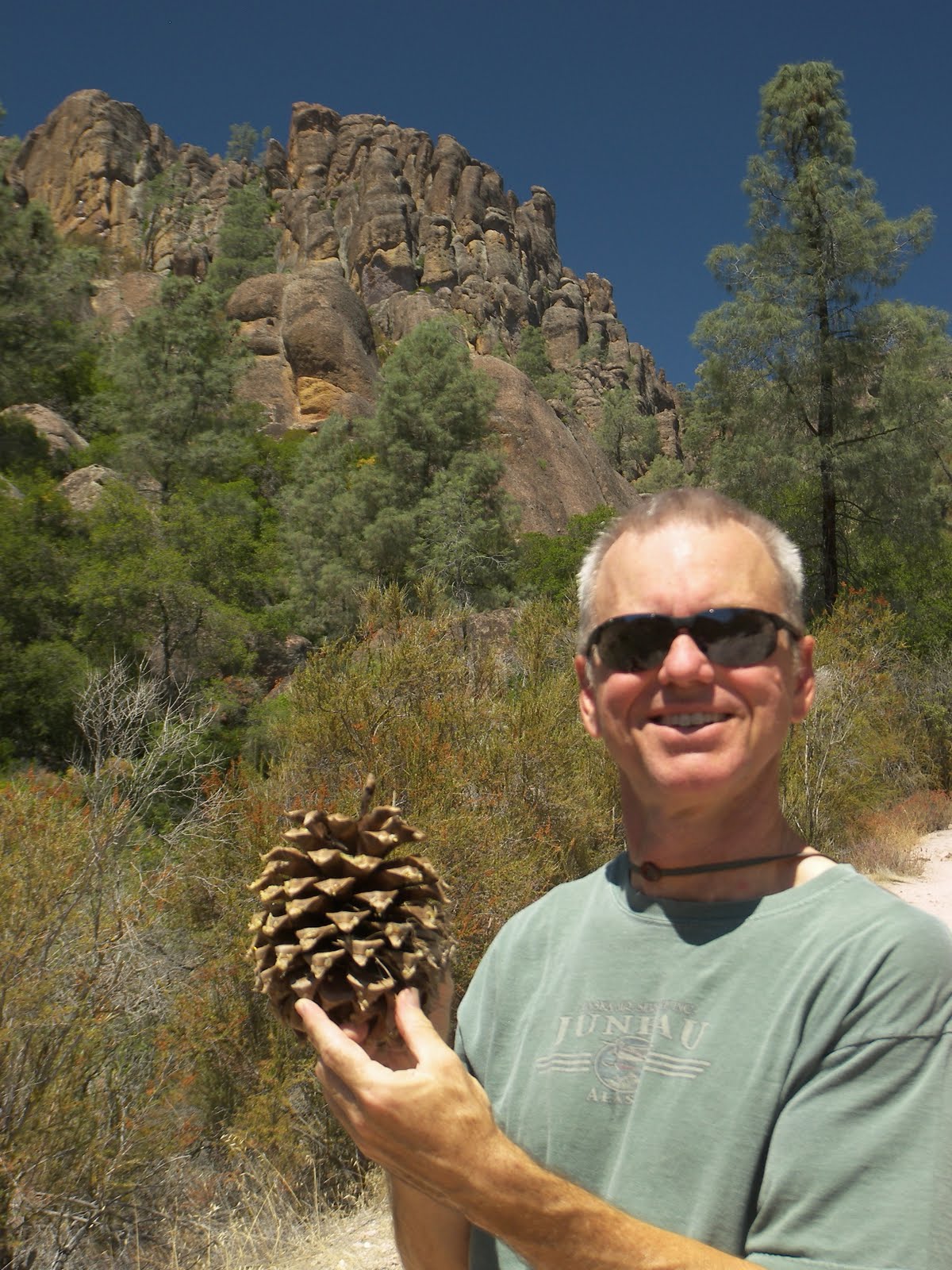
Despite the visual weakness, Aimee and I do enjoy the unique flora and fauna of the Coastal Range. Aimee spots wild turkeys, several Acorn Woodpeckers and what we hope are three California Condors (and not Turkey Vultures). I myself am happy to have finally found a Coulter Pine. Despite being small and straggly, these trees produce the world’s heaviest pinecone. Plus the cones are armed with jagged spikes turning them into Nature’s Hand Grenade. We are thinking we need hard hats hiking around them.

Pinnacles is Tucson-like hot and dry, so we quit our hike after a couple hours and head out of the park along some more winding roads to the Salinas Valley where we link up with the 101. We are again in America’s garden although this time it is rabbit food, lettuce and broccoli. Nowhere else in the US will you find dozens of old school busses pulling port-a-potties cruising the highway. (They are carrying migrant workers picking the crops.)

Eventually we make it to Monterey where we make a hard left and head south along the coast. We are looking for Big Sur but a thick layer of fog covers almost all the coast. When we get to Big Sur State Park, the campground is full but they let us camp in the parking lot for $35. Welcome to California.

Tuesday, August 23, 2011

August 23, 2011

August 23, 2011

Even though the weather is wonderful, staying at Yosemite Valley is getting to be too much of a hassle for us; so we head out this morning. We take the southwest gate this time and stop at the Mariposa Grove. In 1864 Abraham Lincoln took time out from the Civil War to protect this stand of Sequoia trees (along with Yosemite Valley).

Since Yosemite gets so much traffic, seeing the Sequoias is time-consuming. When we get to the Mariposa turnoff, we find the parking lot is full so we have to park at the gate and board a shuttle into the grove. The entrance has a few Sequoias. To see the big ones we have to hike more than an hour uphill. Aimee and I are thankful we are no longer at 8000 feet. The upper grove is nicer but we both much prefer Sequoia National Park. It is has bigger trees and fewer visitors.

Afterwards we descend almost to sea level into the San Joaquin valley, America’s garden. At one point we drive a solid fifteen minutes through nothing but Pistachio trees. There had to be millions of trees. Somebody eats a lot of nuts. Later we pass by tomato fields and grape vineyards. All this food is making us hungry so we stop at a roadside stand and buy a bag of pistachios and oranges for $5.

So far in our California travels we have seen nothing but barren deserts, high mountains and vast farmlands. You wouldn’t guess California is the most populated state. We spend the night in the town of Los Banos. Who would name their town “The Toilets”???

August 22, 2011

August 22, 2011

We were only able to get a one-night reservation for Yosemite Valley. But we know the tricks of the National Parks so we are up early today, carrying our coffee to the ranger station. We are first in line. Based on prior experience we should easily be able to get a cancellation that will let us stay for a few more nights in Yosemite National Park. When 8am rolls around the ranger says nothing is available and we have to come back at 3pm. We still have first dibs if we come back, but there is no guarantee. We have to temporarily park the RV outside the campground till we have a new site.

Knowing I travel with my lucky charm, I am not worried; so we head off to a Photography walk led by the Ansel Adams Studio. Ansel is hands down the most famous landscape photographer. The shop is still owned by his descendents. I don’t learn much about taking better photos, but the guide does alert me to some good vantage points.

We spend most of the day walking in Ansel Adams footsteps, taking photos throughout the valley. I posted the above in black and white in Ansel’s honor.

At 3pm we return to the ranger station and find there are plenty of cancellations but unfortunately not one is for more than one more night. I have lots to say about the reservation system at Yosemite but most comments can’t be printed. On the plus side our new site is pretty nice. It is on the bank of the babbling Merced River. Aimee just loves the sound of running water.

August 21, 2011

August 21, 2011

We seem to have really overshot looking for cooler weather. Summer is very fleeting at high altitude. The last couple nights got down near freezing. Our thin Arizona blood can only handle so much. So this morning we decamped and coasted downhill to Yosemite Valley.

Yosemite Valley was not discovered until 1851 when soldiers went chasing after some Indians. I am not surprised since the entrance to Yosemite is a narrow V-shaped canyon. Only after many miles does it open into the famous vertical granite valley. Unfortunately it is being loved to death. The crowds are thick. We head immediately to our campsite to lose the RV and the first thing we notice is the moderate temperature. We found what we were looking for! The rest of the afternoon Aimee and I take a leisurely stroll thru the valley soaking up the ambience. We keep looking up at North Dome and can’t believe we were atop it yesterday.

August 20, 2011

August 20, 2011

Yesterday the camp host (a New Yorker) recommended a hike to North Dome. The trailhead is only ten miles away, so we decide to give it a shot. The trail was nice but nothing special, but…it had a pot of gold at the end. North Dome as we come to find out is Half Dome’s counterpart sitting atop the eastern end of Yosemite Valley. Even though we are still some thirty miles from Yosemite Valley, by road, we are only a few miles as the crow flies. After four miles through the forest the trail emerges onto bare granite. It makes Aimee very nervous. (It doesn’t help that a lady died last week in similar circumstances sliding off Half Dome.) But Aimee troops on through to the end.

We sit on this dome of granite, with Half Dome staring us in the face, eating our trail lunch and soaking up the scenery. We watch the bustle of cars far below in the Valley. The only disappointment is the thick haze covering the valley, probably the result of the thousand campfires that burned in the valley last night. We sit for probably an hour hoping some of the haze will blow away and that the sun would travel far enough to shine on the face of Half Dome. Neither occurred. We hike back with a brief side detour to a pretty rock arch. We are tired after we get back. It was a ten-mile, six-hour hike at high altitude. We are not getting any younger.

August 19, 2011

August 19, 2011

This morning we finish our tour of the June Lake loop. This short road goes past several more lakes. I am amazed at the concentration of alpine lakes we have seen in the greater Mammoth Lakes region. I guess it is a reflection of the number of glaciers that used to cover this area. In the middle of the June Lake loop we spot the best vista, Horsetail Falls. It is a spreading falls way up on the cliff top that can be seen for miles.

From June Lake we drive north to the town of Lee Vining. We call the park system and get a campsite in Yosemite Valley two days from now thanks to a cancellation. In the meantime Aimee and I decide to hang out in one of the campgrounds on the plateau high in Yosemite National Park. So we drive up the steep Tioga Pass road into the park. The topside of Yosemite is basically all smooth granite with some forests growing here and there. It is an amazing place. Unfortunately we pass most of it by. Aimee has me worried. It is Friday, and the road is packed with cars, so she thinks we need to find a campsite. We have three campgrounds to pick from. We pass the first. Full. Hmm. At the Visitor Center, the board said the next two have availability, but that was as of four hours ago. The ranger says we better hurry. We drive to the next one. Full also. Uhoh. We race to the last one. Full. We are experienced National Park goers. How can we have screwed up this bad! We are many miles from any alternative. We are going to have to punt and skip Yosemite. On a lark I drive thru the “full” campground to look for the camp host. I put on my best salesman smile and ask about overflow options. She hems and haws and finally says she has a spot. In fact she has several. It turns out she saves a few sites for problems. Whew! That was a close call. We spend the rest of the day relaxing and giving thanks for our good fortune (and persistence).

August 18, 2011

August 18, 2011

One of the reasons the eight-mile road to Devil’s Postpile is reserved for busses and campers is that it is treacherous. The first four miles is a narrow winding cliff-hugging road. It made Aimee very nervous. On the route in, Aimee closed her eyes and yelled for me to go slow; I went fast because I don’t know how a bus and my wide RV can possibly share this road. We got lucky on the way in and only met a car. I am not taking any chances on the exit trip; so we rise early and drive out still in our pajamas. Once we are safely out of the Monument, we stop at a vista turnout, and have our coffee and breakfast while enjoying the view.

After breakfast, we make a stop at a geologic fissure exhibit. Because of the intense mountain building going on, the ground here pulled apart some six feet leaving a deep scar on the terrain.

Our next stop is the Lake Mary area just outside Mammoth Lakes. There are a half-dozen alpine lakes close together with easy road access. It is also very crowded with lots of families. We make a driving tour looking for a good campground. When we pass Horseshoe Lake we notice lots of dead trees lining it. It turns out that geologic activity is spewing Carbon Dioxide killing the trees. This volcano stuff is giving Aimee the willies so we pass on staying here and drive north to June Lake where we find a spot and relax for the afternoon.

Thursday, August 18, 2011

August 17, 2011

August 17, 2011

Well if we were looking for cool weather we found it. It got pretty cold last night in our uninsulated home. I wish I had turned the furnace on before we went to sleep. But I shouldn’t be too surprised since we are at nearly 9000-foot altitude.

We are planning a lazy day today. We are just going to do a medium hike and then hang out in the campground. At least that was the plan. We didn’t account for the bus ride to and from, the walk to the trailhead or the minor “getting lost” detour. When we get back close to 5PM, we are both exhausted. We are also not used to the altitude!

On the positive side, it was a gorgeous mountain hike that started on the Pacific Crest Trail and ended at the alpine Shadow Lake. Along the way we passed numerous small Sequoia trees. They are either young or more likely stunted since we are on the dry side of the Sierras. The only downside of the hike (and our campsite) is the very fine gray dust everywhere. I have been to enough western locations to know it is probably Tuff or volcanic ash. It is just another reminder that every mountain here on the West coast is a dormant volcano waiting to erupt.

August 16, 2011

August 16, 2011

Even though we drove many hours north on the eastern side of the Sierra Nevadas, apparently we are in Los Angeles. It seems people do value this area, but for only one reason. Water. Many years ago LA bought all the land around here to garner the water rights and built a large aqueduct to drain it south. On the positive side there has been no development and the whole area is a recreational playground.

Last night we stayed in the cute town of Lone Pine in the shadow of Mt. Whitney the tallest peak in the lower 48. We are finally across the desert where the weather is cooler and the scenery beautiful. Now we can slow down.

Ten miles north we stopped at Manzanar National Historic Site. It is the location of one of a dozen internment camps that west coast people of Japanese ancestry were relocated to during WWII. The museum is very well done. While there were some initial physical hardships the experience was mostly an emotional tragedy. Being treated as a criminal without cause. Much of what happened in many ways was just a culmination of a century of prejudice against the Asian immigrants.

From the museum, we took the auto tour around the large camp which looked eerily similar to a concentration camp, albeit one with some nice views of the mountains. At its peak the camp held over 10,000 people.

From Manzanar we continued north along the Sierras climbing ever higher until we came to the Mammoth Lakes area. This is a big winter ski destination and apparently just as big a summer stop. We drove thru the town, past the ski lifts to Devils Postpile National Monument. The last eight miles is restricted to busses only unless camping within the park. This is just another example of why RVing is the only way to see the National Parks.

At the Monument we quickly find a campsite and don our hiking gear. A half-mile down the trail we run into the Postpile, a strange geologic feature that looks like a bunch of black pencils stacked on end. From the top each pencil is a hexagon, making it look very man-made. We continue another two miles on the trail to a roaring waterfall.

Monday, August 15, 2011

August 15, 2011

August 15, 2011

We crossed the Colorado and headed uphill from the Sonoran Desert to the Mohave. Mohave is the high desert and what grows here is different. But so far not much of anything, not even cacti. It is mostly barren making Tucson look like a jungle. Eventually we come to the Mohave National Preserve at the heart of the desert. When I was a small child we drove to California along Rt. 66. I remember my father being worried about this last section thru the Mohave. No wonder, it is desolate. Thinking those thoughts must have jinxed me. When we finally got to the Visitor Center on the site of an old desert ghost town, Aimee notices that one of my tires is flat. Great, just great!? A two day old tire nonetheless! Fortunately at the last minute, I packed our emergency tire pump and after twenty minutes I got enough air into it to make driving a little safer. It seems to be holding. I am crossing my fingers that the valve stem just got a little dirt in it.

A little calmer, we head into the Visitor Center for a quick run-through. It is located inside the town’s restored train station back when trains were super labor-intensive and an iron ore mine operated nearby. Now the train glides right by without stopping.

Mohave National Preserve has several distinct environs including a monster sand dune, a volcanic lava field, granite mountains and an extensive Joshua tree forest. We exit the park thru the forest. Unlike Joshua Tree National Park, these trees are more stunted but much more prolific. It almost looks like a Joshua orchard.

From Mohave we drive most of the day north following the eastern edge of the Sierras. This side is in the rain shadow of the mountain range and is bone dry and desolate. Southern California could easily be given to Nevada or Arizona and nobody would care (or know).

Sunday, August 14, 2011

August 14, 2011

August 14, 2011

It has been almost a year since we have been RVing. We (make that I) am getting itchy to start traveling again. We have spent most of the year playing golf and trying to get our money’s worth from joining the local club.

We got the motor home out of storage a couple days ago, bought new tires and got it packed in record time. We took off heading northwest just before lunchtime. It feels strange, but I am getting used to it again. Like riding a bike. Most of the southwest is pretty hot, and it gets steadily hotter as we pass thru the heart of the Sonoran Desert. After five hours we arrive at the town of Parker, AZ on the bank of the mighty (tamed) Colorado River. We find a shady spot to park and crank the A/C on high until the sun goes down.

Thursday, August 11, 2011

August 8-9, 2011

August 8-9, 2011

With this week’s stock market crash putting a major crimp on our cash flow, we stopped in Amarillo on our westward journey to mooch a free place to stay with Aimee’s sister. I worked off our indebtedness doing some handy man work around the house.

From Amarillo, TX we drove two hours southwest across the border to Clovis, NM. In archeological circles, Clovis is world famous. In countless museums and TV documentaries, I kept hearing about “Clovis points”. I had to stop and find out what was so special about these old Indian arrowheads.

Our first stop is the Blackwater Draw dig, where we are greeted by a very talkative grad student of Eastern New Mexico University. He turns out to be a fountain of information. The migration of man to North America was thought to be a recent phenomenon until arrowheads were discovered here in 1929 inside a fossilized Mammoth skeleton. Radiocarbon analysis dated it to 12,000 years ago at the end of the last Ice Age. The arrowheads have a distinctive fluting, differentiating them from later cultures. Since that discovery Ice-Age “Clovis sites” have now been found throughout North America. It was interesting to note that the flint for these arrowheads came from the Alibates quarry north of Amarillo that we visited 18 months ago.

We walked the trail that circles the dig site reading the interpretative signs. At the end of the Ice Age, this area was much cooler and a spring-fed lake here attracted all the mega mammals of the era from mammoth to camel to saber toothed tiger. All over this former gravel quarry archeologists have found bone beds mixed with Clovis points.

From the dig site we drive twelve miles to the Blackwater Draw Museum. It is pretty good but it has way more information than we have time for today. For some reason the Clovis culture disappeared at the same time many of the mega fauna went extinct. Some blame it on over hunting by the Clovis while others think a comet struck the earth.


Continuing southwest, we are on the lookout for cooler weather. We find it again crossing the mountains of central New Mexico. We take a short break from driving and visit Smokey Bear Historical Park. In 1944, the forest service began using the character of Smokey to promote fire safety. In 1950 a small bear cub was found badly burned clinging to a tree near here. He immediately became the personification of the advertising. We breeze thru a small museum on the history of Smokey and then walk to see his gravesite. Smokey Bear is one of the most recognizable characters throughout the world.

From Capitan, NM we drive the rest of the day arriving home to Tucson very late.

August 7, 2011

August 7, 2011

Yesterday we fished near where the Buffalo River empties into the White River. It was very picturesque because the opposite shore was a tall sheer cliff face. On our way west we decided to follow the Buffalo River upstream. Our first stop was at the Visitor Center for the Buffalo National River. There we learned that the Army Corps of Engineers had plans to build a dam on it like they had done with most of the other Ozark Mountain streams. To preserve it, local conservationists got the Buffalo designated the first National River.

From the Visitor Center we walked along the shoreline of the river. Here the opposite bank is also lined with a sheer rock face. Unfortunately this time of the year, the water level is very low scuttling our plans for a canoe trip. We would have had to paddle all the way. Instead we drive upstream to the Ponca Wilderness area. Here the Buffalo is lined with its tallest and most picturesque cliffs soaring almost 500 feet high.

Afterwards we continue west out of the Ozark Mountains. Although very scenic, the whole region is fairly isolated with few roads. After a few hours following narrow, winding roads we emerge on the west side of the state and spend the evening in Oklahoma.

Sunday, August 07, 2011

August 4-6, 2011

August 4-6, 2011

Aimee and I are staying in a cabin at the junction of the White and Norfork Rivers in northern Arkansas. With the Midwest suffering a terrible heat wave, I was looking for some temporary relief. Last year we found it exploring caves and traveling way north. A closer alternative is standing in these rivers. Both rivers are tail waters off tall dams making the water ice-cold. Very refreshing despite the near constant fog. While I am cooling off I toss in a fishing line. I catch quite a few trout but none are worth taking a photo of. I must be rusty after five years of desert living. The only saving grace is that none of my relatives has any better luck.

August 2-3, 2011

August 2-3, 2011

For the last two weeks we have been in the Midwest visiting family and friends and eating lots of pies. We planned on it being a little vacation from the heat of Arizona, but it was more like being tossed from the skillet into the fire. There is no escaping the humidity.

Today we are starting the journey back home. Like all travels with me, it is not a straight shot. We took advantage of not having the RV with us to do some city touring of the St Louis area. Our main stop was Forest Park which is always a pleasure to visit. There we stopped at the Art Museum, which has a couple pieces representing almost every style and period of art. From there it was on to the Missouri History Museum. It was mostly disappointing except for the two in-depth exhibits on the 1904 St Louis World’s Fair and favorite adopted son, Charles Lindbergh, and his epic trans-Atlantic flight.

After spending the night in town with my sister, the next day we stopped at the mostly boring Laumeier Sculpture Park before heading to Jefferson Barracks Military Post. Located on the bluffs of the Mississippi, it was an important army installation from 1826 thru the end of WWII. There are a couple small museums located in the two remaining stone powder magazines but they are not well done. From St Louis, we head southwest where we spend the night in Norfork, AR.

Friday, June 24, 2011

June 20, 2011

June 20, 2011

Aimee has a love-hate relationship with wildlife. Too close and screams ring out. But at a safe distance, she is enchanted. Lucky for her, our new home has given her mostly the latter. Hummingbirds and noisy Gila woodpeckers monopolize feeders outside her kitchen window. An occasional bobcat will walk thru the yard. All day lizards of all sizes scamper around the yard on the prowl for scorpions, sometimes a little too close. A few days ago while sitting by the pool, a gecko darted toward her and tongue-snatched a bee buzzing around her wet shoes. The show doesn’t stop with sundown. That is when the bats start fluttering through the air and the coyotes begin to howl.

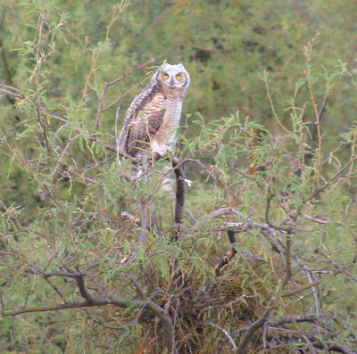
But by far Aimee’s favorite attraction has been a family of owls. We knew something was up when two Great Horned Owls started frequenting a big cottonwood at the back edge of the yard. The Great Horned is the largest owl species in North America. After a month watching the pair sit high in the treetop every evening, three owlets suddenly came on the scene. Like clockwork this family comes out of the nest an hour before dark and every evening Aimee is waiting by the back fence. She is enamored with them.

The owlets remind me too much of human teenagers taking their time to grow up. They sleep all day, stay up all night hooting and screeching. The three hang out together either head bobbing on branches or strutting around on the ground like skinny turkeys. Plus they are terrorizing the neighbors. Dove feathers litter the neighborhood. A trail of blood stains one corner of the house. The doves are not giving up; they are back on the nest trying to crank out a new generation.
Newer Posts Older Posts