Monday, September 10, 2012

August 11, 2012

August 11, 2012

Aimee is sick. Her sore throat is worse and now she has a slight fever. She is bummed and it is not good timing. We are on the move again to the airport for the next leg of our trip. We are headed for the opposite of Cairns, the desert center of Australia. Cairns is on a narrow strip of green lining the coast. As we fly inward, we pass another thin strip of farmland and then nothing, just arid brown rolling hills. No rivers either, only dry washes. I do see an occasional road but they are all dirt. No paved ones and certainly no towns. As we fly on the only thing that changes is the color. The ground goes from brown to gray to red.

After three hours we land in the “Red Centre” at Ayers Rock airport. We secure another rental car and drive the five miles to the resort complex. We have a reservation for a cabin in the campground. We normally wouldn’t have stayed here but the alternatives are budget busters. Besides we are familiar with campgrounds and have often talked about staying in the cabins we’ve seen in the US.

After checking in, we head to Uluru-Kata Tjuta National Park. Uluru is the Aborigine name for Ayers Rock, as Denali is to Mt. McKinley. We pay a stiff entrance fee and drive up to the red monolith. It is one giant piece of rock jutting straight out of an otherwise very flat landscape. It is too late for the base walk so I decide to climb to the top. Aimee waits for me at the bottom. In addition to being sick, she is afraid of heights and wouldn’t have come along anyway. The hike up is not long but is atop very steep slickrock. An iron chain follows the ridgeline so people can pull themselves up the incline. I am huffing and puffing by the time I reach the top. The path up is pretty cool but the uninteresting top is anticlimactic. The peak is so big and flat the views are not 360. Not to mention there is virtually nothing in the surrounding terrain to see anyway.

Ayers Rock is another result of Australia wandering the tectonic globe alone. Since it hasn't bumped into another continent in a hundred million years, no new mountains were formed. The old ones had plenty of time to erode away making Australia the flattest continent. Uluru is a very hard mountain core that resisted millions of years of erosion. The return hike down the steep incline is treacherous. If you are not careful, I could see easily tumbling all the way to the bottom. No wonder a bunch of people have died on this trail.

After the climb, we went to the Cultural Center to learn about the Aborigine owners of the park. It was a big disappointment. They are nowhere to be seen. We saw a few in Cairns but have had little conversation with them. The Australian Aborigine experience parallels our own Indian history, just more recent. Aborigines are a very old people having crossed the sea from Asia to Australia some 50,000 years ago.

Since it is getting late, we went to the sunset parking lot to watch Uluru change colors as the sun drops closer and closer to the horizon. This is the same thing we do at home with our mountain view. Afterwards we went to the market to buy groceries for a very late dinner.

Sunday, September 09, 2012

August 10, 2012

August 10, 2012
This morning we rose a little later than usual.  Aimee seems to have acquired a sore throat and needs some extra rest.  From the Ferntree Rainforest Lodge in Cape Tribulation we head across the street to the last boardwalk hike in Daintree National Forest.  I leave Aimee in the car to recuperate.  This hike is similar to the last, a combination of rain and mangrove forests, but with a lot more circular fan palms.  I mostly tiptoe along as quietly as I can, hoping to see a Cassowary.  This is pretty much my last chance.  I hear lots of jungle sounds, birdcalls, and things dropping from the canopy, and to my displeasure several rooster-like Brush Turkeys scraping at the forest floor.  But no Cassowaries.  I heard a crashing sound and saw a large animal in the distance but it looked like a feral pig, albeit a big one.  I think the rainforest is like the desert.  There are lots of animals but most are camouflaged and quiet.  I probably need to be extremely lucky or very patient.

Disappointed we head south to return to Cairns.  Since Aimee is under the weather I drive slow enjoying the drive.  It is still early and there are few cars to push me along.  Fortunately my lucky charm, even sick, did her job.  Less than 15 minutes later, I see something crossing the street ahead and it has a blue head!  A Cassowary!  And he has a chick with him.  The baby is the size of a rooster and looks like a watermelon with legs.  Both strut slowly across the road letting me take photos.  I am now at peace with the rainforest.

Soon we ferry back across the Daintree River.  Yesterday we talked to a couple from Boston who had taken a guided wildlife hike in the interior Tablelands.  They mentioned seeing kangaroos on a golf course.  Since Roos are still on my must-see list we make a detour to the west climbing up the coastal hills through Mowbray National Park.  As we drive the steep road, what do I see ahead, another Cassowary.  When it rains it pours!

Up on the interior Atherton Tablelands the terrain is noticeably drier, and the trees more scattered.  Brahma bulls are grazing in the fields.  Curiously there are also strange boulders scattered around the terrain.  I stop and look at a couple.  They are not very hard, so I don’t understand how these rocks can be here.  After a while I realize these are the giant termite mounds that I have read about.  They are everywhere.  I wonder how the Australians keep their houses from being chewed up.

After an hour we arrive at the hopping town of Mareeba. It is bigger than I expected for the Outback. We have lunch and then head to the golf course. I am not disappointed. There must be a hundred kangaroos sitting under the trees on the course. And they are huge. One of the males is easily five foot tall. These Eastern or Great Greys are the second largest kangaroo; Reds can be a foot taller and weigh 200 lbs. I get up close and take photos for fifteen minutes. They are all keeping an eye on me, making sure I don’t get too close. They are pretty cool. Several have feet hanging out of overstuffed pouches. Every once in a while I see a Joey head popping out. When I accidentally startle a few, they humorously bounce away.

From Mareeba we head downhill back to Cairns and the same hotel as before.


Saturday, September 08, 2012

August 9, 2012

August 9, 2012

From Cairns we drove up the coast passing sugar cane fields in the process of being harvested. After a while the flat coastal land disappeared and we drove along a narrow winding cliff road. This area is famous for being the only spot where two World Heritage Areas come together. The Wet Tropics of Queensland and the Great Barrier Reef. After a half hour the shoreline flattened out again and we turned inland to the Mossman Gorge section of Daintree National Park. There we board a shuttle bus for the final 1.5 miles to the park trailhead.

We spend an hour hiking a boardwalk thru the rainforest. This jungle is right out of the Tarzan movies. There are vines everywhere. Sunlight is a precious commodity in rainforests. The canopy of the tall trees almost completely blocks sunlight. My camera can attest to that. It is very hard to take photos in the rainforest. It is too dark. I should have lugged a tripod along with me on this trip.

Rainforest plants have to fight for their share of sunlight and they have come up with amazing strategies. Some plants, whose seeds are dispersed by birds, germinate in niches and cracks of trees and then grow as vines upward and downward. Some vines grow to tree-size. The strangler fig, my favorite, ends up completely wrapping itself around the tree to the point the host dies, leaving the fig looking like a hollow skeleton. The basket fern grows a large bowl-like structure high up in trees to collect all the rainwater and nutrients it needs. The huge amount of rain that occurs in a rain forest causes trees to develop strategies to remain upright. Most end up growing wings mimicking the flying buttresses of medieval churches.

From Mossman, we continue our journey north to the wide Daintree River. We cross it by ferry to enter the Cape Tribulation section of Daintree National Park. The next thirty miles are mostly narrow winding roads. We stop at the Jindalba and Marrja pullouts to hike hoping to spot a Cassowary. We see lots of the large colored fruits they eat, but no sign of the elusive bird.
The rainforest has amazing diversity. The Wet Tropics Rainforest heritage area here is especially unique because it lies in Australia, which has been isolated from the rest of the world for millions of years. As a result many of the plants here are living fossils, thought to have been extinct but surviving only because of the isolation.

Our final hike is at Cape Tribulation beach. This area earned its nickname from the famed English explorer Captain Cook who had the misfortune of discovering the Great Barrier Reef the hard way. With his ship damaged, he limped ashore here to make necessary repairs. Cook really got around. We have run into his exploits on previous travels to Alaska, Tahiti and Hawaii.

Australia is full of beautiful sand beaches. But nobody gets too close to the water. The world’s deadliest animal, the box jellyfish, swarms these waters in the summer. That is why I wore a stinger suit on my reef dive. If the jellyfish don’t get you, the saltwater crocodiles will have you for lunch. This brings up my third reason not to come to Australia. It is dangerous. Australia has the most dangerous version of every animal in the world whether it is snake, spider, seashell, octopus, fish, or shark.

Since it is late we spend the night at the Ferntree Rainforest Lodge. We have one of many cabins in this resort nestled in the rainforest. We celebrate our arrival here by drinking a bottle of Australian wine on our cabin porch. That evening while dining al fresco in the restaurant, I hear some familiar screeches in the surrounding trees. The flying fox! We watch them one by one take off for their nightly routine. Welcome to the jungle. For dinner I had the fish entree, barramundi. Barramundi is a large fighting fish that is on every local sportsman’s list to catch.

Friday, September 07, 2012

August 8, 2012

August 8, 2012

The big tourist draw in Cairns is its other World Heritage Area, the Great Barrier Reef. Even though it has been many years since our last dive, I can’t come to Australia and not see it up close and personal. Aimee doesn’t feel the same urge, so I make my way downtown alone. While looking around for a good parking site, a local tells me to be careful parking under a tree with flying foxes. Their droppings will strip paint. I am in a hurry so I don’t ask any questions. Close to the harbor, I hear lots of screeching noise in the trees above and see things hanging in the upper reaches. Bats! Monster bats! Oooh, that’s what a Flying Fox is. These scary looking things have a dog’s head with jet-black wings. They look like little Draculas.

At the dock, I get checked in and find my dive boat. While filling out my paperwork, I realize that I left my dive certification card at the hotel. Uh-oh. I hope they still let me dive! They do, but they insist the first dive be an introductory one.

Although Cairns is a Reef gateway, it is still thirty-five miles out to the dive site. We are on a large powered catamaran and it is flying through the water. Unfortunately not fast enough with the rough water we are traveling through. I don’t do well on boats so I took Dramamine an hour ago. Apparently I am the exception. One by one almost the entire boat ends up on the back deck praying that we arrive quickly. At the reef, I don a Lycra stinger suit, a shortie wet suit, my Scuba gear and jump in. The cold water takes my breath away. I thought this was the Tropics! I am not sure if it was the cold or my rusty Scuba skills but I immediately thought I was too old for this. I am glad Aimee is not along or I would be worried about her too. I slowly descend the anchor line and try to breath calmly. It was a boring dive with little to keep my mind occupied.

Back on the boat, I can’t stop shivering so I delay my second dive until after lunch. I sat in the sun huddled up for 30 minutes before feeling better. I overheard the snorkeler’s briefing mention giant clams. Thinking I might miss this once-in-a-life opportunity I jumped back in the water with only snorkel gear to take a look. About thirty feet below I saw two huge specimens. Unfortunately I couldn’t equalize my ear pressure to get close to them.

Warmed up by a big lunch, I donned my scuba gear again and went out for the second dive. It was much more enjoyable. The coral was colorful and full of anemones. And giant clams were everywhere. I thought they only existed in movies! They were large enough to easily swallow a child. I swam with a huge blue fish as big as me called a Maori Wrasse, and I saw a poisonous but beautiful Lionfish lurking within the coral.

August 7, 2012

August 7, 2012
The hillside to the west of Cairns is rainforest and part of the Wet Tropics World Heritage Area. We are going to explore it today. Just north of the city we get tickets for the Skyrail. Skyrail is a series of gondolas that carry us uphill skirting the treetops of the rainforest. It is an anti-climatic journey. After a very short ride we disembark at the first station where a ranger gives a guided-walk through the rainforest. It was very interesting. He pointed out numerous plants and their strategies for growing in this very competitive environment. Necessity is definitely the mother of invention.

The rainforest here gained World Heritage status because it is the only piece left of the immense jungle that used to cover all Australia and Antarctica during the age of the dinosaur. As a result it holds many living relics from that era. One of those is the endangered Southern Cassowary. A giant blue-headed flightless bird. Only the ostrich is bigger. We would love to see one of them walking through the jungle.


The next station on the Skyrail is near an overlook for Barron Falls. Surrounded by jungle we can’t get a good view of the falls. This is the dry season and the flow is minimal anyway. Based on the surrounding rocks it is clear that in the wet season, this waterfall grows to immense proportions.
The last stop on the Skyrail is the touristy mountain town of Kuranda. Main Street is one big line of souvenir stores. Since we are new to Australia, it is still fun wandering around. The big sellers seem to be Aborigine art, analogous to American Indian jewelry at home. I like this Australian version much better. It is very unique. Buying anything though is going to have to wait till the end of our trip. I am not dragging painted boomerangs all over Australia.
Also in Kuranda are several specialty zoos. We pass on them and choose instead to do a short hike in the rainforest. At 2pm we board the Kuranda Scenic Railway back to Cairns. This is an old Victorian-era gold mine train that follows the rim of the Barron Gorge. Unfortunately the rainforest growth is so thick we only get glimpses of the canyon. Overall Aimee and I were not overwhelmed with our travel today. Despite the Skyway/Rail tour being very popular and pricey, it was kind of a snoozer. The highlight was when we got off and took the guided ranger hike.

Thursday, September 06, 2012

August 6, 2012

August 6, 2012

Finally, almost two days later we have landed in Australia. In Brisbane, on the east coast. Unfortunately it is not our final destination. In three hours we will be back on a plane to head north. Which brings me to my second reason to avoid Australia. It is too big, physically the size of the United States but with a fraction of the population, mostly spread out around the coast. I had initially planned on renting a motorhome and driving around the country. Only in my dreams. I would need six months and several sets of tires. Driving times here are mind-boggling. Imagine wanting to visit New York, Miami, Denver, and Seattle with only a single two-lane road connecting them and you get the magnitude of the problem. So by necessity we are flying everywhere.

After going through customs, we recheck our bags, and meet one of my forty-two cousins in the airport lobby. He works for Peabody Coal and recently moved to Brisbane on a job assignment. He and his wife took the morning off and rode the train out. I was hoping to have a beer with him but since it is 7am here we opt for strong coffee instead. He gives us the lowdown on Australia and how fun it is to work here.

Unfortunately the layover goes by much too quickly and we are back in the air following the coast north to Cairns. I chose a window seat so I could get a good look at Australia’s world famous Great Barrier Reef. We fly over much of its 1600-mile length. Although some claim it is the largest single organism, it clearly is made up of thousands of separate islands and reefs. They are a beautiful brilliant teal color.

After a two-hour flight we land in Cairns. It looks a lot like Hawaii, with sugarcane fields and lush green hills. After getting our luggage, we pick up the rental car. Since Australia is part of the British Empire, the steering column is on the right. I tell Aimee to keep repeating “stay left” whenever we approach intersections. After driving around the tiny parking lot a few times, we head for our hotel. Before leaving home I bought a SD card that adds Australia to our GPS. It works perfectly taking us right to our hotel.

Checked in, we head to “downtown” Cairns to walk along the Esplanade, a sidewalk following the ocean. The weather is delightfully warm and sunny with not too much humidity. Cairns isn’t very big, more of an overgrown beach town than a city. Back at the hotel we eat a quick dinner before a very early bedtime.

Wednesday, September 05, 2012

August 5, 2012

August 5, 2012

I am not sure what happened to this day. It vanished. Flying west we crossed the International Date Line and skipped ahead a day.

Flying today is for the birds. Our plane is packed and I can’t sleep in an upright chair. For me it is a miserable fifteen-hour flight and the biggest reason not to go to Australia. Aimee on the other hand doesn’t mind the trip. Our seats are equipped with an ultra modern entertainment system with endless options. She watches six hours of a British TV show. She is going to regret not trying to sleep.

August 4, 2012

August 4, 2012

Tucson is still fully in the grips of summer, so we are back on the road. Metaphorically speaking this time. We are actually in the air leaving the RV behind. We are taking our adventure overseas, headed Down Under, to Terra Australia (southern land). No matter who we speak to, people are jealous. Australia is a dream destination even for Americans who don’t travel. I think that is because Australia is this mythical place south of the equator on the other side of the world. A mini-US where the water drains counterclockwise and kangaroos run wild. A foreign country where the inhabitants speak English with a funny accent and invite you to their barbie for a beer.


I must admit much of the glitter of Australia has faded for me during the planning of this trip. Our Australian adventure is the antithesis of our typical trip. I enjoy freewheeling it around, lingering as long as we want, and then moving on. For lots of reasons, that isn’t going to happen. In fact if asked, I can give many very good reasons not to ever go to Australia. I would tell people first to look at a globe and find Australia. It is just about as far away from the US that you can go. Anybody who has flown cross-country knows LA to NYC is a grueling five-hour flight. LA to Sydney is three times longer. And for Tucsonans add another hour to fly to LA (and six more on a layover at LAX).

Tuesday, July 24, 2012

July 19, 2012

July 19, 2012

We sleep over the cab of the motorhome. I usually have the inside position next to the front window. Despite sleeping in this spot for almost 500 nights I rarely have pulled the curtain and looked out. I did the last two nights and was pleasantly surprised to find this is a great spot for stargazing. Not only am I warm and snug under the covers; since I am lying down, I don’t have to strain my neck looking up. Too bad this is the end of the trip.

We spend the morning driving south descending off the Colorado plateau arriving back in Tucson in time for lunch.  We unpack the RV in the heat, a not so welcome homecoming.  In the dead of summer, Tucson gets monsoon rains that lower the temperature but add mightily to the humidity.  On the plus side the rain has caused many of the desert natives to thrive and bloom.  And the prickly pear cacti with their ripe purple fruit add to the color.

July 18, 2012

July 18, 2012

After six summers of travel we have seen much of what the West has to offer. There is still more to see but many of those left are more troublesome, like requiring a four-wheel drive high clearance jeep or in the case of today, limited access. Ever since I saw a photograph of “The Wave”, it has been on my list. To my dismay only 20 people are allowed to visit it per day. Half the slots are made through a reservation system that fills up four months in advance in the first few minutes. The other half is a walkup lottery.
So here we are at in Kanab, UT at a small Visitor Center for the Grand Staircase National Monument. Aimee and I are with fifty other people hoping to get two of the ten slots. We are the only Americans! Most are European, although surprisingly there is a Chinese threesome and a Japanese couple. To make my odds worse, this area had a big rainstorm and the eight-mile dirt road access is flooded. I will need to rent a Jeep if we are successful. I do have my lucky charm with me but to my disappointment she is hoping we lose. She wants nothing to do with washed out roads. Of course Aimee wins and we don’t get a permit. If I am ever going to see “The Wave” I will need to buy a jeep and come back here in the winter when my odds are closer to 50% instead of 20%. I am irritated that my tax dollars are going to support this park that I can’t enjoy. The ten lucky international visitors aren’t even paying an entrance fee.

Frustrated, we drove east from Kanab toward the Arizona border. As a consolation prize we stop along the way to do a short roadside hike to the Toadstools. These strange rock formations do resemble giant mushrooms. They were formed when hard rock protected the underlying stone from erosion.

We also stop at a second Visitor Center to see a dinosaur exhibit. Recently this very remote part of the United States has been a hotbed for dinosaur discoveries. They have several exhibits showing the variety of fossils found. Most have been completely new species.

Just before Page, AZ we stop at an overlook to see a great view of Lake Powell. It is a beautiful sight. After a few more hours we stop for the evening in Flagstaff. This is our last night in cool weather. We celebrate with a dinner of beans and weenies.  That is all we have left in the cupboard!

Sunday, July 22, 2012

July 17, 2012

July 17, 2012
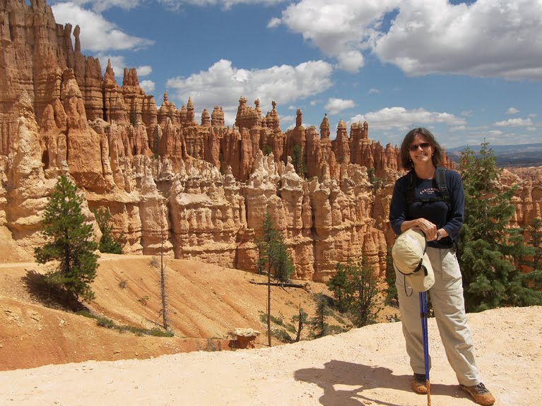
Since we are passing right by Bryce Canyon National Park, we decide to enter and do the hike we both liked so much five years ago. It was great, just as enjoyable the second time. Around every turn of this six-mile hike was a new vista. Bryce is certainly a wonderland when it comes to colorful hoodoos. It is another reminder of how much we enjoyed the month we spent traversing southern Utah. The Colorado plateau is just non-stop scenery that can't be matched anywhere in the world. No wonder so many international visitors flock to this area. The question is why don’t Americans visit???

We need to keep pushing south so after finishing our hike we drive for more than an hour to the Arizona border. Before crossing we stop for the night at Coral Pink Sand Dunes State Park. Here sand from erosion of the surrounding red cliffs has gathered into a small red Sahara. The sand accumulates here because the prevailing wind gains speed as it passes through a gap in the mountains. Once through, the winds slows and drops the windborne sand.

While Aimee cooks dinner I take a quick stroll atop one of the big dunes. Because it is wind sifted the sand is all very fine and virtually the same size. Perfect sand! The kind of sand you would look for if you were assembling an hourglass. The sand is so fine, it blows easily off your hand. It also flows downhill like water. But I admit you have to be an engineer to appreciate that factoid.

Saturday, July 21, 2012

July 16, 2012

July 16, 2012
The post office will only hold our mail for thirty days so we need to get back to Tucson by the end of the week. We spend most of the day driving across Utah to its southern border. Utah like all western states is huge. Despite the marvels of the interstate highway system, they have yet to cross that big monster canyon that straddles almost the whole Utah-Arizona border. Aside from a long detour into Nevada our only way across is at Page, AZ. So eventually we have to leave the highway and take back roads uphill. As we make our way the approaching red rocks of the Colorado plateau mesmerize us, so we decide to stop early and spend the night at a forest service campground. Our campsite is just yards away from stunning scenery. Up until this summer we rarely stayed at forest service campgrounds. We missed the boat. Like National Parks they are set in great locales and unlike National Parks, they are less crowded and have no problem providing more amenities; and they are usually cheaper. Or so we thought.

This year, we again bought the annual Interagency Pass; what used to be the National Parks Pass. We discovered to our delight that this pass gave us a 50% discount at every Forest Service campground. That was a bonus that has made the pass pay for itself in very short order. Unfortunately I am getting mixed signals here in Utah’s Dixie National Forest. The office said yes but the local campground host said no. Not only no, but no in every forest campground. Since I knew that to be false, I ended up getting in a heated discussion with him. To no avail; you can’t argue with the government. In the end he didn’t care enough to find out if he was right.

Friday, July 20, 2012

July 15, 2012

July 15, 2012
It rained last night and for the second day in a row clouds cover the Grand Tetons. I am so glad we took pictures when we had a chance. We say goodbye to the National Park and head south following the Snake River. It flows through a beautiful canyon south of Jackson, WY. When it turns toward Idaho we follow the Salt River, a tributary of the Snake south. Near the southern border of Wyoming, we stop at Fossil Butte National Monument. This area is the source of all the Green River Formation fossil fish that we see so often at the Tucson Gem and Fossil Show. The monument has a great museum on the wide variety of fossils entombed in what used to be a large fresh water lake here 50 million years ago. After a brief tour of the visitor center we do the hike up to the historic quarry. It seems afternoon showers are the norm in Wyoming and it starts to rain just as soon as we reach the ridge top. I take a quick photo while Aimee protects the camera with my hat.

This stop was mainly an excuse to take a break from driving. It is still early so we decide to drive a little further crossing into Utah. We spend the night at Rockport State Park on the banks of a nice man-made lake.

July 14, 2012

July 14, 2012
It is time for a hike so we drove down to Jenny Lake and took the ferry across to the base of the Grand Tetons. From there we hiked Cascade Canyon alongside a thundering mountain stream. The first mile of the hike is up a rocky trail passing Hidden Falls and a spot overlooking the lake called Inspiration Point. The trail then flattens out through a marshy area where we hoped to spot some moose. On our return I was surprised to see so many tourists making this trek. Most seemed to be French, not the usual Germans we so often run into. I was telling Aimee it must be the faltering European economy. The Germans are at home working feverishly to keep the continent afloat while the French are playing. She said no, it is probably the French translation of this place, “Big Breast National Park” that is drawing the curious French.

Thursday, July 19, 2012

July 13, 2012

July 13, 2012

The Grand Tetons are majestic because unlike most mountain ranges they don’t have foothills. Instead they rise suddenly above the waters of Lake Jackson. This string of jagged peaks is hard to capture on film. But we did our best today driving around the park stopping at every turnout to judge the vantage point. We started on the more easterly road that gives views of the whole range from a distance. We finished with the more westerly road that hugs the lakes at the base of the mountains. Here the peaks are huge and in your face.

On one stop that had some old homesteader barns, I made the comment that they look right out of the classic western “Shane”. Minutes later I overheard a lady mentioning Shane and directions to the original movie set. I had to see it. Unfortunately it was in very poor condition. I need to watch the movie again to compare.

Late in the afternoon, it started to pour so we cut our tour short and headed back to our same campground in the park.

Monday, July 16, 2012

July 12, 2012

July 12, 2012
Like yesterday we got up early and took a leisurely drive south out of the park. We stopped at Yellowstone Lake and while we were having breakfast I saw a big bull elk saunter across the parking lot. While I was taking a few photos, an RV full of elderly Chinese pull up and they run right up to it. When the elk charged, the Chinese scattered like pinballs.
After this morning amusement we walked the West Thumb basin of the lake. This area is a volcanic caldera that filled with lake water. It is still active. Hot springs bubble up along the lakeshore and even a few yards into the lake.

Yellowstone has been a zoo and over half of the crowd is foreign. The entrance fee to this most amazing park is only $25, far less than the price charged in other countries. It should be doubled or tripled for international visitors who contribute no tax dollars to its upkeep. That will never happen. The politicians would howl if park rangers started asking for proof of citizenship.
Leaving Yellowstone we follow Rockefeller Memorial Parkway to its neighbor Grand Teton National Park. On our original trip we only spent a few hours here. We intend to fully explore it this time. We just love it. We have no problem getting a nice campsite and the scenery is stunning. The Tetons are the jewels of the Rocky Mountains. After the stress of Yellowstone we spend all afternoon relaxing.

Sunday, July 15, 2012

July 11, 2012

July 11, 2012

We know the routine for busy National Parks. Get there bright and early and there are always campsites available. So we rose early and passed through Yellowstone’s North gate just after 6am. As expected the entrance sign said every campground had openings. The first campground is just a mile up. But it still says full!! In the National Parks, the left hand and right hand don’t communicate! We called the reservation line a couple hours later when we found a payphone (cells don’t work here); they only had one campground with an opening (on the other side of the park). Yesterday I would have been pissed. Tonight I have a secret plan.
We made our way leisurely south through the park down the west side. It is a pure joy. The crowds haven’t woken yet and the animals are active. We see a grizzly just off the side of the road digging for roots. A deer and her baby fawn cross the road in front of us and swim the river. We also see a couple bald eagles and some elk.
The main reason we are back in Yellowstone is for the geyser basins. This area has over half of all the world’s geothermal phenomena. The west side alone has a half dozen geyser basins. On this cool morning they are really smoking; what you would imagine hell to look like. So very cool. We stopped at each basin and did the hike, usually atop a boardwalk to keep our toeseys from being boiled alive. We looked at hundreds of bubbling Mud pots, steaming fumaroles, colorful hot springs, and exploding geysers. The hot springs are Mother Nature’s paint set. The hues are vibrant mixes of orange, green and sapphire blue. The colors are due to the different bacteria types that grow in each temperature zone. The star hot spring is Grand Prismatic Spring. It is also the largest. We have to hike atop a nearby hill to get the best view of it.
Our last stop is the Old Faithful geyser basin. Most geysers are erratic and unpredictable. You have to be very patient or very lucky to see them erupt. This trip we are neither. Despite walking around the basin for several hours, we manage to see only a couple minor shows, aside from Old Faithful, which erupts every ninety minutes like clockwork. We saw it go off six times. Our last hike of the day was to an observation point high above Old Faithful.

Since we don’t have an RV campground site, our backup plan is to go to the backcountry office and get a permit to hike in and tent camp in the wild with the grizzly bears. As part of that process, we also get a sticker that lets us park the motorhome here at Old Faithful. I thought I felt a raindrop (wink-wink) so we skip the hike and stay in the RV overnight. I told Aimee to not answer the door if any body knocks while we are sleeping. That drives Aimee nuts; she can’t stand the thought of us breaking “the rules”.

July 10, 2012

July 10, 2012


If yesterday was our lucky day, today was the opposite.  It was supposed to be an easy stress-free day; a little driving then relax all afternoon.  It started out easy enough.  We drove a mile back to Buffalo Bill Historical Center to go through the last section, the Plains Indian Museum.  It was kind of a bore.  Lots of Indian artifacts but little else.  I must add I don’t have much patience for modern Indian artifacts.  All the beautiful native artwork occurred after they were able to obtain manufactured goods from the white man.  I knew about Italian beads, but I didn’t realize even the bone tubes Indians used to make breastplates were made by an entrepreneur in New Jersey.  The few pre-European relics on display were all made from bone, twine, and rocks…straight from the Stone Age.  Specifically they didn’t want to adopt the ways of the white man, i.e. farming.  That was women’s work.  But they were happy to adopt everything else, especially guns, knives, horses, and liquor.

From Cody, WY, we made our way west up the Shoshone River valley.  Aimee learned that the river used to be called Stinking River because of the sulfur smell picked up in Yellowstone.  I thought I smelled rotten eggs last night.  Aimee just blamed it on me.
About ten miles west of Cody we entered a narrow canyon blocked by Buffalo Bill dam.  We stopped at the Visitor Center for a few minutes to learn about its history.  The dam looks like a miniature Hoover Dam.    At half the height, it was probably a prelude to later construction projects.  When completed in 1910, at 350 feet, it was the tallest dam in the world.
Less than an hour later we pulled into Yellowstone National Park. Thinking we were early, I was dismayed to see “Full” on all the campgrounds except the three on the opposite ends of the park. I also forgot how big this park is. It is a long drive to the other side. When we finally get to the north entrance all the campgrounds are full. This is a pet peeve of mine. The national park has millions of acres of land, but they purposely have insufficient campgrounds and they don’t allow overnight parking. Instead they prefer that everybody drive a hundred miles around the park and then leave…every day. That is environmental lunacy.

After driving seemingly all day through the park, Aimee and I are both frustrated and we leave via the North entrance in Gardiner, MT. Right outside the park is a US Forest Campground. A giant grassy field wide open that is virtually free. We have mostly stayed in forest service campgrounds this summer. The national park system can learn a lot from this sister agency.

Saturday, July 14, 2012

July 9, 2012

July 9, 2012

This morning we drove to Cody, WY, eastern gateway to Yellowstone National Park.  The town is named after William Cody or more familiarly Buffalo Bill.  Our first stop is the Buffalo Bill Historical Center.  This attraction is a five-fer.  Five museums in one.  Our ticket is good for two days, so we decide upfront to take it slow and spread it out.  All day in a museum even for me can be too much.  We start with the Natural History section.  It has lots of stuffed wild animals and tidbits of info about the greater Yellowstone area.  Aimee enjoys it.  We then stroll thru the Western Art wing.  The museum has a wide variety of paintings and sculpture of famous artists.  One of the exhibits is Remington’s actual studio/den.  The third section is the Gun Museum.  It is massive, easily the largest private collection in the world.  I am not a gun fanatic but I enjoy the history of gun technology.  Unfortunately there was little of that.  It was mostly a listing of the guns on display.

After lunch, we went across the street to the Sierra Trading Post outlet.  It didn’t seem to be as big as the catalog nor were there many good sales.  Disappointed we next walked down the main drag.  Cody is definitely a western themed town.
Now that Aimee is rejuvenated we head back to the museum and go through the William Cody section.  Cody’s early life is hard to pin down.  Much is legend, exaggerated to support his rise to stardom as the head of Wild West show.  This Bill was paid to hunt buffalo to feed railroad crews and he later was a renowned military scout.  Buffalo Bill was already a popular character of western literature when Cody began portraying that fictional persona in a touring company.  He soon put together an outdoor Wild West circus show that became wildly successful playing in towns all across America and Europe.  The show even came through my hometown of Alton, Illinois.  Sadly though the constant traveling didn’t make for a good life.  He ended up divorced and penniless at his death.

Well before closing Aimee and I are both museumed out.  Disappointingly all the RV parks in town are full.  We leave town hoping to find an open spot (with electricity) at the state park ten miles to the west.  On the edge of town Aimee notices a small RV park not on our radar.  On a lark we stop and my lucky charm comes through again; we get a spot.  The owner hangs the full sign on the door as we leave.

Friday, July 13, 2012

July 8, 2012

July 8, 2012

From Greybull, WY we drove to Big Horn National Recreation Area. This National Park site is a man-made lake sitting in a picturesque canyon. It is similar to the better-known versions at Lake Powell and Flaming Gorge. We first stop at the Visitor Center to get oriented and learn about the geology of the canyon.

Our next stop is Devil Canyon Overlook to listen to a Ranger talk on Wild Horses. Adjacent to the park is the Pryor Mountain Wild Horse Range, the first established in our nation. Because the herd is so prolific, it needs to be thinned almost every year. Unfortunately it is a political minefield. The excess used to be sold for dogfood. No longer. Now there is an expensive bureaucratic process to adopt a wild horse. A BLM employee has to inspect your property to make sure you don’t sell the horse to a Mexican food company.

After the talk we walk around the overlook. The canyon is impressive, looking like a miniature Grand Canyon. This would be a nice place to have a houseboat. We next drive the short scenic loop mostly looking for Big Horn sheep and wild mustangs. We spot no sheep but do see several horses. Since they look just like the domesticated version, it is anticlimactic. We spend the night at a campground in the park watching the weekend boaters pack up and leave.

Tuesday, July 10, 2012

July 7, 2012

July 7, 2012
From Rawlins, WY we drove 45 minutes north till we met the Sweetwater River. We followed it upstream just as the Oregon pioneers would have done 150 years ago; except they walked. The route is desolate, nothing, not even a tree for hundreds of miles. We stopped at several of the wayside exhibits along the way. Most were landmarks in the distance that pioneers would look for to confirm they were on the right path. No GPS or Rest Stops with games in those days. A most enjoyable stop had to be Ice Slough. This was a marshy area where pioneers could dig down two feet and hope to find ice. That must have been a real treat for weary travelers.

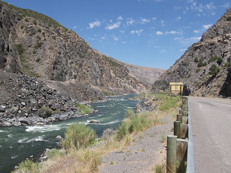
Since we are not going to Oregon (at least not this year), we soon leave the trail and turn north. Our route drops down a steep escarpment into the Wind River valley. We follow it for an hour. The Wind River suddenly flows through a narrow steep canyon in the mountains ahead. The road cut is on the east bank while a rail line follows the west. Wind river Canyon is a geologic and historical oddity. How did a small river carve a narrow chasm across a mountain? The difficulty traveling this narrow canyon caused early pioneers to not recognize that the river entering and exiting the canyon were one in the same. Instead of correcting the name problem, a sign “Wedding of the Waters” was erected at canyon end. Here the river’s name officially changes from Wind River to Big Horn River.
Our next stop is the town of Thermopolis. I am a dinosaur fan so we have to stop at the Wyoming Dinosaur Center. This small museum is well done and chronicles the evolution of life on earth. The museum has several specimens that were locally found including Supersaurus, the largest dinosaur ever discovered. Aimee stayed in the car reading, but I think she would have liked Bambisaurus, one of the smallest of dinosaurs.

Afterwards we explored the namesake hot springs of Thermopolis. From the very urban Hot Springs State Park bubbles up the world’s largest mineral hot spring. It is interesting to see the huge terrace pools built by the dissolved minerals. Today most of the flow has been siphoned off to supply three swimming pools. We pass on them; I am not sure a hot dip is what I want on a sweaty day.

Monday, July 09, 2012

July 6, 2012

July 6, 2012

The weather has broken so it seems safe to return to lower altitudes. From Aspen, CO we drive north past Glenwood Springs. We slowed down enough to glance at the big hot springs pool and then kept driving north for several hours. Eventually we crossed into Wyoming and spent the night in Rawlins. This part of Wyoming is pretty flat and desolate but since the altitude is 7000 feet, the weather is still marvelous.

Saturday, July 07, 2012

July 5, 2012

July 5, 2012

Our campsite is available for one more night, so we decide to stay in Aspen and do another hike in the area. This time we went up Castle Creek Road looking for the Cathedral Lake trailhead. As soon as we turned in, we noticed it was a very rutted dirt road with a sign pointing ¾ mile ahead. I was ready to bail except a car pulled in right behind us. Oh well, I guess we are committed. I took it very slow up this narrow climbing rutted road that was really meant for four-wheel drive jeeps. We made it ok, but it could have been a disaster. The parking lot at the trailhead was mostly empty with plenty of room for us.
Our trail started at 10,000 feet elevation and rose very steeply up to the tree line at almost 12,000 feet. We must be acclimated to the altitude finally because we survived this strenuous hike without keeling over. Cathedral Lake was a smallish lake in a treeless bowl just below the mountain summit. It was nice but not spectacular.

Aspen must be a draw for the outdoor physically fit crowd. As we hiked back down, the trail seemed like Grand Central Station. People were streaming up. Along the way we talked to a professor from Southern Miss, who teaches Recreational Therapy. I assumed it was a version of Physical Therapy devoted to Sports. Not quite. It has nothing to do with medicine. He teaches people how to play and have fun. Now that is the job I want(ed)!

We got a rude surprise when we got back to the parking lot. All those people hiking up the trail have jammed the small parking lot and the road leading to it. I don’t think I can get the RV out. Aimee was prepared to wait all day till everybody left. Fortunately though with her directing, I was able to squeeze through the cars and get out. And our professor friend drove ahead and cleared the road of oncoming cars for us. We were very lucky!!
On the way back to Aspen, we stopped at nearby Ashcroft. In the 1880’s silver was struck here and a boomtown built. Sadly just a few years later, the silver ran out. We toured the ghost town, but it was disappointing. There are only a half dozen structures left and they are not in good shape. But surprisingly the docent is also from Tucson and volunteers at several sites there during the winter.
Newer Posts Older Posts