Sunday, September 03, 2006

August 21, 2006

August 21, 2006

We are up very early so we can see the Condors that inhabit the Colca Valley. From the town of Chivay we drive on a dirt road downstream along the canyon rim. The valley outside Chivay is heavily terraced far up the canyon walls. The canyon walls soon change from agricultural terraces to steep cliffs.
 
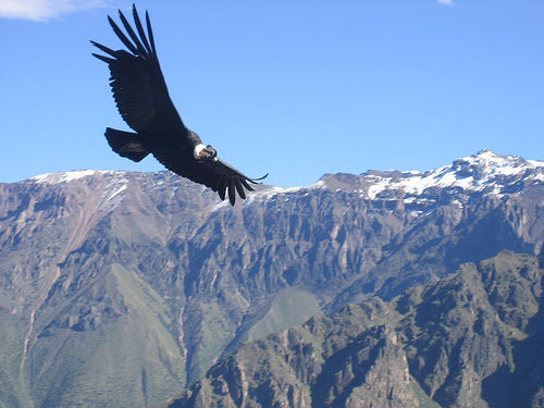
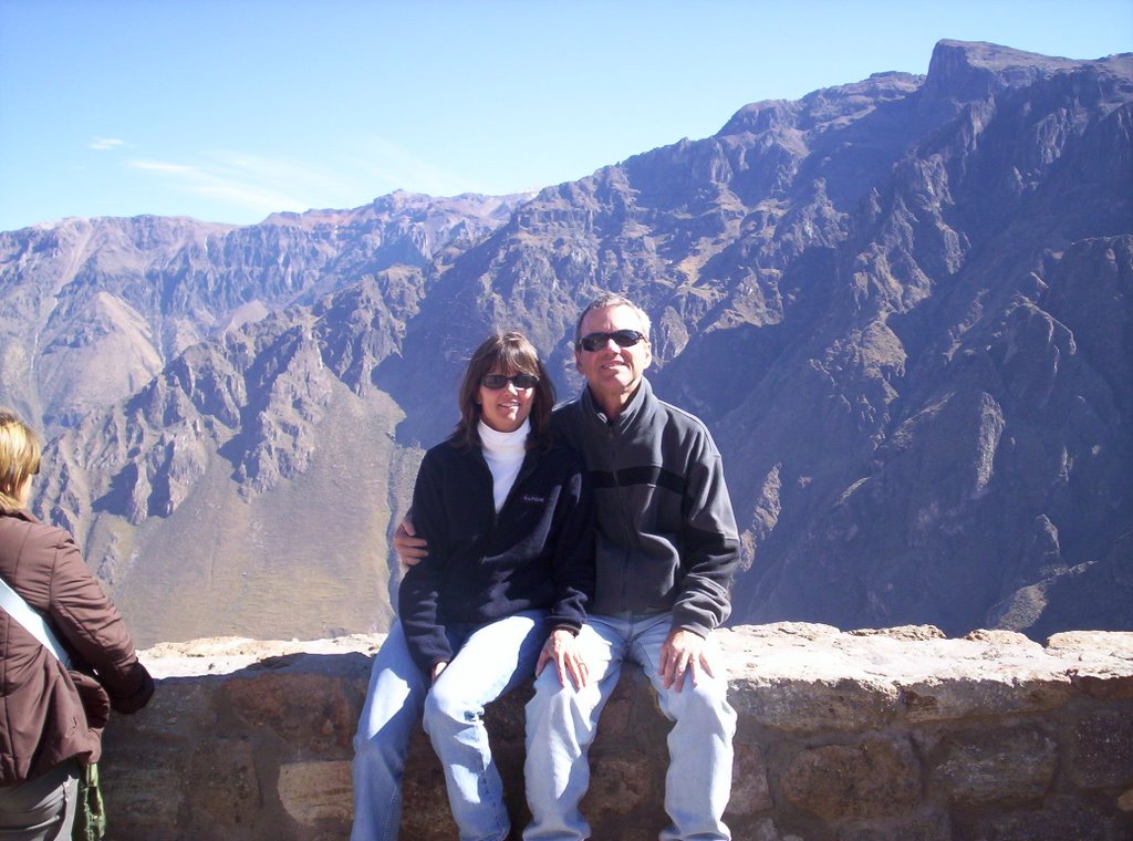
After an hour or two, we stop and hike to the canyon edge. On the way we see that the condors are already up and soaring over the canyon. Condors have one of the largest wingspans of any birds in the world in the range of 9 to 11 feet. Like eagles, they soar effortlessly on the air thermals looking for food. Aimee and I end up going in different directions along the rim. Aimee picked the better direction as she had one condor soar so close overhead she could hear the rush of the wind. I see many condors but almost all at a distance.

After an hour and half of condor watching, we all get back in the van for the long drive back to Arequipa. We stop again in Chivay for a buffet lunch. Guinea Pig (Cuy) is a Peruvian delicacy. I try some. It is good but there is precious little meat on the bones. My nephew John looks on in horror as he can only think of his childhood pet, Alfie.

August 20, 2006

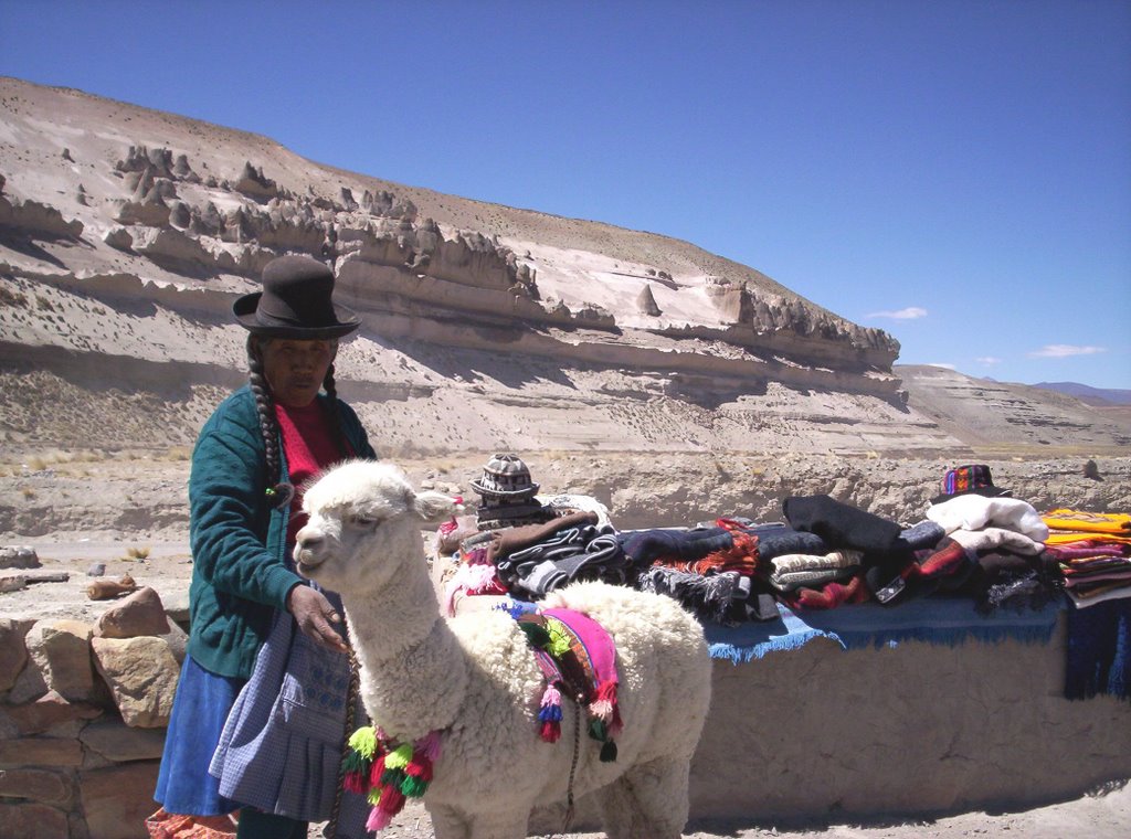
August 20, 2006 Today we are up early to meet our guide for a tour of the Colca valley. There are ten of us from all over the world, a driver and a guide all packed into a van. The vehicle heads four hours up into the highlands. On the way we see herds of llamas, alpacas, and their wild cousin, the vicuna. The Llama is mostly used as a beast of burden as the wool is very coarse. The Alpaca is raised for its fine wool. We stop for coca tea to help with the altitude. Arequipa is in an area of intense geological activity. It has a couple volcanoes to the north and gets regular earthquakes. One of the volcanoes is a perfect cone shape. As we drive we get good views of these snow-capped mountains. Near the end of the four hours, we hit an elevation of 15,000 feet. It is cold and rocky. I think the Andes must be taller than the Rockies. Shortly past the summit we enter the Colca valley and descend toward the town of Chivay. We have lunch and a leisurely afternoon in the small town. Colca Canyon is supposed to be twice as deep as the Grand Canyon. I am skeptical but I must admit the canyon rim is starting out exceedingly high.

August 19, 2006

August 19, 2006 Today we spent a leisurely day, walking around Arequipa, making reservations, and reading. We heard a lot of live music today. The most popular song is El Condor Pasa. Not sure if Paul Simon stole it from Peru or vise-versa.

August 18, 2006

August 18, 2006

The bus left Cuzco at 8:30pm and arrived in the World Heritage city of Arequipa at 5:30am. It was a very nice bus; the seats were better than coach air but not as good as business class. We even had dinner and a movie. Unfortunately I can’t sleep on a bus or a plane. After arrival we head straight to our hotel where they nicely allow us to check in early. Aimee and I sleep for a couple of hours.

Waking refreshed, we have breakfast and visit the Andean Shrine Museum. The Andes Mountains are a hot bed for volcanic and earthquake activity. This museum is about how the Indians used to sacrifice young girls (sometimes boys) to appease the mountain gods. The centerpiece is Juanita, the Ice Maiden, a 12-year-old female mummy found in 1995 at an altitude of 15,000 feet atop one of the local snowcapped volcanoes. Her body was perfectly preserved in the ice for 500 years. The museum is small but quite interesting.

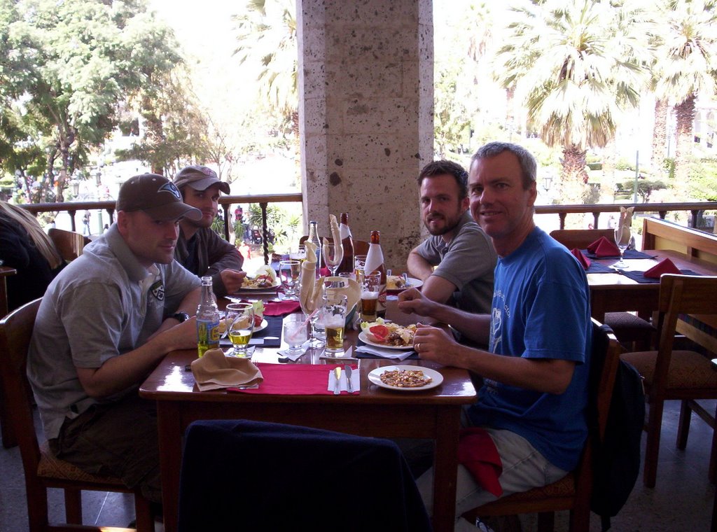
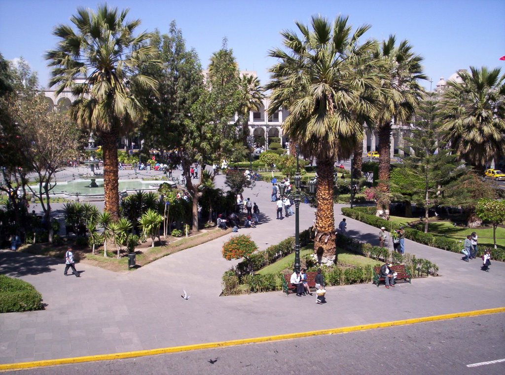
After a romantic Peruvian lunch on a balcony overlooking the main square, we visit the Monastery of St. Catherine. This is a 250-year-old city-size monastery for nuns. The nuns at this walled facility led a cloistered life with almost no outside contact. Based on the tour the nuns led a tough life that changed little for 300 years, until 1968 when an earthquake damaged their old living quarters and new digs had to be constructed.

For dinner we eat at a Turkish restaurant; I can’t believe I had to travel to Peru to sample Turkish food for the first time.

August 17, 2006


August 17, 2006

After two days of hiking and returning to high altitude Cuzco, we need a slow day. After breakfast we walk downtown to buy bus tickets. My nephews are on the budget tour so we are taking the overnight bus to Arequipa instead of flying. Unfortunately the First Class seats are sold out. My nephew, Ryan assures me these are luxury buses and not to worry. Ryan is an archeology grad and has spent three summers here.

Later we tour the Cuzco Cathedral in the main square. The cathedral is nice but I think we have seen all the Spanish colonial churches we need to. Afterwards we head back to the hotel to read and chill out. At the hotel Aimee trips on the two steps going into the dining area and falls face first. Her right ankle is now the size of a baseball. She had no problem climbing up to the top of sheer Huayna Picchu yesterday, but these hotel steps do her in. I guess I should be glad she didn’t trip going down Huayna Picchu; I might have lost her.

About 7:45pm we catch a taxi to the bus station and run into one of the normal hassles of traveling in the third world on your own. At the bus station, we are first sent to buy a departure tax stamp. The bus line agent then sends us to Platform 1 to catch our bus. Soon after, the bus headed for Puno pulls into platform 1. When we inquire about the bus to Arequipa, a little man picks up my luggage and heads out to a taxi. The taxi takes us to another very small bus terminal a few blocks away. We try to check our bags with an attendant, but he points us to the front door. There we find we have to first exchange our voucher for a bus ticket. We scurry back to the baggage check and then onto the bus. As soon as we sit down the bus pulls out. That was too close!

August 16, 2006

August 16, 2006

We got up early today to head back up to Machu Picchu. Yesterday I was enthralled by the scenery and didn’t pay attention to the bus ride. This time I watch the route up. There is little room for error on this dirt road. There are no guardrails to prevent us tumbling down 3000 feet to the bottom. Now I know how Aimee felt while I was driving the RV through the mountains.

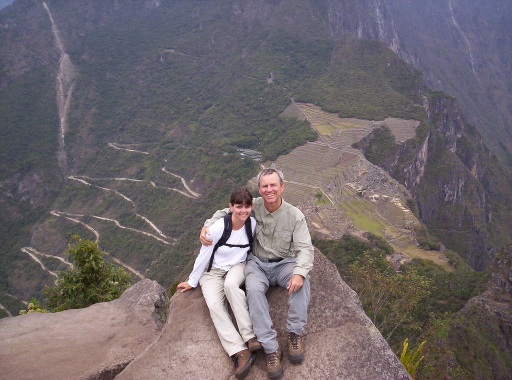
Once at Machu Picchu we pay full price again despite the guidebook suggesting 50% off the second day. We head straight to the far side of Machu Picchu so we can hike up to Huayna Picchu, the famous mountain that overlooks Machu Picchu in post cards (see yesterday's pic). The trail is only open from 7:00am to 1:00pm and access is limited. Huayna Picchu’s walls look like sheer cliffs but somehow the Incas built a staircase along ledges to the top. It takes us an hour of climbing. It is straight up but we make it with only a handful of stops. Maybe we are finally getting acclimated to the altitude (we are also 4000 feet lower than Cuzco). You can’t tell from the bottom but there is a small village clinging to the top complete with terraces for agriculture. I can’t imagine why they would have built it up here. The last part of the trail is especially steep. At one point we have to squeeze single file thru a cave. I am proud of Aimee for coming along. A month ago, she would have turned around midway.

At the top we take a few pictures and head down. Halfway down there is a trail cutoff to a cave on the mountain backside containing the Temple of the Moon. We follow the trail but turn back after ten minutes. It is another hour to the temple and our old legs are giving out. Back at Machu Picchu we sit on one of the grassy garden terraces overlooking the city. We sit there for an hour resting and having a picnic of snacks and water and wallowing in the scenic beauty.

We take the bus back to Aguas Calientes and have lunch at a French-Peruvian bistro. It is delicious. We write a few post cards and then head back to the hotel to retrieve our bags. The train back to Cuzco leaves just before 4:00pm.

August 15, 2006

August 15, 2006

Aside from walking, the only way to travel the 72 miles from Cuzco to the World Heritage Site of Machu Picchu is by a tourist train. We are up early today to catch our 5:30am taxi to the train station. Our train leaves at 6:15am. The train spends the first half hour going back and forth. Apparently they have train switchbacks that take us above Cuzco. Halfway thru the four-hour train ride, we enter the Sacred Valley of the Urubamba River. It starts out a small river in a wide valley of barren dry mountains. We descend some 5000 feet altitude with the river flow. By the time we end the trip, the river is raging down a boulder-strewn bed, the canyon has deepened and the mountains have turned steep and green with highland jungle vegetation.

The train ends at the tourist town of Aguas Calientes. After disembarking, we have a quick lunch and then head to buy our $12 bus ride up the hill to Machu Picchu. I am curious how this bus is going to get up these sheer canyon walls. The bus crosses the river just downstream of the town and begins going up fourteen hair-raising dirt road switchbacks that slowly carries us up the side of a hill. The bus lets us out at the base of Machu Picchu. Entry fee is $40 each, about 2x what the guidebook said. I have to ask for a site map.

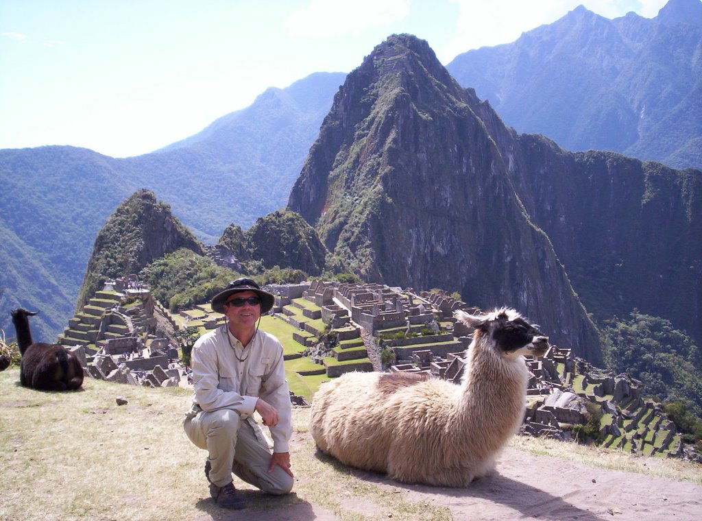
Machu Picchu is hard to describe. It is a magical place. Hiram Bingham, a Yale archeologist and the inspiration for Indiana Jones, discovered it in 1911. He called it the Lost City of the Incas. There is no record of the Spanish ever knowing about its existence. No big surprise as this place is isolated. But that is part of its magic. Machu Picchu is in a forbidding part of the Andes Mountains in very rugged territory. At this point the Urubamba River almost makes a complete circle. Machu Picchu’s mountain is a mostly sheer cliff pinnacle in this river circle. Machu Picchu sits atop the pinnacle. Surrounding Machu Picchu are even higher jungle mountains. Nobody knows for sure the purpose of the city, but I think the Incas used this as a winter retreat (warmer than cold Cuzco) where because of its isolation; the king did not have to worry about being attacked. He could relax. I can relate to that.

Even today the only way in is either the four-day Inca trail hike or the train/bus combination we did. Given the ruggedness of the terrain, I am awed that the Incas even found this spot to build. The other magical part of Machu Picchu is its harmony with the environment. It is built with the terrain not on top of it. A short hike up into Machu Picchu, gives us our first view, picture postcard perfect. In the center is a large courtyard. To one side are the royal residences and to the other are the worker homes. Surrounding it all are huge numbers of terraces that spread down and to the cliff edges. The terraces were used to grow food to support the population.

Before exploring Machu Picchu we head left and hike up the last section of the Inca trail. The Inca trail is a rock-paved path that runs over the mountain from the direction of Cuzco to bring the Inca king to Machu Picchu. In Inca times this was the only way in. We hike up to the Sun Gate at the top of the ridge. The Sun Gate is a guard station protecting the only route in. After returning to Machu Picchu we head over to the other side of the ridge and hike to the Inca Bridge. This side of Machu Picchu Mountain is sheer vertical cliffs. The short hiking trail follows a narrow ledge around to the site of a drawbridge built into the cliff side. It is an enigma because there is nowhere for the trail to go after this bridge.

We head down into Machu Picchu city. We walk through many of the buildings and temples. Shortly after 4pm, we are exhausted and head back to the bus for the return to Aguas Calientes. I have Alpaca steak for dinner. It tastes like lean beef.

On the hike up the Inca trail, I made the mistake of converting my pants to shorts. There weren’t any mosquitoes but there was a bunch of gnats. Unbeknownst to me, until it was too late, they were biting my legs. I now have itchy welts all over my calves. I hope these gnats don’t carry malaria, yellow fever, or dengue fever like mosquitoes do.

August 14, 2006

August 14, 2006

Aimee and I are up early as we slept a lot last night. We feel much better today. I guess like most mountain environments, the temperature swings are huge. By 10am, it is hot again in the sunshine. Cuzco was the capital of the Inca Empire for the 100 years until the Spanish conquered them in 1532. It is situated in a scenic mountain valley. Cuzco, now a World Heritage Site, is a charming medium-size town that retains much of its ancient history with its narrow stone paved streets old architecture and Inca wall bases. The 11,000+ feet altitude takes some getting used to. I am huffing and puffing up the hilly streets. I am beginning to think the allergies I had in Yellowstone may have been just altitude problems.

Our first task today is to arrange tomorrow’s journey to Machu Picchu. We taxi to the train station and buy tickets. We then head to a travel office to prepay our hotel room outside Machu Picchu. We also stop at the bank for more cash; credit cards are useless here. Credit cards are either not accepted or come with a very healthy 9% service charge.

After lunch we walk to Coricancha temple. Coricancha was the primary temple of the Incas. In the local Quechua (still spoken!) language of the Incas, the name means Gold Room. It was said that its rooms were lined with gold. Unfortunately the gold was stripped to ransom the Inca emperor from the Spanish. The Spanish killed the emperor anyway and melted the gold and sent it back to Spain. They quickly built another church on its base. We tour the temple. There are a few rooms and a couple walls that were amazingly spared destruction. Like other Inca walls they exhibit the same fine stone craftsmanship. This would have been a temple to see in Inca times.

When finished we head to a local craft market to buy some gifts. Sweaters, rugs, hats, and other items made from Alpaca wool are the hot items. We buy a few. Not wanting to drag them all over Peru, we decide to wait to do most of our shopping in Lima on our last day.

So far the Peruvian people have been very nice; and they seem industrious. They have security everywhere but I don’t know why. Their only flaw seems to be they have learned bureaucracy all too well.

Thursday, August 31, 2006

August 13, 2006

August 13, 2006

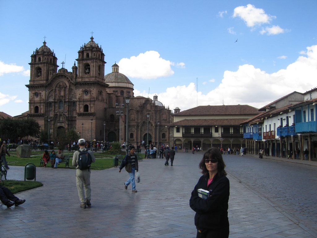
We have a very early flight today. We rise at 3:15am to catch a 6am flight to Cuzco, capital of the Incan Empire. At the airport we meet up with a third nephew John. Once at Cuzco we head immediately to our hotel but we are too early to check in. We sit in the breakfast room and have some bread and Coca tea. The coca tea is supposed to stave off the effects of altitude sickness. None of us knows if we are going to succumb or not. Afterwards we walk to the central Plaza de Armas to see the cathedrals. Cuzco is having a military parade in the square. We watch for a while. All the cathedrals in town are built on top the bases of Inca temples. The Spanish had torn down the temples and built churches to reinforce their control. The Inca bases can still be seen throughout town. There is a sharp contrast between the Inca stonework and Spanish construction. The Inca stones fit together perfectly with no crack whatsoever between them, whereas gaps and mortar joints abound with the Spanish. Whenever an earthquake hits, the later construction tumbles down while the Inca bases survive.

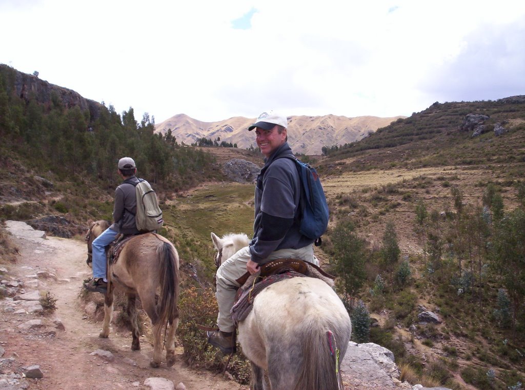
Afterward we catch a cab uphill to the Inca fortress of Sacsayhuaman (pronounced Sexy Woman). At the entrance we are persuaded to take a horseback ride to some of the other Inca sites further uphill. It is fun, but our butts are not conditioned for a 3-hour ride! We stop at Pukapukara, a military outpost, and Tambomachay, a spring that may have been a royal spa. We hike around them, but there are no interpretative signs anywhere so we have to use our imagination for their purpose. The Spanish carted off most of the upper stones for their own construction projects. The altitude is 12,000 feet and we are getting severely winded on the walks and we have only a few snacks to provide energy.

After finishing the horseback ride, we head in to see Sacsayhuaman. It is a hilltop fortress. Even though the upper sections of the walls are gone, it is very evident this was a substantial fortress rivaling those made in Europe. It is quite impressive. I can’t believe the Incas were not able to withstand the Spanish siege. It must have been too little too late.

By this time most of us are succumbing to lack of sleep, lack of food, sunburn, and altitude sickness. We can barely walk. There are no taxis in the parking lot despite the guidebooks comments otherwise. We trudge downhill till a taxi drives by. We head to dinner immediately, but it is a chore and our stomachs are queasy. We are exhausted and complaining of headaches. Aimee and I hit the hay when we return to the hotel room at 6:00pm. It is freezing in our room and we go to bed with all our clothes on!


August 12, 2006

August 12, 2006

This morning for breakfast Aimee and I both try the Coca tea. It is not particularly flavorful so we switch back to coffee. The goal today is to visit Pachacamac, an archeological site twenty miles down the coast south of Lima. To get there we take two different local busses. The busses are an experience and apparently they are all privately owned, as they are everywhere, inexpensive, and run frequently. Capitalism at its best!

On the outskirts of Lima, the terrain turns into giant sand dunes. Land, I would consider of no value. However much of it is covered with shantytowns. I remember reading that the Lima area has grown exponentially the last few decades because of farmers flocking to urban areas. Lima now has a population of eight million people.

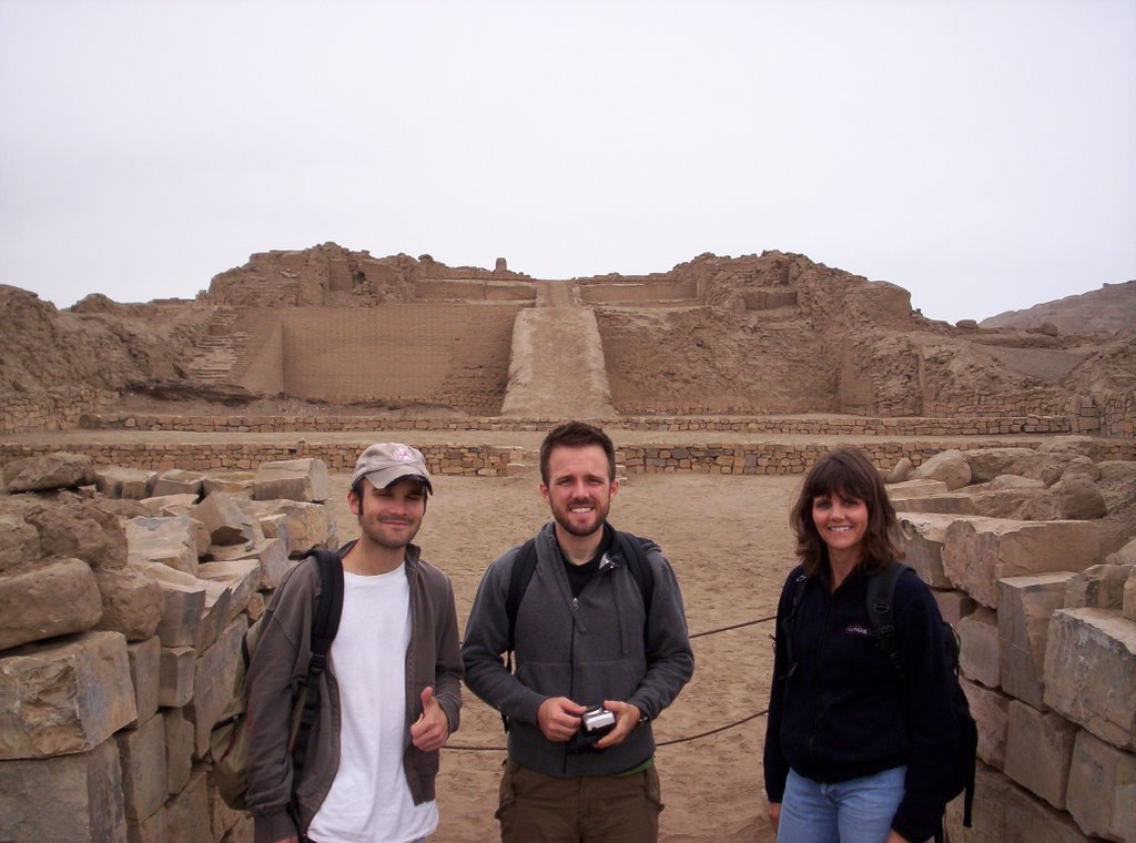
The bus lets us off at the gate of Pachacamac. Our first vision of the area is just an extension of the sand dunes. As we walk closer, we can see the outlines of bricks in the sand. Pachacamac is a huge archeological site. The construction was all of adobe bricks. Adobe is basically dried mud. They are cheap and easy to make in the millions. It was also probably the only building material around. Unfortunately they don’t last forever like stone does. The buildings here all look like they are melted because of wind erosion of the bricks. Even though the site is large, they believe it was mostly ceremonial. Pachacamac was renown for being the location of a famous oracle. Unfortunately a defective one as it told the last Inca king that he would succeed in battle with the Spanish conquistador.

The focal point of the site is the Pyramid of the Sun. We climb to the top and get a good view of the surrounding coastline, sort of. There is a persistent fog over the ocean. This is because of the Humboldt Current that brings cold ocean water up the coastline from the Antarctic. Unfortunately south of the equator the jet stream runs east to west and the Andes Mountains wring all the moisture from the air and sends it down the Amazon River. Instead of being lush the Peruvian coast is one big giant foggy desert.

Pachacamac is not visually stunning. Most of it remains buried under the sand, protected from further erosion. However, it is mentally stimulating to see the couple areas that have been uncovered and knowing you are walking atop an archeological site early in its excavation phase. We eat a typical Peruvian lunch at the site cafe. It is a variation of chicken fingers and fried potatoes.

Back at Miraflores, we head straight to Huaca Pucllana. This is an ancient adobe pyramid right in the middle of this upscale neighborhood. We miss the last guided tour but we are still able to take some pictures. Like Pachacamac it mostly looks like a giant mud hill, but you can clearly see that it was built from an infinite number of bricks.

This evening we have Peruvian cuisine. We start off with an appetizer of Ceviche. This consists of raw fish marinated in spicy lemon juice and garnished with onions. It is quite tasty.

August 11, 2006

August 11, 2006

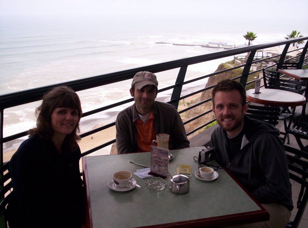
Our hotel is in the nicer Miraflores district of Lima. It is small and old. Breakfast is included and consists of bread, orange juice, a mandarin orange, and instant coffee or tea. Quite a few other adventurous English-speaking tourists come and go during our breakfast. Thankfully, we are not alone! After breakfast we meet up with two of my nephews, Ryan and Jamie, and walk the few blocks to the ocean. Despite its location near the equator, Lima is cool and overcast. This is Peru's wintertime. We have coffee and hot chocolate at a cafe overlooking the ocean. This cafe and apparently much of Lima is atop a highly eroded cliff overlooking the ocean. It would be pretty but the skyline is foggy, the ocean muddy, and the constant breeze is cool and damp. This is not the place I would have picked for the capital of the Spanish colonial empire as the conquistadors did in 1535. As we finish our drinks several glider parachutists soar over the beach right in front of us doing pirouettes. They must be skilled as they use the breeze to stay at our eye-level seemingly forever.

Afterwards we taxi to the historic town center, Plaza Mayor, a World Heritage Site, to tour the Cathedral of Lima. All around the plaza are Peruvian police with riot shields. Peru recently elected a new president and protest marches by the opposition are expected today. They let us through their barricade so we can see the cathedral. Only small sections of the original 16th century cathedral remain. The rest was destroyed by earthquakes and rebuilt later. Francisco Pizarro, the Spanish conquistador, who conquered the Inca Empire, is buried here in an alcove. The cathedral also has a museum attached with various church artifacts. For lunch we head to Lima’s Chinatown and sample Chifa (Chinese-Peruvian) cuisine. Figuring out what to order is difficult. My Spanish dictionary doesn’t include Chinese food.

After lunch we taxi to the National Museum of Archeology. I knew that Peru had an advanced Inca civilization but I had no idea Peru had many other prior civilizations and is full of archeological sites. Unfortunately the museum is in Spanish with English interpretations only randomly inserted. Nonetheless, it is worthwhile as an introduction to what Peru has to offer.

For dinner we head to a pizza joint a short walk from the hotel. So far the food is just like home.

Monday, August 14, 2006

August 10, 2006

August 10, 2006

Our flight leaves at 10:16am so we arrange for pickup at 7:30am. Last night it was supposed to be plenty of time but this morning we are not sure. We awake to news of terrorist activity in London. Homeland Security has put new rules in place effective immediately not allowing liquids or gels on carry-on luggage. The radio relates chaos and long lines as a result at O’Hare airport. We had planned on carrying everything on board, but now we repack to rearrange shampoo, toothpaste, water, and makeup to checked baggage.

Once at O’Hare the security lines are very long but they move quickly. It appears most people, like us, got the warning before arrival.

Either because of this new terrorist concern or because of bad weather, all of our travel today is very delayed. We arrive in Lima, Peru after midnight. Expecting to be met with a sign for our hotel, we are instead met with a throng of humanity and signs everywhere. Undaunted we search and find Eduardo; he delivers us safely to the hotel.

Along the way we drive thru some gritty areas of Lima. Surprisingly for 1:00am, there is still a lot of street activity and police presence. We are definitely not in the US anymore.

Tuesday, August 08, 2006

August 7, 2006

This is the end of Chapter 1. We are packing for chapter 2, a 16-day trip to Peru. We will take notes and keep a journal but it is unlikely we will be able to upload it anytime during the trip. The best estimate of new uploads is likely to be near Sept. 1. If you would like an email to alert you when the postings restart, send us an email at mgroshans@gmail.com with 'blog' in the subject and i will reply to you when we have restarted. Thanks to all those who have followed chapter 1.

Monday, August 07, 2006

August 6, 2006


August 6, 2006

The author is on vacation.

August 5, 2006

August 5, 2006

Before lunch we hit the road again. We don’t want roots to start growing. We head twenty miles east to link up with I55 and head north. Seventy miles later, we enter Springfield, capital of Illinois and home of Abraham Lincoln. Springfield has numerous interesting Lincoln sites. We have seen most of them. Within the last year, a new Lincoln Museum and Presidential Library was opened. With two thumbs up from my brother, we stop to see it. It is well worth the stop but very crowded. We should have come earlier in the day. The museum reviews Lincoln’s life in a very un-museum-like way. It is designed for the DisneyWorld, no attention span generation. For example, the Civil War battle history is covered in a repeating four-minute movie. I still like it a lot. The Gettysburg Address also moves me. Put in context by the museum, I think it is the shortest and the best political speech ever written. It embodies the spirit of the US.

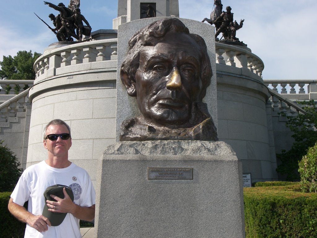
Before heading out of town we stop at Lincoln’s tomb. This is the one site we missed on previous Springfield stops. In front is a giant bust of Lincoln, sculpted by Gutzon Borglum of Mount Rushmore fame.

Back in the RV we head north. Near 9:00pm we roll into Itasca, outside Chicago. Aimee’s mother lives here and has food ready for us.

Sunday, August 06, 2006

August 4, 2006


August 4, 2006

Alton is a very old town with a rich but unfortunately forgotten history. Situated strategically on the Mississippi River near its confluence with the Missouri and Illinois rivers, it was a center of history and commerce in olden times. A few miles down river are the Cahokia Mounds, remnants of an ancient Indian civilization. Lewis and Clark started their journey from the area. Lincoln and Douglas had one of their famous debates here. Alton has a couple Civil War era monuments. Alton was the home of some major industrial corporations. Alton seems to be most proud of Robert Wadlow, tallest man ever.

Alton does a poor job remembering its history. Alton could take a lesson from the tiny hamlet of Arrow Rock, MO we visited a few days ago. Perhaps, the Piasa Bird painting is most typical of Alton history. North of Alton is a very beautiful stretch of road that hugs the little bit of land between the Mississippi on the west and sheer limestone bluffs on the east. In 1673 Pere Marquette and Louis Joliet explored the area and noted in their journals a fantastic flying monster painted by the Indians on this bluff wall above Alton. Later journalists noted the painting and recounted the Indian legend associated with it. In the mid 1800’s it was razed to make way for a limestone quarry. Many years later, town fathers began to repaint the Piasa Bird on a nearby cliff. At one point, tiring of the repainting effort, they hung a large sheet metal replica in its place.

August 3, 2006


August 3, 2006

Aimee and I spend another day with my parents catching up on our magazines, doing laundry and paying bills. I also give the RV its first bath. It needs it after 5000 miles and almost 500 gallons of gas. That is 10.55 mpg for you engineers.

August 2, 2006

August 2, 2006

It has been over a month since we have sold the house and have been living on the road. For all that time I have had the mail sent to my parents’ house in Godfrey. It is now a large stack. Aimee and I spend the day opening mail. Finding my 401K check in one of the letters, we drive to St. Louis and deposit it with Charles Schwab.

To get to St. Louis, we have to travel back over the Lewis and Clark Bridges. Both have been replaced in the last 10 years. The Missouri bridge is an uninteresting highway extension but the Mississippi one was replaced with an ultra-modern cable-stayed bridge. It is very pretty, resembling a giant sailboat. Its construction was portrayed in a NOVA special in 1997 called Super Bridge.

Thursday, August 03, 2006

August 1, 2006

August 1, 2006

While surfing the Internet, I discover that the reason for the Mormon Visitor Center in Independence, MO is that the city was a western outpost for the Mormon Church and their early missionary work with the Indians. Their founder Joseph Smith had declared Independence to be the site of their “Zion”. The next-door Community of Christ temple and auditorium are related to Mormonism. Community of Christ is the modern name for a Mormon splinter group. After Joseph Smith was killed in Nauvoo, IL in 1844, the church split into two groups, one following Brigham Young to Salt Lake City and the other following Joseph Smith’s son.

This morning we need to get a new tire. The campground owner points us to the town of Marshall ten miles north. After driving there very slowly, we get the local tire dealer to replace the blown tire. I also have him switch the spare and the other right rear tire that had the slow leak.

From Marshall the road east along the Missouri river seems to be the shorter route to St. Louis. Ten miles east we enter the town of Arrow Rock, a historical spot on the map. Arrow Rock was a location noted in Lewis and Clark’s journal and gets its name from the local flint rocks that Indians used to make arrowheads. We plan on making a quick driving tour of the small town and then get back on the road. The town still has many pioneer age buildings but we have seen enough of them. On the way out of town, we are surprised to see a Visitor Center hidden down a walkway. Curious, we stop and visit. To our pleasant surprise, it has some very interesting displays about the local history and economy. Arrow Rock was a thriving pioneer town outfitting travelers on the Santa Fe Trail. Daniel Boone’s two sons also ran a salt making business in the area. Salt was key to preserving food for travel, especially salt pork. We also learn that Santa Fe travelers brought back Mexican donkeys and mated them with local horses to produce the famous Missouri mules. Afterwards we stop at the pioneer tavern in town for lunch. The tavern claims to be the oldest continuously operating restaurant west of the Mississippi. Aimee and I both comment to each other that if it hadn’t been for the tire problem, we would never have stopped here. Missouri does a poor job of tourist advertising and signage.

We continue east and eventually meet up with I70 again. I let Aimee take the wheel so I can take my afternoon nap. After a short respite, we head south to Hermann and Missouri’s more famous wine country. In Hermann, MO we visit the Hermanoff and Stone Hill wineries. The Stone Hill winery claims to have been one of the largest wineries in the world till Prohibition shut them down. After sampling some of the local vintages we buy a few bottles for our cellar in the RV.

Once back on the highway, we continue toward St. Louis. On the way, I call my second oldest sister and make plans to meet her and her family for dinner in the western suburb, St. Charles, MO. My niece and her kids also join us. We have a little family reunion and after dinner give them a tour of the RV in the restaurant parking lot.

At 9:30 pm we roll into Godfrey, IL (outside Alton) just north of St. Louis. To get there we have to cross the Lewis Bridge over the Missouri and the Clark Bridge over the Mississippi. We don’t have to worry about reservations as my parents live here. This will be the first time sleeping in a real bed in almost a month. I can’t wait.

July 31, 2006

July 31, 2006

Well today we had some real excitement on our Big Adventure, but I am getting ahead of myself. Our RV Park is just off downtown Independence. Our first stop is only a couple blocks away at the National Frontier Trails Museum. This is a museum about the trails pioneers followed to “go west”. Independence, MO being on the western edge of civilization was a common starting point for many pioneers. The Santa Fe was one of the earliest trails and was mainly a trade route established for commerce between the isolated Mexican town of Santa Fe and the US. The Oregon and California trails were one-way routes for settlers to make their fortunes in the west coast. The majority of the museum is about what the pioneers saw and experienced along the trail. It is interesting and I would have liked to stay longer but Aimee is getting museum-ed out.

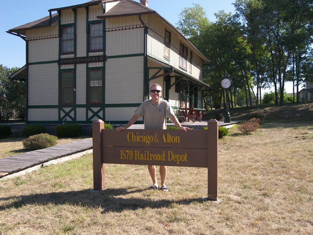
Next to the parking lot of the trails museum I spy a restored train station with the name Chicago&Alton Railroad. Since I was born in Alton and lived in Chicago, I have Aimee take my pic in front of it. As we open the door of the depot, we are greeted by an attendant that asks if we would like a tour. Aimee and I agree expecting a quick show around the small station. It turns out to be an hour long. Although we initially felt trapped by this enthusiastic host, the tour does get interesting as we progress around the depot. The local preservation society did a great job saving, restoring and outfitting the station with authenticity.

Our second stop is across the street at the Bingham-Waggoner Estate. We only stop because the RV park owner recommended it. George Caleb Bingham was a very famous pioneer artist and was an owner of the house for a short time in the 1880’s. However, it was the wealthy Waggoner family that expanded it to its mansion size and lived in it the longest. I have seen a lot of old mansions. This one’s notoriety is that the final Waggoner owner was a childless, wifeless, elderly packrat; so when he died he left the mansion still decorated and furnished as it had been by his mother at the turn of the century.

To get out of the area, we have to drive thru downtown Independence. As we do, we notice an unusual church. It is a very large spikey structure that looks like a cross between a circus tent and a witch’s hat. I am not familiar with this Community of Christ religious organization that it belongs to. Next door is a large auditorium and a Mormon Visitors Center. Being hot, tired and hungry, we don’t stop to look but I make a mental note to google these when we have an Internet connection again. We also pass on seeing Harry Truman’s home and Presidential library, also in downtown Independence. They will have to wait until our next trip through town. Instead we head back to the interstate; stopping at a pizza buffet along the way.

Further east on I70, we veer north ten miles to the restored site of Fort Osage. Fort Osage was a fort established on the banks of the Missouri river after the Lewis and Clark expedition to protect traders plying the Missouri. The tourist office is closed for some reason so we make a quick tour and get back on the road.

We head east a short way down the Missouri river to the Battle of Lexington State Historic Site. Unbeknownst to me, a couple of the earliest battles of the Civil War occurred in Missouri. Missouri was a heavily divided slave state and the strategic gateway to the western states. Both North and South wanted Missouri on their side. Lexington was where the two sides met. 12,000 Southern forces headed by the Missouri National Guard General Price besieged a few thousand Union troops from Irish Chicago holed up on a hilltop beside the Missouri. Most of the battle site has never been built upon. You can still see original buildings and the outline of much of the defensive breastworks. Interestingly the South brought the siege to a quick conclusion and victory by rolling large bales of hemp slowly up the hill. These bales protected the Southern forces from bullets until they could overrun the hilltop.

From here we head back to I70 and continue east. Since Missouri is having a record heat wave we are thinking of driving late into the evening. A half hour later, the RV is acting like the road is bumpy. Thirty seconds later, we hear terrible thumping under the RV. I come to a quick halt and pull off onto the shoulder. I am thinking I dropped a water tank. I look all under the RV and I don’t see anything. Upon second examination I see that one of the inner back tires lost its tread. There is still a strip of rubber attached making the noise. I spend fifteen very hot minutes trying to snip thru the steel belts unsuccessfully. Finally I brace my feet under the tire and pull the remnants off. We are not going to make St Louis tonight. Fortunately luck is smiling on us again and we are only about a 100 feet past an exit. Aimee looks in our guidebook and finds an RV park less than a mile north. We slowly back up, take the exit and make it to the park. It has plenty of room for us. We are so happy we are not in the middle of nowhere. After parking, Aimee and I head to the swimming pool to relax and cool off. This is a problem we can solve in the morning.
Newer Posts Older Posts