Saturday, August 22, 2015
The sky is fairly clear this morning, so we decide to take the cable car (packed to the gills with maybe a 100 people) up to the top of the mountain, Schilthorn, on our side of the valley. It is at 9740 foot elevation. Unfortunately by the time we get to the top, the clouds have moved in and the vista is not nearly as impressive as it could be. The restaurant, Piz Gloria, that sits on the peak was the star of the James Bond movie, “On Her Majesty’s Secret Service”. In the movie, the restaurant was the lair of Blofeld. The ski scenes were filmed on the slopes between here and our hotel in Murren. On one floor the restaurant has a rather large museum dedicated to the movie. Sadly for George Lazenby he turned down big money to continue as James Bond.
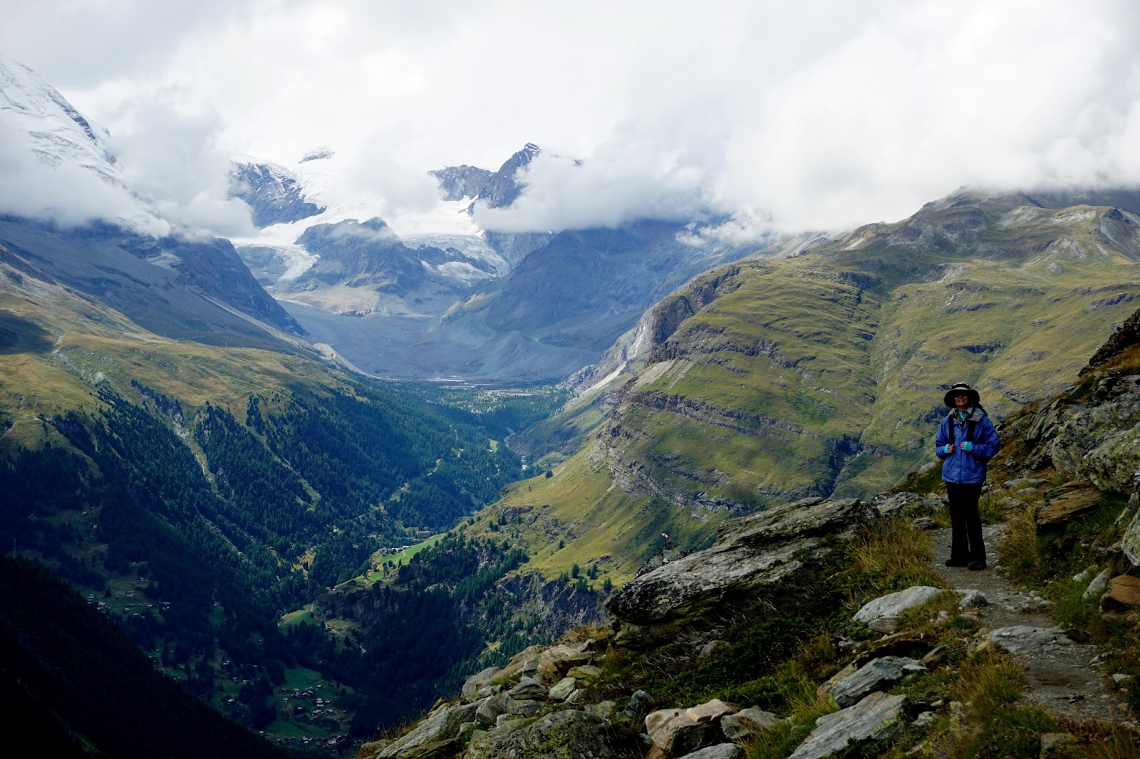
From the Schilthorn, we took the cable car back down one station to Birg. There we exited and hiked the rest of the way back down to Murren. The initial terrain reminds me of Hawaii with very steep wet green cliffs. The only thing different is the snow. The temperature is only a few degrees above freezing. Luckily I was able to borrow a fleece from the chalet. An hour into the hike we turned the corner and the massive wall of Alpine peaks comes into view. The three tallest are named Eiger, Monch, and the Jungfrau. This translates to Ogre, Monk, and Young girl. The monk is the middle peak protecting the young girl from the Ogre.
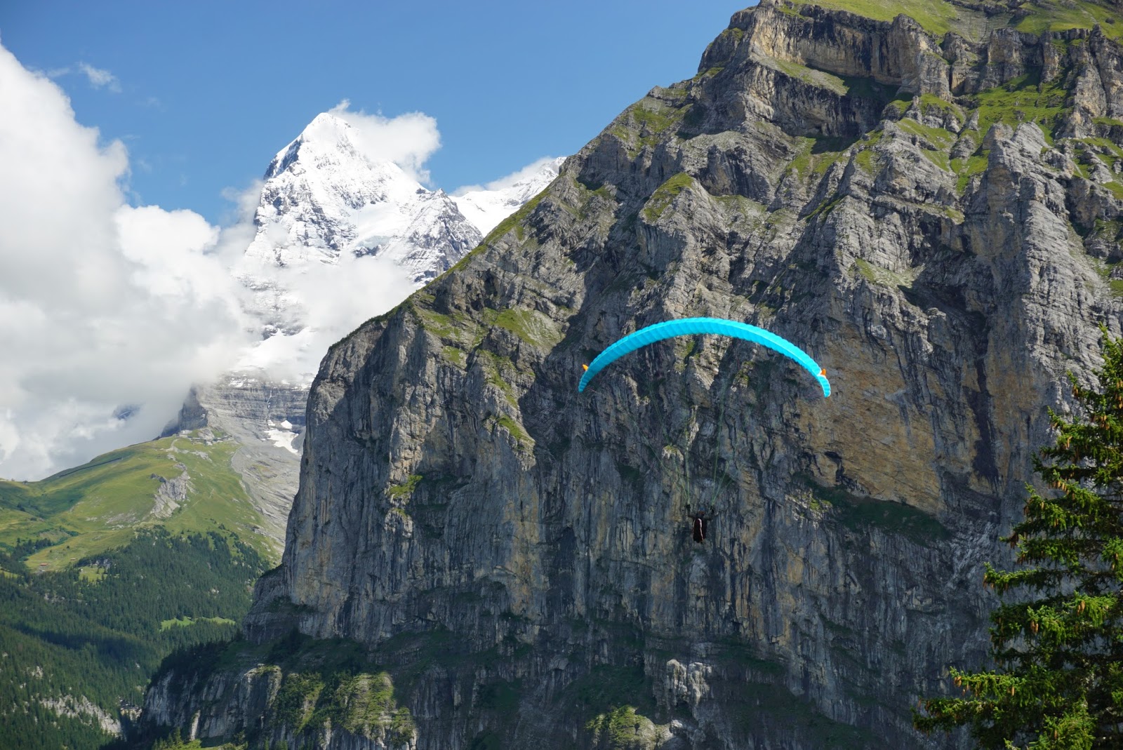
After three hours we make it back to Murren where we rest at a park bench, chill out, and watch para-gliders soar above the valley below. We also saw three base jumpers take a dive off the edge. Back at the chalet we had some wine while catching up with the world. For dinner we have pizza at a restaurant with an outdoor deck overlooking the valley.
Friday, August 21, 2015
August 20, 2015
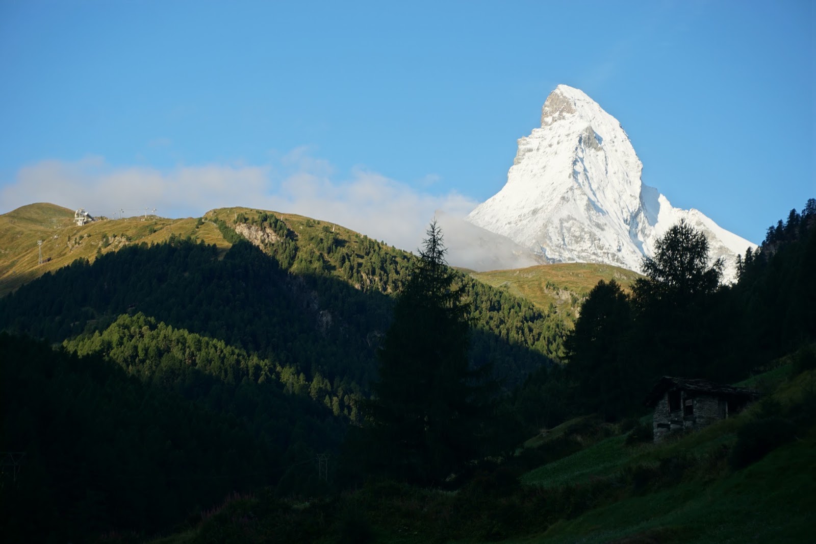
We set the alarm to wake up early today on the off chance that my lucky charm might come through. I looked out the windows and saw clouds again. Drats! I told Aimee to forget it and we took our time getting packed, then moseying down to breakfast. I said “Cloudy again” to the hostess and she replied, “No, It is a beautiful day” and pointed out the window. I looked and what did I see but, the Matterhorn, naked and glorious. I gulped down a bowl of cereal, grabbed the camera and sprinted for her. I took a dozen photos of her in various poses. I then turned around to get some of her with the town in the foreground and I could see the cloud layer rising out of the valley. When I got to the Zermatt bridge, she was dressed in clouds again.

We hopped on the train and headed back north. Two trains later we pulled into Spiez, and switched to another train going east past the very large glacier-carved Lake Thun. It is very pretty surrounded by steep mountains. In Interlaken we transfer to another train that takes us into the Lauterbrunnen valley. There we take a cable car up to the cliff top and then a short train along the rim to Murren. Murren is an alpine town that is perched on the cliff edge.
After all the travelling we have done in the United States, we sometimes think we are hard to impress. But here Aimee and I are mesmerized by the scenery. The Lauterbrunnen valley looks like Yosemite but with green grass and waterfalls everywhere. (Lauterbrunnen means loud waterfalls). To push the scenery over the top, the entire valley is in the shadow of a line of tall snow-capped peaks.
After checking into our chalet, we head to the cliff edge and have a picnic lunch while watching one paraglider after another take off to our right and sail over the Lauterbrunnen valley right in front of us. It looks like a blast but Aimee nixes us partaking in the fun. Seeing that clouds are socking in the peaks on our side of the valley, we decide to hike along the rim downhill to the village of Gimmelwald through the forest. Like every trail we have hiked in Switzerland, it is very steeply downhill. Gimmelwald has some tourist accommodations but the village is still very rustic and agricultural. We take the cable car back up to Murren.
This trip we have had a tradition of drinking a glass of wine before dinner, so we take our bottle and sit on a park bench overlooking the valley. The daytrippers have left Murren and we have the whole place seemingly to ourselves now. Aimee and I are in heaven.
Thursday, August 20, 2015
August 19, 2015
August 19, 2015
Last night Aimee and I discussed having Fondue, one of the specialties of Switzerland. Dunking bits of bread and potato in cheese just didn’t capture our fantasy. Instead we opted to try the Swiss National dish of Rosti. It is supposed to be a baked combination of potato and cheese. Since it was raining we darted next door into the restaurant claiming to be the oldest in town. We opted for the Rosti with ham. It was delicious and filling. A very young American couple seated next to us chose the fondue. The delightful elderly owner showed them the proper fondue technique. He took a potato and instead of dipping it in the cheese, he smashed it with a fork and poured a spoonful of cheese on top. Now it looks just like our Rosti. I think Rosti is just pre-made Fondue at half the price.
This morning we woke to rainy weather. The temperature is in the 40’s. It is only supposed to get into the high 50’s. I didn’t bring enough warm weather clothes. Aimee and I put on every layer of clothes we have and take a walk in the opposite direction of yesterday. Northeast uphill to the hamlet of Ried. From the top we get a good view of Zermatt and what should be the Matterhorn.
Back in Zermatt, we stop at the neighborhood grocery to stock up on wine and chocolate for the next leg of our journey. This is our third and last day in Zermatt and the cloudiest of all. It looks like the Matterhorn is not to be.
After lunch, we walk south uphill following one of the gondolas. We pass a tree-top adventure course which is a great way to amuse children on an overcast day. I am surprised at all the rustic hamlets scattered throughout the area. Many are probably maintained for tourists but surprisingly there are a couple in the oddest places in central Zermatt. The ones high up on the cliffs remind me how hard scrabble a life the older Swiss had it trying to eke out a living on a tiny farm perched precariously up a cliff. No wonder so many of them rented themselves out as mercenary soldiers in olden times. Today the Swiss are the opposite, extremely rich, mercilessly extracting every dollar possible from tourists.
Wednesday, August 19, 2015
August 18, 2015
August 18, 2015
We woke in Zermatt, Switzerland to partly cloudy weather. But it looks like the sun may be burning the clouds and may clear by afternoon. So we do a short morning hike up the valley to the south to the little Alpen town of Zmutt. A Bernese Mountain dog accompanies us part way. After an hour of gradual uphill we make it to the tiny cluster of wood homes in a large meadow that looks right out of a “Heidi” filmset.
Back in Zermatt we rest, have our picnic lunch waiting for the last remnants of the clouds to depart. It looks like we have another hour, so we decide to walk the town. Zermatt is definitely pretty. Most of the buildings are Swiss classic, made of rustic wood with long balconies on every floor. All are decorated with colorful flowers. The ground floors are shops and restaurants. We also pass a small cemetery we come to realize is just for climbers who died trying to scale the local peaks.
Finished with our town walk, we see the cloud cover is here to stay so we decide not to ride the gondolas up mountain as planned. They are expensive. Very! The lift to the spot we planned today is $86 per person. It isn’t worth it if the Matterhorn is not on display. Instead we head back to our hotel balcony for some wine and cheese. Like yesterday, a light rain ensues late afternoon.
Tuesday, August 18, 2015
August 17, 2015
August 17, 2015
Walking to the train station, we notice Bern is a buzz of activity. It is Monday and everything is now open. There are lots of guys in camouflage heading for the train. Switzerland has a long history of compulsory military service. That is the way this small country has maintained its independent neutral status, a strong defense.
We board our train headed south deep into the Swiss Alps. We head up steep river valleys with some hillsides of green meadows. Lush fields only come from regular rain and that is what we have today. The low cloud cover is obscuring our mountain view. I look at my lucky charm sitting next to me and tell her to get me some sunshine.
Two hours later we dead-end in the car-free village of Zermatt, near the Swiss border with Italy. After checking in, we set out for some hiking. Zermatt is the home of the Matterhorn. I came here some thirteen years ago for a day of skiing on a side excursion from a business trip. I was lucky and had a clear glorious view of that chiseled mountain. Unfortunately I didn't take along a camera and at that time I wasn't into photography.
With the clouds obscuring the mountains, we first talk about doing a valley hike. After Aimee reminds me of our limited time here, we decide to chance it and head up one of the lifts. We first take a funicular train carved into the mountain and then a gondola up almost three thousand feet to the Blauherd station. We hike a half hour out to Stellisee at the bottom of the Findel Glacier. We are hoping to catch the Matterhorn reflected in this glacial lake. Sadly the Matterhorn is just teasing me. She is showing a piece of her leg but won’t disrobe all her cloud cover.
We hike an hour downhill on the Marmot Trail along a rocky cliff edge. Several times we spot an Alpine Marmot scurrying atop the rocks. They look like fleet-footed tan beavers. At Sunnegga station we stop and order a beer on the ski-deck still hoping. I can see a little more of the Matterhorn but she is still shy.
We then hike two hours along a mountain bike trail through the pine forest back to Zermatt. The trail is easy but straight downhill. By the time we get to the bottom the soles of my feet are sore from sliding inside my shoes and my hips are killing me from the pounding. I look up and catch a short glimpse of the Matterhorn disrobed and framed by clouds. That is the best I can hope for. A little later the rain starts and she disappears.
Monday, August 17, 2015
August 16, 2015
Last night we meet up with Becky, the daughter of one of Aimee’s cousins. She lives here with her German husband. Both are physicists with scientific jobs, living only a few minutes east of the lively and cute Old Town Freiburg. They also have the most adorable four year-old daughter. I don’t envy her finances though. Multiple tax returns. She is an American citizen (dollars), living in Germany (spending Euros), working for a Swiss company getting paid in Swiss Francs. Yikes!
This morning we hopped back on board the train and crossed the border into Switzerland at Basel and continued on to the capital Bern. When Aimee needed $2 to use the bathroom, I knew the price of tourism just doubled. After checking into our accommodations we give ourselves a walking tour of the Old Town. We start off in a drizzling rain, but after an hour, the weather clears and we enjoy our first cool weather. Finally!
Old Town Bern, a UNESCO World Heritage site, sits on a tight U-bend of the very swift Aare River, an easy to defend spot in Medieval times. It is a cobblestoned city similar to Freiburg, just upscale. Instead of rowdy university beer halls, there are lots of expensive classy restaurants and pricey shopping. Luckily most are closed on Sunday. Bern derives from the German word for bear, so this animal adorns everything, including the dozen or so fountains filling the city. They even keep a few live bears in a city park. All the Bern streets are lined with medieval looking arcades, apparently to protect residents from the frequent rain showers.
The favorite adopted son of Bern is Albert Einstein who moved to Switzerland from Germany and got a job as patent clerk here. This not-so-demanding government job gave him to time to think about the universe and in 1905 he published five groundbreaking papers in Theoretical Physics. The most famous was his Special Theory of Relativity. We tour the little museum that is contained in his old apartment.
My feet are tired after three days of walking, so we finish by riding the trams around town getting to know the city and stopping at nice vantage points.
Sunday, August 16, 2015
August 15, 2015
This morning we left Stuttgart and took the train west back to the Rhine River at Karlsruhe. We learned yesterday Carl Benz was born here. My great great paternal grandfather, Andreas, was also a local, born in a little town on the outskirts. We are here to investigate my family roots, so we take a suburban train seven minutes north to Blankenloch. We stop at the city hall to check records to no avail; it is Saturday and is closed. Down the street is St Michael’s Church where Andreas was baptized. It is also locked. Attached is the large parish graveyard. We walk through hoping to see his father Ludwig’s grave or at least a familiar last name. Aimee and I are shocked to only see very modern graves. After a complete circuit, we finally find a little corner with a memorial to the war dead and a wall with loads of names that died during WW II. Nothing older. I tried my limited German on a groundskeeper who motioned that the old graves were gone. I couldn’t discern if they were bombed out or deliberately moved. Either way the memorial just reminds me that this heavily industrialized area was devastated by the war. It really brings home what a tragedy it was for the people who lived here.
My great great grandfather emigrated to the USA in early 1845. Most of the Germans who left for America came from this German state. Why? Probably for any number of reasons. This area was a center of the German Industrial Revolution. Many were pushed off farms by mechanization. Others chafed under the authoritarian monarchies that dominated the German states. Only a few years later revolution rocked Karlsruhe. Marriage was also restricted to those gainfully employed. Maybe Andreas had to leave to legitimize his wife and children. Either way we know Andreas and Ludwig moved around. A sister was baptized in an eastern suburb, and Andreas’ exit papers showed his last residence was a third small town ten miles away. Where Ludwig died is a mystery.
With no better answers forthcoming, we took the tram to the center of Karlsruhe. A former royal hunting ground, the local king, Karl, decided to move his home here and build himself a new palace in 1715. Hence the name Karlsruhe or Karls Rest. The palace is magnificent, no wonder the emerging German middle class revolted against this excess. From the circular grounds streets radiate outward in this planned city and provided inspiration for the layout of Washington DC.
Next to the palace is the main shopping street. It is packed. After a little shopping, we eat a delicious Thai lunch, and then head back to the train station where we catch the local express south to Freiburg.
In Freiburg, we drop our luggage at the hotel and take the tram into the Old Center. It is also crowded. Freiburg must be a popular weekend hangout. After walking around we discover why. It is a very cute town that meshes the colorful old buildings with modern shopping very well. (note the picture of an old city gate with McDonalds by its side) The city center is a maze of cobblestone alleyways lined with small street gutters with flowing water. Local kids love to float little boats in them. The jewel of Freiburg is the Munster towering over the city. It is a Gothic beauty. Unfortunately it should be nicknamed Cathedral of Perpetual Scaffolding. But I guess that is what it takes to maintain 800 year-old buildings in pristine condition. We should have allotted more time in Freiburg. Our one hour quickie tour leaves us wanting more.
Aimee and I were asleep at the wheel on our train journey and neglected to notice we had to get off the train in Offenburg and catch a different one. We caught our mistake early, got off at the next station and 45 minutes later caught a local back to Offenburg. We eventually make it to Freiburg, an hour later than planned and very chastened by our mistake.
In Freiburg, we drop our luggage at the hotel and take the tram into the Old Center. It is also crowded. Freiburg must be a popular weekend hangout. After walking around we discover why. It is a very cute town that meshes the colorful old buildings with modern shopping very well. (note the picture of an old city gate with McDonalds by its side) The city center is a maze of cobblestone alleyways lined with small street gutters with flowing water. Local kids love to float little boats in them. The jewel of Freiburg is the Munster towering over the city. It is a Gothic beauty. Unfortunately it should be nicknamed Cathedral of Perpetual Scaffolding. But I guess that is what it takes to maintain 800 year-old buildings in pristine condition. We should have allotted more time in Freiburg. Our one hour quickie tour leaves us wanting more.
Saturday, August 15, 2015
August 14, 2015
August 14, 2015
From Heidelberg, Germany, Aimee and I took the morning train forty minutes up the Neckar River to Stuttgart, the capital of Baden-Wurttemburg, the state we are travelling. Aimee and I had been discussing the program the German car companies promote. You can buy a car directly from the factory and use it to tour Europe before having it shipped home. So you can sense her excitement when I told her we were going to Stuttgart to look at Mercedes-Benz cars. Little did she know we were headed for the Mercedes-Benz Museum.
Stuttgart is known as the cradle of the automobile. In 1876, Nikolaus Otto developed a stationary gasoline engine for powering industrial equipment. Ten years later, two entrepreneurs Gottlieb Daimler and Carl Benz independently adapted the technology to propel horseless carriages.
While Benz concentrated his efforts on the automobile, Daimler adapted his engine to power anything that moved, including boats and zeppelins. Although both inventors grew up in this area, because they were rivals, they never got to know each other. After the German defeat of WW I, the companies had to merge to survive bankruptcy. (Mercedes was the daughter of a key Daimler car dealer who gave her name to a new race car design.)
The museum does an outstanding job keeping both Aimee and I interested and captivated. With a short break for lunch, we spent almost the entire day here. Besides lots of cool vehicles, the museum had lots of technology for me and people stories for Aimee. At the same time the museum briefly reviewed the major world and social events that paralleled Mercedes-Benz history.
Despite inventing the automobile Daimler Benz had a very tough history and by all rights shouldn’t even be in existence let alone a major player. Because of its military focus, the entire manufacturing base of the company was virtually obliterated by bombing during WW II. To rebuild the national infrastructure, trucks were vital and Mercedes engineers developed the Diesel engine, an ideal power source for goods transport and the key to rebuilding their future.
From the museum we headed back to central Stuttgart to check into our hotel. After a short break to rest our feet, we walked into the Old Town. After the devastation of WW II, most of Stuttgart was rebuilt modern. The preserved Old Town is very small and mostly consists of two palaces and an old church with their attached gardens, now parks. In the shadow of the old palace and church we had a nice dinner of SauerBraten, essentially a very tasty version of roast beef and gravy.
Friday, August 14, 2015
August 13, 2015
August 13, 2015
After making it through Passport Control at the Frankfurt International arrival terminal, we had to take a shuttle bus to the airport train station. After almost an hour wait, we boarded a train for the half hour ride to Mannheim, which sits at the confluence of the Rhine and Neckar Rivers. From there we took a suburban train a dozen miles up the Neckar River to the town of Heidelberg. Our hotel is conveniently next door to the station. Heidelberg is hot. We change into more appropriate summer wear and head out on foot towards the Old Town. It is a little farther (and more humid) than I thought.
The Old Town is a large pedestrian zone of old German style buildings strung along the narrow, steep sided Neckar River valley. At the opposite end from the train station is the remains of Heidelberg's Castle. It is built of red sandstone and sits on a ledge high above the valley.
We make the sweaty climb up to it and pay a fee to enter the courtyard and a museum about the ancient history of pharmacists. Aimee and I found both to be boring.
We walked back down to the Old Town and across an old stone bridge where we found a great view of the castle; the free ones are always the best. By this time our feet are sore and we are overheating. So we find a little outdoor plaza serving cold refreshments. The beer is outstanding or we are just thirsty. Rested we make the long walk back to our hotel, for an early dinner, and an even earlier bed time. Our bodies need to catch up with the new time zone.
Overall we found Heidelberg to be a snoozer. We are not totally surprised. Although it is a common stop on Germany tours, it is not on Rick Steves’ recommended list. Still, it is a convenient nearby stop for arrivals into Frankfurt.
Thursday, August 13, 2015
August 12, 2015
By this time in the summer, I am tired of the Tucson heat and can’t wait to get out of town to some cooler climes. If I needed any further incentive, I got it a couple days ago when I made the mistake of going out to the garage after dark. Night is when the denizens of Tucson’s summer come out. They are better left alone, but I needed something from the garage. Unfortunately guarding one corner was a large web and a big black spider. A Black Widow with its characteristic red hourglass. Jeez, don’t we have enough scaries with scorpions and tarantulas, and rattlesnakes. Now Black Widows too!!
Properly motivated, Aimee and I pack up and head to the airport bright and early for the first of three long legs. We spun the globe and the Alps are our target. They are high up and cool, right? We fly Delta Airlines. I haven't flown with them in years. It may be my imagination but the legroom and service seemed a little better than our last flights on American and United.
Our gateway city is Frankfurt, Germany where we arrive early the next morning.
Saturday, July 18, 2015
July 5, 2015
July 5, 2015
Our Colorado River trip is at an end but the excitement is not over. We still have to exit the Canyon and return to civilization. We got up early, had our last river breakfast, and repacked our gear into our own duffel bags. The dry bags and sleep kits were returned. We made our goodbyes to the crew. They have a long day ahead. After deflating the side tubes, they will do the last 90 miles to Lake Mead, where the rafts will be taken apart and trucked back to Marble Canyon.
In Marble Canyon, we stocked up on cold water and began the long drive back to Tucson. Very long unfortunately. Just south of Flagstaff we ran into stop and go traffic. It is Sunday afternoon and apparently every Phoenician spent the holiday weekend up here in cooler climes.
Our Colorado River trip is at an end but the excitement is not over. We still have to exit the Canyon and return to civilization. We got up early, had our last river breakfast, and repacked our gear into our own duffel bags. The dry bags and sleep kits were returned. We made our goodbyes to the crew. They have a long day ahead. After deflating the side tubes, they will do the last 90 miles to Lake Mead, where the rafts will be taken apart and trucked back to Marble Canyon.
After careful weighing of all the passengers and their bags, we boarded a helicopter in groups of five. This very short trip took us to the canyon top and five miles north to a small ranch called Bar 10. Aimee and I were in the second group. Bar 10 Ranch sits inside the very remote Grand Canyon-Parashant National Monument.
At the ranch early, we had the opportunity to take a much-needed shower. The dirt and sand ran off us for minutes. Ninety minutes later we loaded onto a nine-passenger Cessna for the fifty-minute flight across the north rim to our starting point. Both the pilot and the co-pilot (Aimee) looked a little inexperienced but I was not concerned. One of my fellow passengers is an F-16 fighter pilot. We have backup.
In Marble Canyon, we stocked up on cold water and began the long drive back to Tucson. Very long unfortunately. Just south of Flagstaff we ran into stop and go traffic. It is Sunday afternoon and apparently every Phoenician spent the holiday weekend up here in cooler climes.
Friday, July 17, 2015
July 4, 2015
July 4, 2015
Since today is both the trip end and a Holiday, the raft crew restocked us with more beer and vodka. We have no fireworks (The National Park forbids them), so we sing a couple patriotic songs.
This is our sixth and final day on the Colorado River. Our only big stop is at the confluence with
Havasu Creek. It is just a narrow crack
in the Cliffside. We hiked a mile
upstream to where it opens up into a little playful stream. It has a hint of the teal blue color of the
Little Colorado River. I think the
rains this week has muddied it up. The
creek is nice enough with a continuing series of minor waterfalls, but I would
love to hike the four miles to Havasu Falls.
That gorgeous blue water 100 foot waterfall on the Havasupai
Reservation, another Bucket List item, will have to wait.
The rest of the day is mostly quiet. The Granite Gorge has disappeared. (We must be coming down off the peak of the
Colorado Plateau.) The river is calmer
and we spend most of the day motoring downstream.
At lunch, one of the younger passengers is digging in the
sand in search of Ant Lions. Having never
heard of them, I am amused to find an innocent looking weevil-like insect with
that name. It turns out they are
ferocious. All around I notice little
sand pits. I drop an ant into one and
am shocked to see the Ant Lion clamp down on it. The ant struggles but can’t escape the death trap.
Near the end of the day, the landscape suddenly
changes. Volcanoes have altered the
landscape. Basaltic lava rock coats the
Cliffside. We can see the
characteristic hexagonal columns in the cliff walls. Our guide describes how lava flows dammed up the Colorado River
several times over the last million years.
Mother Nature and the river eventually destroyed each one but not
without altering the course of the river.
The last lava dam is not completely gone. The resulting Lava Falls rapid is probably
the biggest we ran. It is a boiling
cauldron of coffee-colored water. We
survived, but not without some major splashes in the face. This rapid also marks the end of our
trip. We camp a few miles down at mile
187.5.
Since today is both the trip end and a Holiday, the raft crew restocked us with more beer and vodka. We have no fireworks (The National Park forbids them), so we sing a couple patriotic songs.
Thursday, July 16, 2015
July 3, 2015
July 3, 2015
Today is our fourth day on the Colorado River and our second big rapids day. When we started this trip, we felt like we were on John Wesley Powell’s landmark trip through the Grand Canyon in 1869. He certainly didn’t know what lay ahead of him exploring this last blank spot on the map, but he was used to a rougher life. Aimee and I have been greatly softened by civilization. Fortunately the rafts we ride have been designed for us tender foots. They have big inflatable side tubes making them almost impervious to flipping. Any trepidation we had about the rapids quickly evaporated by the tenth one. Now it is just a question of how wet we are going to get.
Our first break to dry off is at Stone Creek. We follow this side canyon up to a small waterfall. After four nights of camping and no bathing, we relish this opportunity to stand under the flow hoping to wash away some of the accumulated sand and smells.
Just a few miles downstream we enter the Granite Narrows, the river’s tightest spot. The river is surprisingly quiet and still. We stop at a ledge to allow a few of the younger passengers to jump into the water. Not me. 46 degrees is not my idea of fun.
Shortly afterwards we spot a big male Bighorn scaling the sheer granite cliff. We have seen Bighorn everyday, but this is our first male. Apparently they are not very family oriented.
Just before lunch we make another stop at Deer Creek. This elevated stream plunges to river level in a beautiful 150 foot waterfall. For exercise we hiked up to the slot canyon feeding it and carefully walked the ledges back to where the canyon opens up into a grotto called “the Patio”. After a hot hike back to river level, it was refreshing standing next to the cool rush of air by the waterfall. Ahhh, natural air conditioning!
After an afternoon of more big rapids, we stopped at Matkatamiba Canyon, a tiny crack of a canyon hidden at the entrance to a rapids. Here a tiny stream of water flows inside a smooth narrow chasm. Many of us shinnied our way up the tunnel. Aimee took the easier route up and over the side wall along the crest. It ended at another secluded grotto.
We camped around the corner at mile 149.
Wednesday, July 15, 2015
July 2, 2015
July 2, 2015
Our last stop was at Blacktail canyon. The Grand Canyon is filled with narrow side canyons formed from rain on the plateau spilling down the canyon walls. We camped across the river at mile marker 121. We were again blasted by sand until rain came to our relief. We took shelter under an overhang. Within minutes, a small waterfall formed to our side. Oooh, the beginnings of a new slot canyon!
We awoke to a higher river level. The dam must be generating more to meet electrical demand. This should make for some wilder rides. The river is also noticeably browner from
rain on the plateau above. No wonder
the Spanish named it the Colorado (colored).
It is only because of the settling affect of the dam that the river
oftentimes runs clear.
Soon after departing camp, we find the river has exposed a
completely different strata. No more
sedimentary rocks; we are into the basement rocks of the continent. We have entered the beautiful inner Granite
Gorge. It is a significantly harder
rock layer, hence the river is narrower and much swifter.
We don our rain suits today because of the rapids. It is to stay warmer. Since the water comes off the bottom of Glen
Canyon Dam, it is a bone chilling 46.
Mostly I have been riding with Aimee in the back of the boat, jokingly
referred to as the “Tea Room” for its calmer ride. Since I am feeling better, I take a couple turns sitting in the
very front of the raft, an area known as the “Bath Tub”. It takes a couple big rapids before I learn
to hold my breath until the last splash.
Our first stop today was at the only piece of civilization
along the entire journey, Phantom Ranch.
It is connected to the outside world by mule train. We only stayed long enough to refill water
jugs.
A second stop was at Shinumo Creek for a short hike to a
little waterfall. It was cute because
we were able to climb around a rock and come out under the waterfall. With an air temperature well over 100, the
water felt great.
We also passed the site of several old Asbestos mines in the
cliff wall where the sedimentary and granite layers meet. The guide explained that this mineral forms
where hot water encounters igneous rocks.
Our last stop was at Blacktail canyon. The Grand Canyon is filled with narrow side canyons formed from rain on the plateau spilling down the canyon walls. We camped across the river at mile marker 121. We were again blasted by sand until rain came to our relief. We took shelter under an overhang. Within minutes, a small waterfall formed to our side. Oooh, the beginnings of a new slot canyon!
Tuesday, July 14, 2015
July 1, 2015
July 1, 2015
Tonight we camped near mile marker 75. While setting up camp we were blasted with gusts of hot air and sand. The sky was beautiful with storm clouds and lightning but not a drop of rain to dampen the sand. It rains little in the desert. We left the tent in the bag. Like previous nights we slept on cots outside under the stars, or in this case clouds.
Last night one of the other campers gave me Pepto-Bismol
tablets they had in their first aid kit.
It was almost instant relief.
Thank god. After 24 hours of
misery, I was considering getting myself helicoptered out. Instead I awoke refreshed and happy.
As we cruise down the river the canyon walls get taller and
taller. We can see the effect of the
river cutting down into the Colorado plateau uplift in the rocks being
exposed. Every few miles a new rock
layer is exposed. The boat captain
identifies each strata and its geologic source. Most of the rock must be very hard and durable as the walls are
surprisingly sheer and vertical.
Our major stop today is the confluence with the Little
Colorado River. The LCR comes from the
south across Navajo land cutting its own major canyon. Aimee and I are stunned. The Colorado is fairly clear but greenish
brown. The LCR is a brilliant teal blue
color. It stands in marked contrast
with the red canyon walls.
From the confluence we hiked up stream. The guide shows us a spot we can slide down
a chute in the river using our life vest as a diaper or butt protector. Aimee loves it. Besides being fun, the water is a pleasant 70+. Aimee can’t stop herself from making run
after run. She and two other girls even
form a train and pretend they are water ballerinas. Our whole rafting trip would have been worth it just to see this
amazing spot. Unfortunately this little
slice of paradise is under pressure.
Even though the Navajos consider this piece of land sacred, they want to
cash in. They are hoping to build a
gondola that would shuttle 2 million people down to this site every year. The uniqueness would be destroyed.
While Aimee played, I walked upstream to investigate
more. I have never seen a teal-colored
river, only glacial lakes with their finely divided silt. Travertine bowls are all over the
river. Apparently this river picks up a
lot of lime underground and now it is degassing causing the precipitation of
finely divided calcium carbonate. Very
cool and already the trip has exceeded our expectations.
Back in the raft we continued our journey downstream. The LCR marks the historic beginning of the
Grand Canyon. From here the canyon
walls rise even higher and set farther back.
How truly grand it is.
Just downstream, we pass aluminum glinting off the canyon
wall. This is the site of the 1956
crash of two passenger jets that killed all 128 aboard. At the time it was not uncommon for passenger
planes to make maneuvers to improve views of the Grand Canyon. This first major crash prompted the
establishment of the FAA. Eerily one of
the lost souls has my same last name, likely a long lost relative.
On the opposite bank, we pass an area where salt clings to
the side of the canyon walls. Some of
the rock strata include sediments formed when the ocean covered this area. That deposition must have trapped salt water
that now leaches to the surface with groundwater seepage. The Hopi Indians used to travel to this spot
to collect salt for preservation of meat.
Tonight we camped near mile marker 75. While setting up camp we were blasted with gusts of hot air and sand. The sky was beautiful with storm clouds and lightning but not a drop of rain to dampen the sand. It rains little in the desert. We left the tent in the bag. Like previous nights we slept on cots outside under the stars, or in this case clouds.
Monday, July 13, 2015
June 30, 2015
June 30, 2015
Despite not eating at all today, I am still not hungry.
I must have eaten something I shouldn’t have on the drive up
because just after going to bed my stomach started to ache and I eventually got
sick. Oh what a time for that to
happen! I was miserable the whole day
with my stomach and body aching. Add to
that was the heat. I couldn’t stay
cool. I sat in the boat and watched the
beautiful scenery pass by as best I could.
After throwing up I would feel good for an hour and then the cycle
repeated.
We stopped several times.
One was at Redwall Cavern. It
looks like a small cave in the towering red sandstone cliff until you walk into
it and realize it is an enormous amphitheater capable of holding 50,000
people.
Our second was at the proposed site of Marble Canyon
dam. In the 1950’s several more dams
were proposed along the Colorado River above Hoover Dam. Glen Canyon was completed in 1966 forming
Lake Powell. An outcry of “Save the
Grand Canyon” scuttled the other dams and finished with President Johnson
proclaiming this stretch of river as Marble Canyon National Monument. In 1975 it was merged into Grand Canyon
National Park. Despite being a national
treasure, the Grand Canyon had a rough time making it to true National Park
status. A test bore was drilled into
the cliff wall as part of the dam prep work.
Flashlight in hand we explored the 50 foot long narrow cave.
Our third stop was Saddle Canyon for a hike in a hanging
slot canyon to a small waterfall. The
first section required a hot climb up the cliff. I am not up for it, so I let Aimee go without me. She said it was hot but the waterfall was
refreshing.
Tonight we camped at Nankoweap Canyon, mile 53. This large river delta was farmed by Anasazi
Indians 1000 years ago. High above us
on the cliff is a small granary used to protect the food they grew. A steep trail leads up to it. I am still not up to it. Aimee makes the hike and reports back that
the granary is unimpressive and small, but the view of the river is outstanding.
Despite not eating at all today, I am still not hungry.
Saturday, July 11, 2015
June 29, 2015
June 29, 2015
We are in northern Arizona for a Bucket List item, an
adventure raft trip down the Colorado River through the Grand Canyon. In the hotel parking lot we meet up with our
outfitter. He gives each one of us two
dry bags to store our gear; a small one for items we will need during the day
and a larger one for everything else.
All the bags look alike so we write the bag numbers on our coffee cup. We then hop a couple vans for the short
ride down the road to the river access at Lee’s Ferry. There we meet our guides and load all the
gear onto two large rubber rafts.
Before long, we are headed downriver.
Lee’s Ferry, located at the confluence with the Paria River,
was historically the only point the Colorado River could be easily accessed
from both sides for many hundreds of miles. It was the most important crossing point until Navajo Bridge
was built in 1929.
Lee’s Ferry is also mile marker 0 of the Grand Canyon
National Park. The Colorado River is
not a big river but it is swift. It
drops an average of 8 feet every mile, 25 times more than the Mississippi where
I grew up. That gradient means we have
a wild ride ahead of us. It is not long
before we hit the first rapids. It is a
small one but gives a taste of what to expect.
Neither Aimee nor I are big whitewater rafting fans; we are on this trip
to see more of our favorite national park, not to get knocked off into a
swirling vortex. I hope we didn’t bite
off more than we can handle.
Fortunately the river alternates between calm stretches and
rapids, giving us time to enjoy the scenery.
On three occasions we spot Bighorn Sheep. All were groups of ewes with juveniles looking for a drink of water.
We stopped once for a lunch of deli meat sandwiches and another time to stretch our legs at a large sand cave carved out of the cliff. Around 3pm we stopped for the day at a sand bar located near mile marker 30. We formed a fire line to bring our night packs to shore along with all the kitchen gear. While we each set up our own personal camp space, the crew of three prepared dinner. They served us hors d'oeuvres followed by a steak and mashed potato dinner, and Aimee’s favorite, brownies. I would call it Glamping (glamorous camping) except for the potty situation. Number One is done in the river and Number Two is on portable outhouses (lovingly nicknamed the “Groover”) setup on either end of the camp. Thirty-two people camping on a mostly barren sandbar doesn’t make for privacy.
June 28, 2015
June 28, 2015
It is summer again and Tucson is sizzling. We are set to revisit one of our favorite
National Parks, the Grand Canyon, in a new and exciting way. So we packed our bags and drove north. Fours hours later we pull into
Flagstaff. The 4000 feet increase in
elevation provides a delightful and welcome drop of 20 degrees.
Looking for an excuse to stretch our legs in the cool
weather, we stopped at Lowell Observatory situated on a small hill in the
middle of town. Built in 1894, it is
one of the oldest in the US. Locally it
is famous for its discovery of the now demoted dwarf-planet Pluto. The observatory was founded by the eccentric
astronomer Percival Lowell, who believed he saw fanciful canals on Mars
popularizing the belief that it must harbor intelligent life. The historic main telescope is out for
repair so we opt to delay the tour of the facility and museum until our next
visit.
Unfortunately, we are not staying in Flagstaff. We drive another two hours north to the Colorado River. At the Navajo Bridge crossing, we stop and walk out onto the span and check out the river far below. That is our destination tomorrow. Ten miles west we check into Cliff Dwellers Lodge situated in the shadow of the Vermillion Cliffs. We are back in the sweltering heat.