Sunday, July 30, 2006

July 30, 2006


July 30, 2006

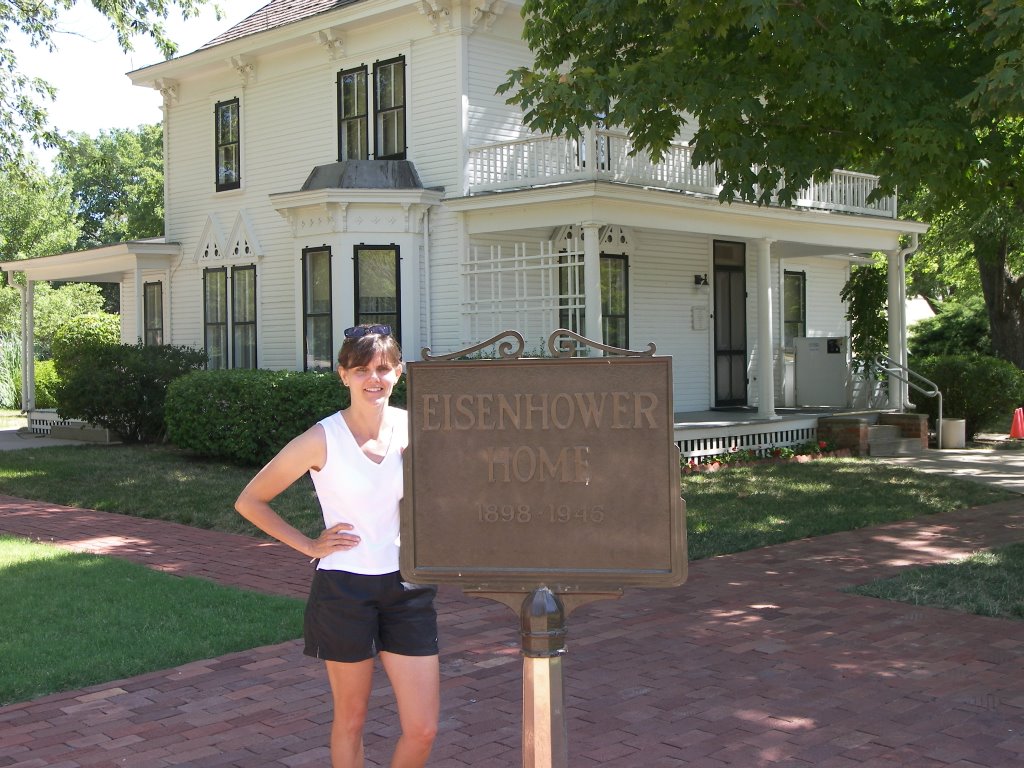
We hit the road this morning at a decent hour. It is already hot. The forecast is for even hotter weather today. We continue east along I70 thru Kansas. Our first stop today is Abilene, home of Dwight D. Eisenhower. We stop at the Eisenhower Center to see a short film extolling his life and accomplishments, both as commander in Europe in WWII and as president. He served during extraordinary times we can’t appreciate. I think history will look vary favorably on his presidency in the future. We stroll the grounds of the center and tour his modest boyhood home. We decide to pass on the Ike Museum. I know Abilene also has some prairie history but I don’t see any signs of a historical center, so we get back on the highway.

Our next stop is Fort Riley. Fort Riley is an active army base with a long history. After following some useless visitors signs we head to the base guard shack where we are admitted after showing license, registration and proof of insurance. We head to the Main Post area and visit the US Cavalry Museum. It is ok but not great. Before leaving we also tour one of the original stone barracks now known as Custer House. At one time, they thought Custer had lived there, but that was later found to be untrue. Custer was stationed at Fort Riley at one time when his Seventh Cavalry was formed to fight the Indians.

Once back on the road, we drive until we cross the Missouri River and hit the tall buildings of Kansas City. It is late on a Sunday, so we stop at an extremely nice campground in the adjoining town of Independence, MO. This is our first layover in a big city. Before hitting the sack, I lean over and tell Aimee, “We aren’t in Kansas anymore, Toto”.

July 29, 2006

July 29, 2006

This morning we rise early to get a head start on a long driving day. We are going to head east across a very wide Kansas and we are not expecting to stop and see much, plus the forecast is for 100° F temperatures. Colorado is bigger than we think and it is over an hour before we hit Kansas. Right across the border, we stop at the Visitor Center to pick up a better Kansas map. We ask the attendant on duty what there is to see and she gives us a rundown of the attractions at each major exit along I70. Some of them sound interesting so we may not get as far as we hoped today.

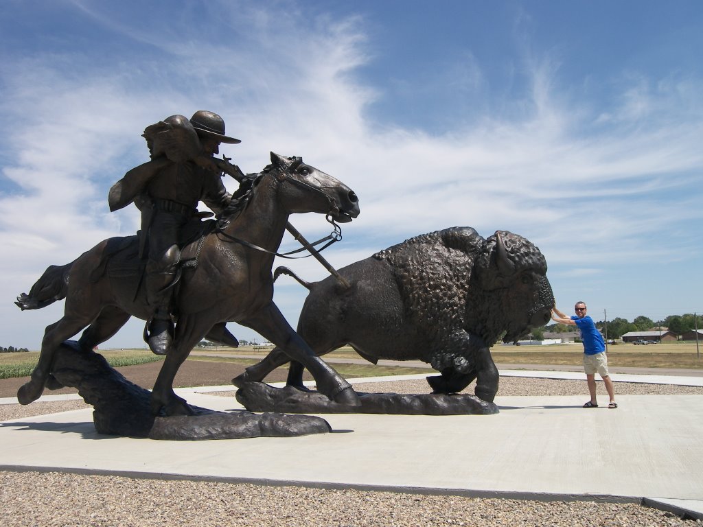
Back in the RV, we soon hit the central time zone and we lose an hour. Oooh! forgot about that time change; so much for getting up early. We decide to make our first stop in the town of Oakley. Oakley is where Buffalo Bill (Cody) got his name and first became famous. As the legend goes, he was one of two “Bills” paid by the railroad to hunt buffalo to feed the construction crew. To decide the best Buffalo Bill, the town arranged a shooting contest and Cody won. They have erected a twice-lifesize statue of Cody shooting a buffalo to commemorate their favorite son.

Also in town is something called the Fick Fossil Museum. I am not expecting much; we are mainly using this stop as a break from driving to stretch our legs. The museum is small and connected to the town library. I am pleasantly surprised. Typical of museums out west, they all seem to be an eclectic combination of dino fossils, pioneer history and old town memorabilia. There is something of interest for both Aimee and I. Aimee likes to read about human interest stories, such as the pioneer family that gets attacked by Indians, the parents scalped, and the daughters abducted and later rescued. I like dinosaurs and it seems there are fossils being collected everywhere in the west. Each location is a little different. In ancient times, this part of Kansas was a shallow ocean, so they have found sea serpents in the limestone outcroppings here. In particular, swimming reptiles (Plesiosaurs and Mosasaurs) and fish-eating flying Pterodactyls. I would like to head the twenty miles south to see the “Monument rock” limestone cliffs that stick out of the prairie, and where they found these fossils. Aimee vetoes it once we learn that gravel roads are involved. The RV doesn’t respond well to gravel.

We are hungry so we stop at a greasy spoon called the ‘Dairy King’. After lunch, we order ice cream ‘to go’ but it is melted by the time we hit the highway. Back on the road, we continue east. We see an advertisement for the world’s largest ball of yarn; Aimee wants to go but I veto this one since it is way off the highway. After another hour of driving we stop at Fort Hays State Historic Site to see the original cavalry fort. This is one of many forts in the west that were erected by the army to protect the railroad and settlers from native Indians. Contrary to Hollywood, most of the western prairie forts were constructed of stone because trees were hard to find. The tour is interesting but the 100° heat and fierce wind is draining. I would not have survived either as a cavalryman or Indian.

Also in town is the Sternberg Museum on the campus of Fort Hays State University. In the Fick Museum, I had learned that Sternberg was a famous local fossil hunter, so I assume this will be about his collection. This museum turns out to be more upscale than I would have expected for a small town. The museum is indeed built on Sternberg’s fossil collection but is much more. For example, there is one area with large animatronic dinosaurs roaring and moving. I thought I was in the movie ‘Jurassic Park’. Besides the fossil exhibits, the museum also has a big section on elephants and their mammoth ancestors. It is a first-rate museum I would expect to see in Chicago, not Kansas.

On this month-long cruise of the West, I have seen many more fossil exhibits than I ever expected. I had no idea fossils have been found in so many places in the US. (Chicago is even a fossil hot bed with the Mazon Creek Formation.) The one big advantage to seeing a lot of these collections in a short period of time is that I am starting to understand terms like Jurassic and Cretaceous and I am making connections between what I see in one area with what I see in another. Scary!

By the time we get out of the Fort Hays area, it is after 6:30 pm, so we stop at the next campground east in Russell, KS. Russell is the home of Bob Dole and Arlen Specter. Right next door to the campground, is a small mostly outdoor “Oil Museum”. (Apparently this part of Kansas is oil country.) In between dinner courses, I walk over to the museum without Aimee to check the hours. It is only open 4-8pm so I look around for a half hour. It is a nice break from dinosaurs.

July 28, 2006


July 28, 2006

We spend the day with Aimee’s relatives. Late in the afternoon we head north on I25 toward downtown Denver and link up with I70. Heading east we return to prairie ranchland. East of Denver, there are very few trees and even fewer towns. Getting tired early, we stop in the small town of Limon, to stock up on groceries and to spend the night at the local KOA campground.

Friday, July 28, 2006

July 27, 2006

July 27, 2006
We haven’t exercised much lately, so before we leave Rocky Mountain National Park this morning, we stop at the Green Mountain trailhead a few miles down the road. We put on our hiking boots and make the 3.6-mile hike up the hill to a large green meadow that is the valley floor between several mountains. I had no idea there were so many high meadows in the mountains. We were hoping to spot some moose in the mountain meadow, but no such luck.

Once back at the RV, we head out of the park southeast towards I70. On the way we pass thru the ski town of Winter Park. From there, to get to I70 we have to pass up and over a high mountain pass back to the eastern side of the continental divide. It is then downhill a very long way. Once we hit the outskirts of Denver, we exit to the south a few miles to the town of Morrison. Our first stop there is the Red Rocks Amphitheatre. In this area there is a several hundred foot thick layer of red rocks that have been pushed up on end and exposed with the uplifting of the Rocky Mountains. The massive rocks resemble the Titanic when it was in the process of sinking. During the depression, workers built a large outdoor amphitheater within two faces of the rocks. This would be one of the coolest places I have seen to attend a concert.

Also in the small town of Morrison is the Dinosaur Ridge National Landmark. This hillside was the location in 1877 of some of the first dinosaur bones found in the west. Although most of the bones were excavated and shipped off to Yale University, there is a small section where some dinosaur bones are popping out of the rock face. “Popping out” is not really the right phrase, as there is very hard rock fossilized all around the bones. I have some new appreciation for how hard it is to separate the bones cleanly from the surrounding rock. What this site is most famous for now is the dinosaur tracks. This area used to be the location of an ocean beach. Somehow this soft surface was preserved. You not only can see the rippled sand surface very plainly, but also the tracks of several dinosaurs that walked the beach. Since these rocks are also uplifted and on end like the red rocks, the tracks are almost vertical, going up the cliff of this roadside exhibit. At one time the dinosaur tracks were artificially blackened to make them easier to see. Most of that coloration, however, has since worn away and has not been redone. Many of the individual footprints require you to use your imagination to recognize them as dinosaur marks and not just random holes in the rock. However, taken as a group, they are clearly tracks of some very large animals. Just what you might see on a crowded beach - a beach crowded with dinosaurs, that is.

Our next stop is downtown Denver to see the US Mint. However, by the time we arrive it is after 4:00 pm and the place is closed. From here we head south to Parker, CO to see Aimee’s brother and his family. We make them look at all of our pictures.

Thursday, July 27, 2006

July 26, 2006

July 26, 2006
This morning we head back into Rocky Mountain National Park and begin the Trail Ridge road. Similar to the Beartooth Pass road we did into Yellowstone, this road goes up over the mountaintop. We stop at several overlooks along the route including one beautiful vista where we lunch on peanut butter sandwiches and milk while soaking up the view. Several bold little ground squirrels or chipmunks try to help me finish my lunch.

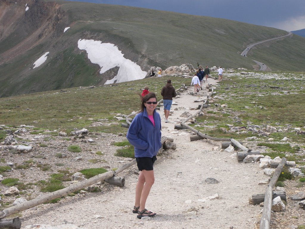
The road continues to climb and eventually passes above the treeline (11,500 ft) into grassy alpine tundra with splotches of snow. We stop at the Alpine visitors center at the summit and hike up to a nearby hilltop for some nice pics. At the hilltop, the temperature drops suddenly and the wind picks up. It looks like it may rain again. We head down the mountain and decide to hit camp early at the Timber Creek campground. We pick a nice wooded campsite. As soon as I get the awning deployed, it begins to rain. Aimee and I move indoors and read for a couple hours till it blows over. Apparently it rains almost every afternoon in the Colorado Rockies.

When the rain finally clears, I head to the Colorado River a few hundred yards away to fish. I end up having to hike farther downstream than planned because of a beaver dam that has flooded the marshy river area near the campground. Unfortunately the hike was a waste of time as the rain made the stream muddy and unfishable. This stream is the headwaters of the same Colorado River that eventually flows into the Grand Canyon and beyond.

After dining on BBQ chicken this evening, we hike over to the ranger station and hear a talk on moose. On the way back, we see a coyote trying to separate an elk baby from the rest of its herd. The temperature is very cool and we are thinking tonight might be the coldest of the trip. Once back in the RV, I figure out how to turn on the furnace just in case. It works. This is the one item on the RV that I had not pretested. I didn’t think we would need the furnace during the summer.

Wednesday, July 26, 2006

July 25, 2006

July 25, 2006

This morning we get started earlier. After some email and investing work, we head towards downtown Cheyenne, WY to see the capital building and other local sites. We run into lots of barricades and roadblocks; it looks like they are preparing for a parade. We later find that this week is Cheyenne’s Frontier Day’s celebration, which is the reason for the crowded campgrounds. Since parking is non-existent we decide to head out of town. On the way out we fill up with gas; the “service engine soon” light finally goes off!! Must have been bad gas after all. Most problems will go away if you ignore them long enough.

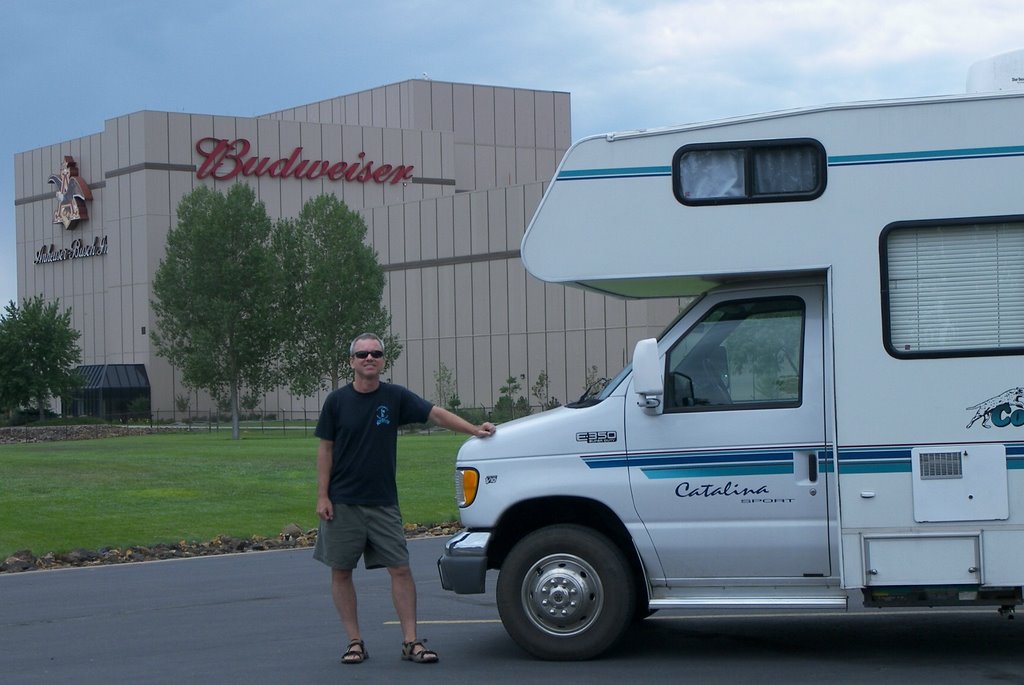
We take I25 south and we are soon over the border into Colorado. Our first stop is Fort Collins and the Anheuser-Busch brewery tour. I think this is our third brewery tour in the last month. The tour is mediocre but Aimee and I and most of the other tourists decide the Amber Bock makes up for it. Aimee also enjoys the new 2-month old Clydesdale foal.

After visiting the local Colorado Visitor Center to stock up on maps and brochures, we take Rt. 34 west toward Rocky Mountain National Park. The route takes us up the mountains thru the Big Thompson Creek canyon. Very Pretty. We stop in the mountain town of Estes Park, gateway to RMNP, to get a fishing license and visit a rock shop. Our first stop in the park is the Moraine campground. Of course it is full, that is our life now. Aimee is able to get out on my Cingular cellphone and makes a reservation at an Estes Park private campground. Aimee’s T-mobile phone has been virtually useless in the west. Since we now have a campsite, I pull out the flyrod and try my hand in Big Thompson Creek. No luck. Darkness and rain cut the fishing short. We pull into the campground in pouring rain. This is the first time we have had significant rain since starting the trip. Instead of BBQing, we eat leftovers and watch the movie, Fargo.

July 24, 2006

July 24, 2006
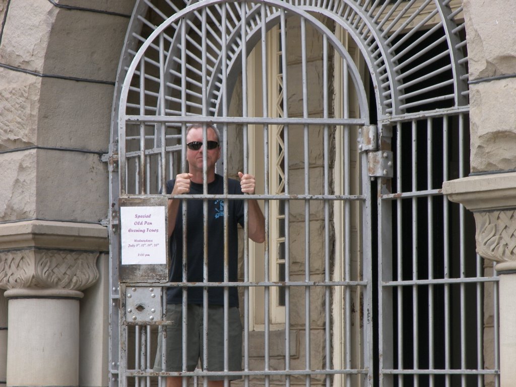
This morning we got a leisurely start. Today is mostly a driving day as we head east toward the capital, Cheyenne. There is a lot of nothing in this part of Wyoming. I would call it a northern desert. Wyoming is much bigger than it looks and progress is very slow. We make a brief stop at Rawlins to see the outside of Wyoming’s early territorial prison; otherwise we spend the time driving, alternating between music and Pimsleur Spanish language CD’s. Near Laramie, we see several dozen windmills by the roadside. This is a good spot for them as there is plenty of land and wind. We spend the night at a private campground in Cheyenne. The park is crowded and we get one of the last sites. What is going on, that all of a sudden we are having difficulty finding open sites? We make a point to get started earlier so we can stop earlier and have an easier time finding RV sites.

Monday, July 24, 2006

July 23, 2006

July 23, 2006

I haven’t had any allergy problems since coming down from Yellowstone. The wildflower pollen I am allergic to must only grow in the mountains. I guess I am destined to be a flatlander forever. Aimee is fine with this as she is scared of heights. I guess this is what you call Star-crossed compatibility.

This morning we rise again with the alarm clock. At 8:00am we meet the fishing guide where the local road crosses the Snake River. We fish about a half-mile upstream from there. In the first half hour I catch several cutthroat trout but nothing of a size to write home about. I failed to hook the lone big one well and he got off. I don’t get a bite for the rest of the morning but I do learn a few tips about fly fishing from the guide.

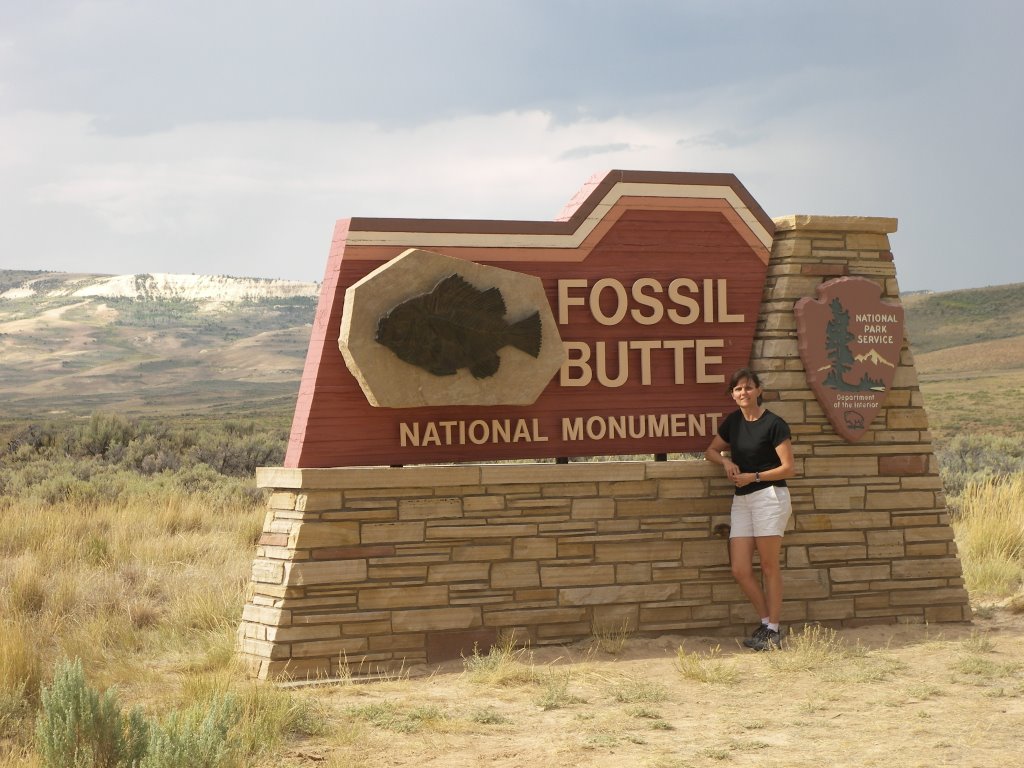
Just after noon, we hit the road again and head south following the Snake, then the Hoback and finally the Green Rivers. I like the beautiful forested area the Hoback flows through. The upper Green river valley is back to desert ranches covered mostly with sagebrush. Farther down the Green we come upon mile after mile of Badland type terrain. South Dakota has nothing on Wyoming badlands, just better advertising. After what seems hours and with a little backtracking we finally get to Fossil Butte National Monument outside Kemmerer, WY. Fossil Butte was the site of a large shallow lake 50 million years ago. Because of some unique circumstances a huge variety of fish and other freshwater animals were entombed and fossilized almost perfectly in a narrow white limestone layer called the Green River Formation. I have often seen these fossils for sale in stores and on the Internet. A former coworker had one on display in her office. Because of lightning, we tour the nice visitors center, but forgo the hike to the original quarry site atop the butte.

Since it is late on Sunday night, I can’t visit any of the local fossil stores so we decide to keep moving. By the time we get to the city of Green River, it is very late and the campground is full. (By the way Green River is the Soda Ash capital of the world). Another fifteen minutes east on I80 we find an open spot in the Rock Springs, Wyoming, KOA. As we turn in, Aimee and I both comment that it looks just like the initial campground in the recent Robin Williams’ RV movie, just a big gravel parking lot, next to an oil storage depot. No character at all. Oh well, Beggars cant be choosers.

July 22, 2006

July 22, 2006

Last night we figured out how to get the alarm to work loudly on my Palm Pilot. This will be the first time we will need an alarm to wake us up. We have a pickup scheduled for 9:15am and Aimee needs her coffee time.

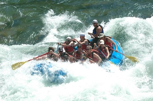
The van picks us up at the camp office and we head to Sands main office a few miles out of Jackson, WY. After signing all our legal rights away, a school bus picks us up at 10:00am and heads 30 minutes south of town. We follow the Snake River the whole way. We are scheduled to take a white water trip down the Snake River canyon in a 14-man rubber raft. Aimee is very nervous as she recently heard a horror story about white water rafting from a girlfriend. At the launch ramp, we don life preservers and get a safety spiel about what to do if we get bounced out. We then get seat assignments. I am one of the portside oarsmen and Aimee gets a middle seat with lots of handholds. She is happy. The trip is nice with some rapids and cold-water drenchings but neither one of us was particularly afraid at any point. The flows during the summer are much less than during the spring runoff. The water is very cold though. To cool off, at one point I stick both feet in for about a minute. They are somewhat numb when I take them out. If we were to have been tossed, hypothermia would have quickly overcome our thin frames. We both decide this was a good first introduction for us to real white water rafting.

On the way back some fellow passengers tell us about the rodeo that is held every Wednesday and Saturday in Jackson. That sounds like fun so we make plans to go tonight. Since we don’t have a second vehicle we unhook the RV after dinner and drive into town and locate the fairgrounds. Rodeo is big in Wyoming. They have one channel here that seems to be devoted to rodeo. The warm up for the rodeo is a bunch of the local guys and gals exhibiting their riding skills. They must get lots of practice. The rest of the evening is devoted to bull riding, ladies barrel racing, bucking bronco riding, and calf roping. It was very entertaining. Aimee liked it the most. She was glued to my binoculars through the whole show. If I didn’t know better I think she was staring at the cowboys in their tight Wrangler Jeans. It is after dark when we return and I rehook the RV with a flashlight.

Saturday, July 22, 2006

July 21, 2006

July 21, 2006
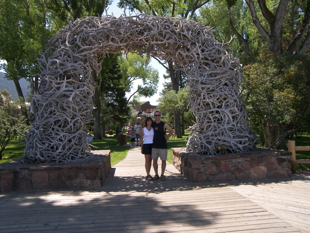
I spend the morning catching up on blogs and postings, while Aimee does laundry. Around 11:00 we decide to head into Jackson and walk around. Jackson seems to be an upscale town with lots of high-end art galleries and very expensive real estate based on newspaper advertising. This is in sharp contrast to an exhibit we saw in Jackson Hole saying this area was one of the last to be settled in the lower 48 because of the harsh climate. What a difference a national park makes next door. Our second stop is a Mexican restaurant named The Merry Piglets. Despite the name it has great salsa and good food. I spend the rest of the afternoon softening Aimee up by following her from one store to the next. After her resistance is well lowered with this large dose of retail therapy, she agrees to stay a few more days and we make arrangements to whitewater raft tomorrow and I schedule a fishing guide for Sunday morning. For the blog, we get our picture taken in front of one of the elk antler entrances of the central square. On the way back to camp, we stop for groceries and beer. I am desperate for some real beer. At the last provisioning stop I accidentally picked up a six-pack of Busch NA (non-alcoholic).

Friday, July 21, 2006

July 20, 2006


July 20,2006

This morning we plan to leave Yellowstone. I think four nights atop the world’s largest active volcano is pushing our luck. Besides we have seen enough hot springs, fumaroles, mudpots, and geysers, (there are thousands) even if many of them are spectacular. Our propane supply is low and we stop at the nearby service station to make our first fill of this tank. A student from Massachusetts assists us. $21, hmmm, not bad for two weeks of cooking, hot water and refrigeration.

We head south out of the park and into Grand Teton National Park. They touch at this point. For some reason we don’t pass through a fee booth. I guess the Yellowstone fee must cover both. Either way it doesn’t matter to us as we bought a National Park annual pass at the Badlands and it has already paid for itself.

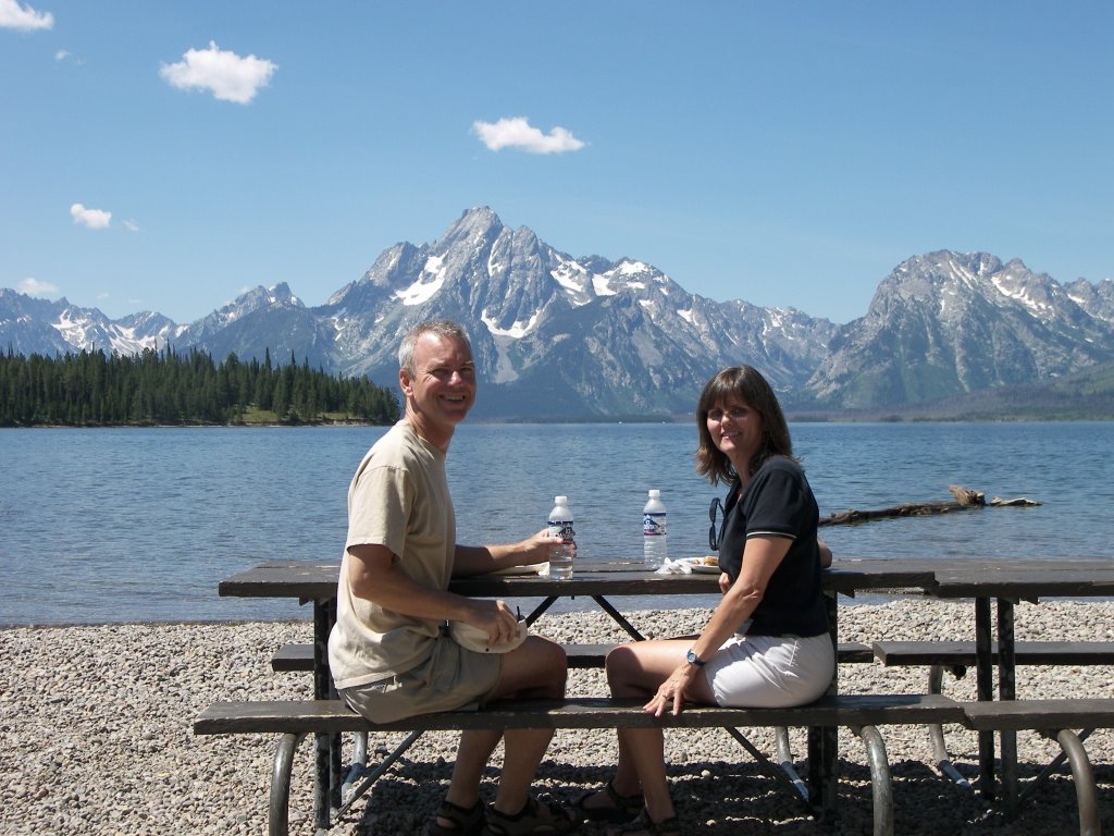
Grand Teton Park was formed some years ago by the merger of Grand Teton reserve and the Jackson Hole monument. Geologic forces that uplifted the Teton Mountain range while at the same time dropping the Jackson Hole valley floor formed this region. Because of this, the Tetons rise dramatically from a broad flat valley. The Tetons are considered the jewels in the Rocky Mountain crown. They are stunning. The Snake River runs along the Tetons in the Jackson Hole valley. A dam was built on the Snake here forming Jackson Lake. The juxtaposition between lake and mountains make the Tetons even more dramatic. Our first stop is for a picnic lunch on the lakeshore with both of us facing the Tetons.

Our next stop is the Colter Bay visitor’s center. John Colter discovered this area after he finished with Lewis and Clark’s expedition. They have a small Indian Arts Museum. Aimee likes it more than I. Much of their clothing was decorated with tiny glass beads. Nothing unusual until you learn that all the beads the Indians used only came from Italy. The beads were some of the trade goods the Indians wanted in exchange for pelts and hides. Even back then Italian imports were all the rage.

Colter Bay marina rents boats, so we decide to get a tandem kayak and skate around the lake for better views. I also think this would be good exercise. However, shortly after we get in the water, I am mesmerized by the view and we just sit facing the Tetons soaking up the view. It doesn’t hurt that the lake water keeps the air around us comfortably cool. This sure beats working in an office.

Tonight we stay at a private campground on the western side of Jackson. Jackson must be a hopping place, as we have to endure a traffic jam all the way thru town.

July 19, 2006

July 19, 2006

This morning we want to see Old Faithful and the southwest side of the park and hopefully stay in Grand Teton Park to the south tonight. Near our campsite is the West Thumb geyser basin. We hike the circular boardwalk that straddles West Thumb, a large circular cove off Lake Yellowstone. One of the signs says that this cove was formed as the result of a small volcanic eruption about 150,000 years ago. Hot water and steam is gushing out of the ground all over this small area, even in the lake itself. There is one spot about 10 feet offshore called Fishing Cone, where if you pull your boat alongside, you can catch a trout on one side and on the other, dip it into the hot spring cone to cook it.

We head on towards Old Faithful. I am hoping to get lucky and arrive just before Old Faithful does its thing, so we can see it and move on. We have seen enough geothermal activity. We arrive at the Old Faithful parking lot and we immediately see it is the largest so far. Old Faithful is probably the biggest draw at Yellowstone and you probably have a lot of tourists waiting around till it goes off. Once we park, we head straight to Old Faithful. I don’t see a clock anywhere, but fortunately a ranger soon walks up and announces to the crowd that Old Faithful is still 45 minutes off, but that the indicators are showing that the Beehive geyser will erupt in 5-10 minutes. We quickly hike the few hundred yards to its location. On the way I am thinking that the Park Service has installed some temperature sensors in the geysers to monitor and predict eruptions. Less than a minute after we arrive, it erupts. Wow!! It is cool. Out of a two foot wide cone shoots a massive fire hose of steam and water. Not only does it shoot water almost two hundred feet in the air, it continues to do so for at least 5 minutes. I am hooked on geysers now. I want to see more. We head to the nearby Visitor Center and along the way I am telling Aimee how lucky we were to arrive just as Beehive went off. Any delay and we would have missed it.

At the Visitor Center, we find they have a board with the time estimates for six geysers. Beehive isn’t one of them. Looking at the site map, I see that Old Faithful is on the Upper Geyser Basin, which has at least several dozen geysers. This is a very large area. I write down the schedule of the six but we have a big timing problem. Aside from Old Faithful, the others don’t go off but once, maybe twice a day, and their estimates are plus or minus 90 minutes. If we have to wait around three hours to see each geyser explode, we are going to be here at least another day. Old Faithful is set to go off in 15 minutes, so we stroll back out to Old Faithful and find seats on the bench and wait. Old Faithful erupts five minutes early. It is nice but nowhere near the excitement of Beehive. I find that Old Faithful is not the biggest, highest or most predictable; it just happens to go off the most frequently (not quite hourly) so it pleases the quick tourist.

The next scheduled eruption isn’t for another couple hours so we head to nearby Old Faithful Inn for lunch. I have seen the lobby on the Travel Channel and it is just as pretty. The five-story lobby is totally constructed of varnished pine logs with a massive fireplace in the center. We dine leisurely in the restaurant just off the lobby.

After lunch we head back out to the basin and stroll the boardwalk. This area has geysers of every name and description. This Upper basin is a 2-mile long rectangular white chalky strip with a large stream running right down the center, called the Firehole River. The interpretative sign for Beehive explains that it and a couple others have secondary spouts alongside that are tied into the same geothermal plumbing. So when Beehive gets close to erupting, the tiny geyser next to it begins spitting providing a natural indicator for Beehive’s next eruption. So much for Park Ranger temperature sensors, Mother Nature’s way is much more elegant.
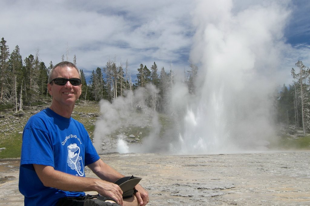
Old Faithful and Beehive are both cone geysers shooting water straight up from a rock nozzle. We come next to Grand Geyser, supposedly the largest predictable geyser. Grand is a fountain geyser, meaning it spews water from a pool in many directions. It is set to go off in another 30 minutes at 2:00pm. I would like to see the difference so we make plans to walk a little farther down and come back shortly before 2:00pm. Just as we turn to leave, Grand takes off. Luck is with us again today. Grand shoots a bouquet of water up in large pulses, like rockets in a fourth of July fireworks display. It continues for fifteen solid minutes. A river of water soon begins to drain underneath our bench headed I am sure to the Firehole River.

As we continue on down the boardwalk, we are finding that the majority of geysers are very unpredictable and may not erupt for years. One, the Giant geyser has a very large cone. When it is ready it spews water for ninety minutes, almost a million gallons of water. Another, the Castle geyser has a cone the size of a kids play fort. Because the cones are made from minerals left behind by the geyser water spray, they are an indicator of the geyser’s age. Castle is ancient; Old Faithful is just a baby at a few hundred years.

Shortly after Grand, we come to the turnout for Riverside geyser. The map explains that its notoriety is that it sits on the bank of the Firehole River and shoots water out in an angle over the river. That would be nice to see. It is set to go off in 20 minutes at 2:25pm. I tell Aimee that the end of the boardwalk is just ahead. Lets quickly go see the Morning Glory Pool at the end and come back to see Riverside. Just as we do, Riverside starts erupting and I run down the path to get a look. I didn’t need to run, as Riverside spews for twenty minutes and we are able to take as many pics as we like.

Well I am feeling very blessed today. In just a few hours, we have toured the main geyser area and have seen four major geysers explode, three of them almost on cue of our arrival. Aimee must be my good luck charm. I will have to keep her awhile. We are finally tiring of geysers, so we head to the exit. On the way we stop for ice cream at the Inn. It has been a hot steamy day. It is later than we thought, so we decide to stay in the park again. We head to nearby Grant Village, the campground closest to the Tetons. Being tired I don’t notice the “Full” sign at the campground entrance. No matter, this is our lucky day and we get a site due to a cancellation.
July 18, 2006

July 18, 2006

This morning we get a slow start. We stayed the night on the outskirts of West Yellowstone. It is a cute little town with lots of fly shops. Besides getting gas, which is much cheaper here, we stop at the library and make use of their wireless Internet to post a couple blogs and catch up on news in the outside world.

We head back into Yellowstone. The road within Yellowstone is basically a big circle and it is difficult to make the circuit without a lot of backtracking if you don’t intend to arrive and depart from the same entrance. We decide to cut across the middle and see the canyon area today on the eastern side. Along the way I make a few casts on both the Madison and Gibbon rivers that the road follows. No luck but there is an elk watching me fish the second time. We also make a quick stop at Tuff Cliff, which is an exposed cliff that shows how thick the ash was that covered the park after its last volcano eruption. Aimee poses in front of the interpretative sign. At that moment, a rather large coyote walks right behind her, giving her a jolt. I hadn’t seen her move that fast in awhile.

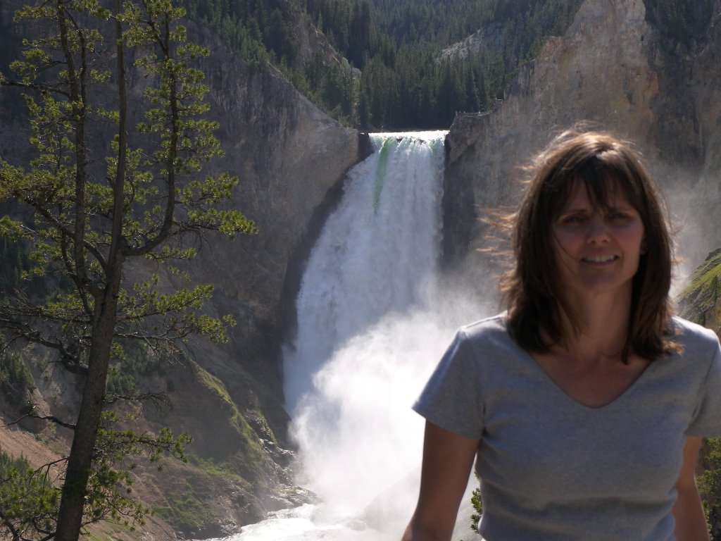
We next explore the Grand Canyon of Yellowstone. It is a very nice canyon carved by the Yellowstone River that flows through. It is interesting because of the colors of the cliff walls. They are multi-colored in many areas because of past and present hot spring activity along its 25-mile length. The highlight of this area though is the two waterfalls at the head of the canyon. The Lower Falls is a stunning display of water. The Yellowstone River gushes out of a flat window of hard volcanic stone and drops into a canyon of softer material below, all within a pine mountain background. Picture Perfect. Unfortunately we almost missed it. As we did the canyon drive we got tired of seeing the canyon from the many angles and skipped one. It was the one with the Lower Falls. Later, I figured there had to be a better view of the falls so we backtracked and stopped at the missing pulloff. Thank God.

We planned to stay the night at the Canyon area campground but it was full, so we had to drive farther south towards Lake Yellowstone. Along the way we stop at Mud volcano. Along with bubbling mud, we see one cave-like opening called Dragon’s Lair that is spewing steam and stench. A dragon flying out of it would not come as a surprise. About 7:30pm, we pulled into the Bridge Bay campground and got a site. After dinner, I am looking at our mostly treeless site and thinking the grass here is way too high. For the fee, I figure the park can mow the grass once in a while or at least get a goat to graze here. Just then I spy a buffalo next to an RV 50 feet away. Well, I guess a buffalo will do instead. Aimee comes out and we make a stroll around the campground. The third site down we see a tent and a car with “44 in 27” stenciled on the back window. We have to stop and ask. It turns out to be a father and son team who are almost done with a goal of seeing all of the lower 48 states in thirty days. That is a lot of driving. They have a website www.naffie.com. As we are talking two big bull bison walk right by us. Aimee and I both step to the other side of their car just in case.

Tuesday, July 18, 2006

July 17, 2006

July 17, 2006

Last night in our campground we listened to a ranger give a slide show talk on the grizzly. He talks about how the park used to feed the bears and how the bears begged tourists for food as they drove thru. This is what I remember from childhood TV and what I sort of expected. Many years ago they stopped this practice and the bears have returned to feeding in the wild making them unlikely to be seen.

This morning we return to the springs and follow the boardwalk along the lower tier. Water is bubbling up in several places making different kinds of weird chalk architecture. The boardwalk although nice, has few interpretative signs and is constructed with nails that are popping up. Private deck construction switched to screws many years ago but apparently not our nation's showcase park.

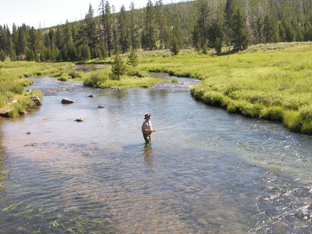
From Hot Springs we head south and come upon Indian Creek campground. It has a nice stream running thru it and I want to try out my newly acquired fishing license. I strike up a fishing conversation with a guy who is preparing to enter the water. He is heavily tattooed but looks really familiar. I get my fly rod out and put on a caddis fly imitation. While Aimee reads streamside, I work the deeper section along the opposite bank. I am getting lots of surface hits but I can’t hook any. Further downstream I finally bring in a couple brook trout and I realize the problem. My small fly is too big for the small mouth on these midget fish. It is still fun as the environment is beautiful and I rarely get to watch fish attack a lure on the surface. While we are eating lunch by the stream, Aimee tells me my fellow fisherman is Lex, from the TV show Survivor. I thought I recognized him!

After fishing, we head farther south and arrive at the Norris basin area. Norris is a flat chalky white valley with geothermal activity everywhere. Some spots have hot water bubbling up into large blue Jacuzzi-like pools. Elsewhere there are jets of steam hissing from holes in the rock. This is also the location of several geysers including Steamboat, supposedly the tallest in the world when it occasionally erupts. Most of the time it is spitting water some 10 to 20 feet in the air. This is an eerie place until you realize that Yellowstone is the top of an ancient but very much alive Supervolcano. This is what you should expect on a volcano. Yellowstone erupts every 640,000 years and of course it has been 640,000 years since the last eruption.

The wildflowers are still getting to me making it difficult to do long walks. Very frustrating! I need to get in some air-conditioning so we head out the western gate in the early afternoon and stay at a private campground with electricity.

July 16, 2006

July 16, 2006

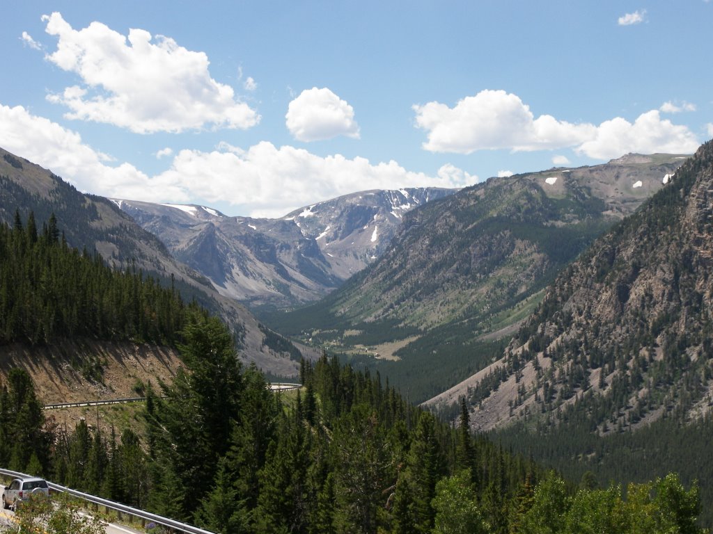
We got a late start this morning. Our first stop was Wal-Mart to replenish food, gas, and supplies for entry into the mountains and Yellowstone National Park. After reading some literature we decide to take Rt. 212 over Beartooth Mountain Pass, described as the most beautiful drive in America. The Rt. 212 exit is just 10 miles west of Billings. This road starts out innocent enough travelling due southwest on a flat straight road through farm country. But the mountains loom very high ahead. As we get closer a gap appears in the mountains and we travel along a stream valley into the range. Quickly the road leaves the river valley and ascends the mountain thru a series of steep switchbacks. The views become spectacular. We stop for a few photos on the way up. Although the edges are very steep, the road is fairly wide and easy to maneuver albeit slowly. The RV does great on the climb. Much better than the navigator who sits in the back of the RV with the curtains closed. At the crest is a wide treeless flat grassland with remnants of snow scattered around. As we descend back down, pine trees reappear and we pass thru alpine meadows of yellow, blue and purple wildflowers.

Eventually we hit the northeast entrance of Yellowstone and follow two mountain streams farther into the park. We see lots of fly fisherman along the way and I kick myself for not getting a license at the entry point. We decide to drive to the northwest corner of the park and see Mammoth Hot Springs first. As we get closer we spot a whitish splotch on the mountainside that looks like a remnant of an earlier mining operation. Later we find this is the Hot Springs and that whitish material is chalk left behind by the steaming hot water. The Hot Springs are Mother Nature’s version of infinity edge pools. The water bubbles up into some chalk-lined pools and disappears over the edge filling more pools below. There is a hint of sulfur in the air. Pretty Eerie.

We spend the night at a park campground at the Hot Springs. There is a flush toilet at this site but no showers and of course no electric or water hookup. I get the feeling that the Park is not that people friendly and is more worried about keeping it a nature reserve than accommodating the tourists. I have heard stories of how crowded the park is, but so far we haven’t seen it and I think the vast majority of tourists drive into the park, make the circuit and head out. Unless you have prior reservations at a lodge, most people aren't prepared to camp.

Sunday, July 16, 2006

July 15, 2006

July 15, 2006

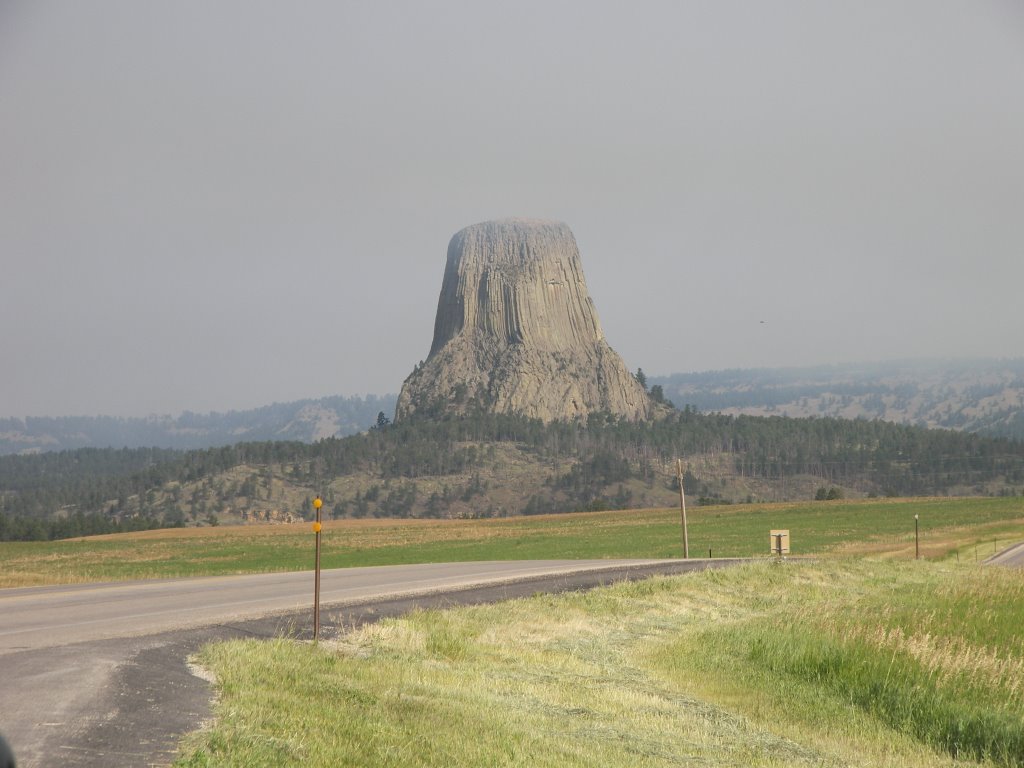
Last night, the setting sun was orange with wildfire smoke. This morning it looks a lot clearer. We head northwest on Rt. 14 towards Devils Tower National Monument. As we get closer we see a lot of black smoke to the left but no signs of the tower on the right. We find that the turnoff to Devils Tower is open but our route back southwest to I90 is closed. As we descend to the river valley we finally see the tower. It is much smaller than I had expected. As we get closer, we snap a picture from the road and plan on getting better shots on the way out. Despite being smaller it is really cool and very unique. Devils Tower is the solidified core of a volcano. The rest of the volcano being softer eroded away over millions of years. The sides of the tower are relatively smooth and cornered and look like a big stack of gray pencils on end. On entering the park, we do the circular hike around the base of the tower. We run into a park ranger giving a talk who says that the tower is a popular rock-climbing venue. Halfway around we see a group of climbers partway up. I would love to climb it also, but not today. The further around we get the smokier it becomes. As we finish the smoke smell is getting intense. On the drive away, the tower is enveloped in smoke and we are glad we snapped a picture on the way in.

We return to I90 and head west again. The land starts out like prairie ranches but slowly gets drier and eventually looks like a prairie desert. This could be called the badlands in my estimation. We start to see the Rocky Mountains in the distance still snowcapped despite the weather forecast of 104F today! The interstate system does not extend to Yellowstone. We have to decide which local route to take into the park. As I look at the height of the mountains, I wonder if an RV is the best way to travel over them. We decide to take I90 as far as we can first. I90 in the middle of Wyoming makes a right turn in front of the Rockies and heads north into Montana before heading west again.

As we pass into Montana the land starts looking a lot better again. About a half hour into Montana, we pull off to make a quick tour of the Little Bighorn Battlefield National Monument. It turns out to be much more extensive and interesting than I thought and we end up spending two hours walking around and listening to the ranger talks. Here on the prairie banks of the Little Bighorn River, Custer ran into an assembled mass of several Sioux tribes led by Sitting Bull and Crazy Horse. Alone, without reinforcement, and greatly outnumbered, he attacked and made his famous last stand in 1876. With archeological digs they have been able to place markers where most of the some 250 soldiers fell.

Because of the intense heat, we decide to continue driving and at 7PM we arrive in Billings and spend the night at KOA#1. It is a large and crowded park, but it sits right on the banks of the Yellowstone River. Probably fed by snowmelt, the Yellowstone here is broad and swift with an eroded undercut cliff wall on the opposite side. Ten miles down river is a place called Pompey's Pillar where William Clark (of Lewis and Clark) carved his name and date into a rock. On the return voyage, Lewis and Clark had temporarily split up with Clark taking the Yellowstone River back, right by our campsite.

Friday, July 14, 2006

July 14, 2006

July 14, 2006

In the morning we make the short drive into Deadwood. Deadwood is a gold rush town that didn’t die like others did because the gold in this area lasted for some 125 years. Deadwood gained some infamous notoriety when Hollywood made legends out of local characters Calamity Jane and Wild Bill Hickok. Today Deadwood is a casino town with a western motif. Despite that fact we make a pilgrimage up to see the gravesites of Jane and Bill on the steep hill above town on foot. It looks like a modern cemetery with a lot of old dates. We have lunch at a local saloon. Afterwards we drive up the hill to the sister town of Lead where the gold source was found. Lead is the primary location of the recently closed Homestake Mine. More gold was recovered here than anywhere else in the world. In the center of town is a half-mile wide open pit where the gold was once strip-mined.

We now exit the Black Hills and South Dakota by taking the scenic Spearfish Canyon road. It is a beautiful canyon drive and was the site of the Sioux winter camp in the film, Dances with Wolves. It is a long downhill ride that is interrupted by more road construction. Like Chicago they seem to have only two seasons here, winter and construction.

As we head west into Wyoming, we head back into ranch country. It seems the Black Hills is a now small but very ancient mountain range oasis in the middle of the prairie. Our next stop is Sundance, Wyoming, famous for the Sundance Kid and the gateway to the Devils Tower Monument, 30 miles north. There is a large wildfire just west of the Tower that has closed some of the roads leading to it. We stop at a private campground in Sundance for the night and hope the roads will be open in the morning.

July 13, 2006


July 13, 2006

Today our plan was to bike along a section of the Michelson trail, which runs thru the forest atop an old railroad line. Because I am still feeling a little under the weather we skip it and head north for more leisurely activities. In the town of Custer, we see a rock shop that might be interesting. We stop for a quick look. In the parking lot, are collections of minerals similar to the ones we saw on the hiking trails, only these are boulder size. They are cool and would look neat in our next front yard, but I am not sure how we would get them home. Inside the shop are smaller but finer specimens and various art objects. We think about buying a pair of pretty blue mineral bookends but right now we are not looking for more items to put in storage.

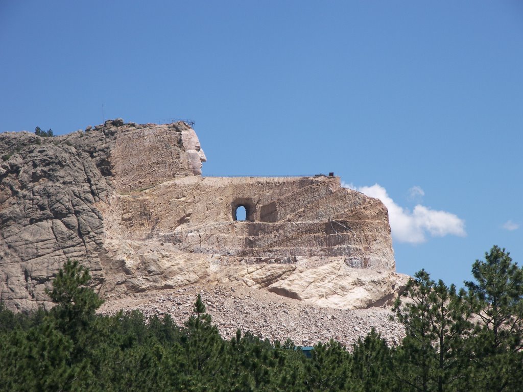
A few more miles down the road we come to the Crazy Horse Monument. Analogous to Mt. Rushmore, this is a mountain sculpture of the Sioux Chieftain. It has been a work-in-progress for over 50 years and little noticeable progress has been made except for the face. It is supposed to be a tribute to Native Americans but the museum inside is very poor. It is not much more than a haphazard collection of unrelated photos and artifacts. There is precious little about Crazy Horse himself. Most of the large complex is devoted to a restaurant and various gift shops. Instead of visiting, take a picture from the road.

Further north we pass pretty Pactola Lake. Like the other handful of lakes in the Black Hills, they are manmade but very pretty as they sit within the granite cliffs. Next to the lake is one of the Black Hills Forest visitor centers. It has some interesting tidbits about the discovery of gold in the region. Tonight we are staying in a private campground just south of Deadwood. To accent the fact that this is now gold country, we see a husband and wife panning for gold in the very tiny stream running alongside our RV campsite.

July 12, 2006


July 12, 2006

This morning we got up and returned to Sylvan Lake for another hike. This one was a circular route down Sunday Gulch and back up along another ridge. It was another pretty hike with Aimee taking pictures of butterflies and bees visiting wildflowers along the route. The only problem starting off with a 1.5 mile hike straight downhill is that eventually you have to climb back up 1.5 miles. I was dragging big time on the way back, thinking I am getting old, but it turns out I either caught a bug or I am allergic to the wildflowers. Either way I am out for the count and we return to the same campground to rest up. While I sleep, Aimee relaxes out on the veranda with her Tom Clancy novel. She made Chinese stir-fry for supper and homemade brownies for dessert. I may have to give her a little more time off in the future.

Tuesday, July 11, 2006

July 11, 2006

July 11, 2006

We now have driven 1200 miles since leaving Milwaukee. For the first several days we were refilling the tank every day at a cost of $75. I was beginning to think this was going to be an expensive adventure. Fortunately now the attractions are getting closer together and the scenery better so we are driving much less. I haven’t had to fill up now for several days. I did stop at the park general store to add air to one of the tires; it seems to have a slow leak.

This morning we backtrack a couple miles to the Peter Norbeck visitor’s center. Our camp neighbors from Milwaukee recommended it last night. It has some interesting exhibits about the park and was well worth the detour. Afterwards Aimee and I debate the path we are going to take to Sylvan lake, our next stop. The scenic Needles highway has several small tunnels along the route. We remeasure the RV three times and it will be very tight but we should be able to make it. As we are debating, the park ranger stops by and adds his two cents and now it is 2 against one and we take the longer tunnel-less route.

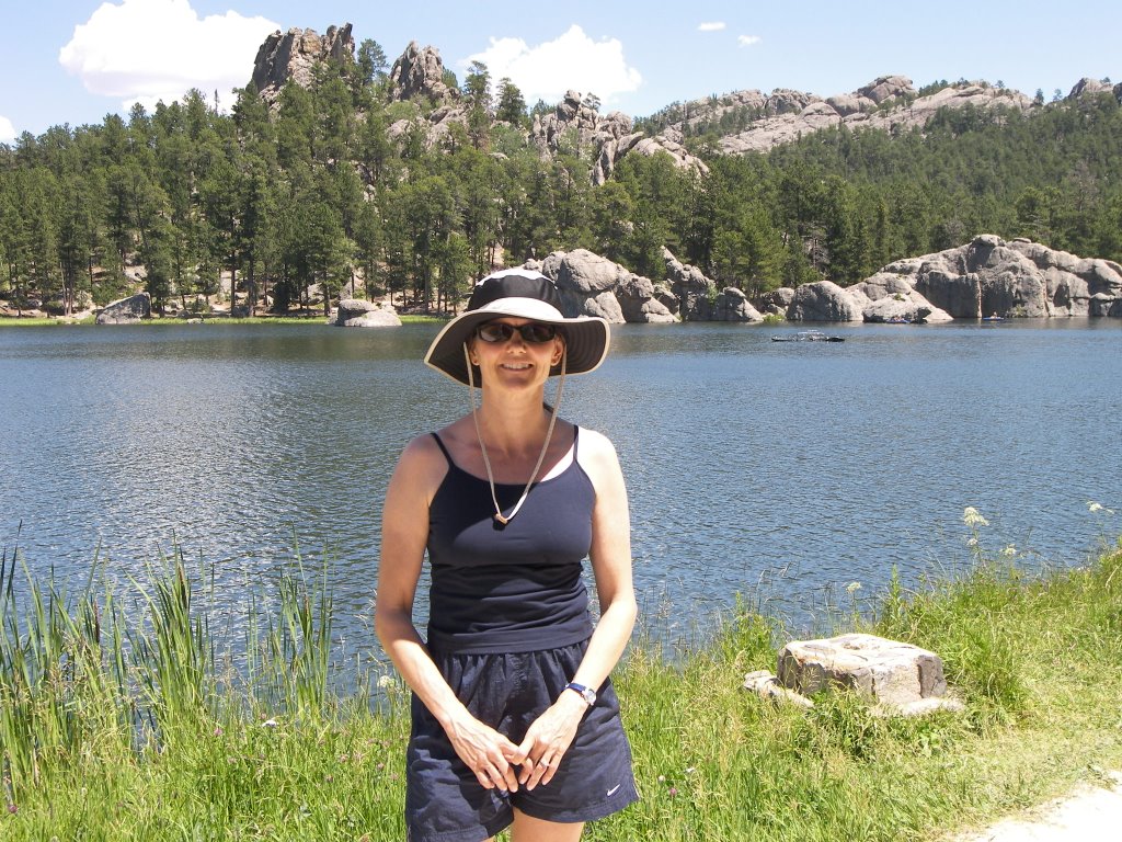
Sylvan Lake is the location of the trailheads headed for Mt. Harney, the tallest peak in South Dakota at 7200 feet. It will be our first entry in the HighPointers club, whose members want to scale the highest point in each state. The trail to the summit is three miles long and runs through a ponderosa pine forest. The trail floor up is a geologists dream as it is littered with beautiful rocks, including granite, pink and white quartz and mica. Aimee’s first thought was that there was broken glass on the trail until we noticed it was mica. Mica is a mineral that comes in sheets and looks like translucent cellophane. There were so many mica sheets and particles on the trail that it glistened like diamonds in the sun.

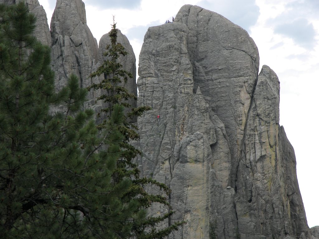
At the summit we can see all the surrounding granite outcroppings including the needles that we missed on our route detour. We also see a large granite outcropping that we think is the back of Mt Rushmore. On the flat granite summit we spy a mountain goat grazing. It looks somewhat like a shaggy polar bear with horns. We take an alternate trail down the mountain. This time we pass very close to the Cathedral Spires, which are very majestic and impressive. You can’t get these views from a car. We hear some yelling and notice a group of rock climbers scaling the sheer cliff faces of one of the spires. These guys are nuts as the spires have got to be at least 500 feet high and it doesn’t appear they are using rope protection. On the way down I am dragging. Four hours of hiking seems to be the limit of my arthritis now. Getting old is going to place limits on my big adventure.

This night we are staying in a private campground just outside Sylvan lake and the park limits. Custer State Park is so large and beautiful we are thinking of staying here another night.
Newer Posts Older Posts